With winter bearing down on us in Ushuaia (at the southernmost ends of the earth!), we boxed up our bikes again, said goodbye to Patagonia where we’d spent the last 4 months, and flew over 2,000 miles north to Salta, in Northern Argentina. It’s a vibrant city with a lovely Mediterranean climate, and very near to an amazing variety of things to see and do. It was the perfect place for us to hang out a bit, catch our breath, and meet Kacia’s parents for a new and different phase of our trip - exploring the NW corners of Argentina and Chile, by CAR.
The screenshot below shows the route and elevation profile of our drive. We estimate that for us to cycle the same 2,360 kilometers with over 27,000 meters of climbing, on a lot of bad, dirt roads would have taken about 2 months - about 50 riding days plus 10 break days. With the car we did all of this in 21 days, only driving for 16 of those days - making it a very different experience from cycling! Therefore, there’s a lot of material in this post. So, grab a lemonade, find a comfy chair, and join us!

Beginning in Salta (elev 3,780 feet)
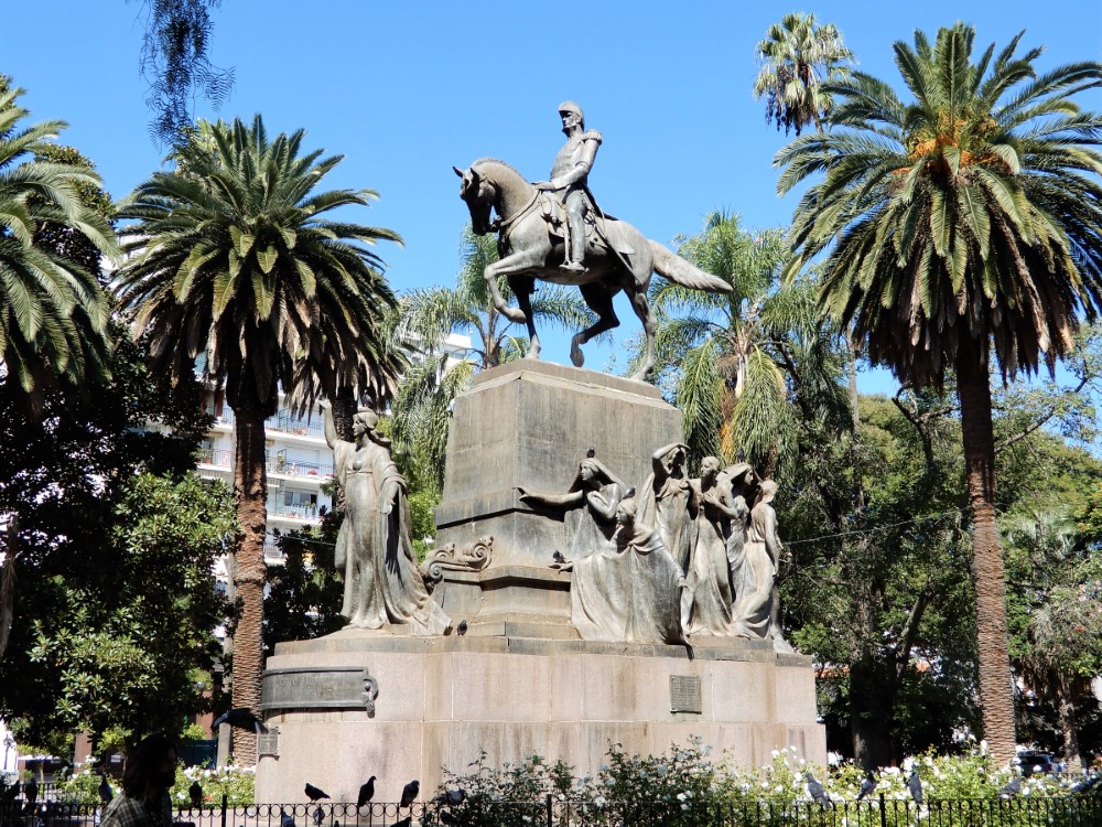
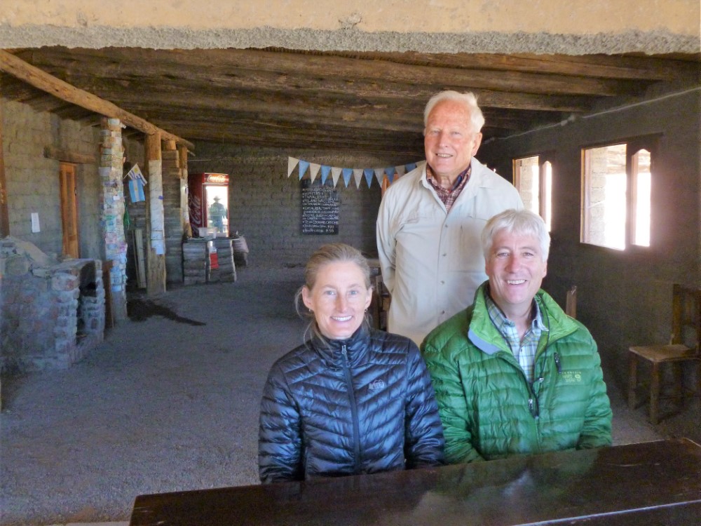
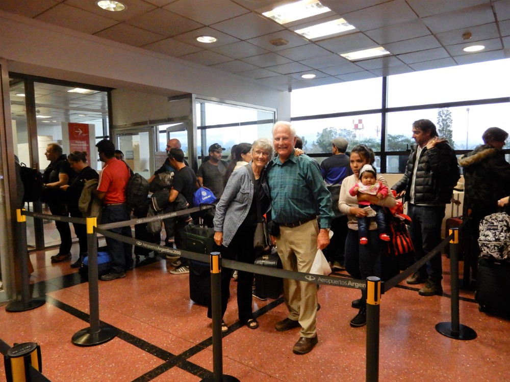
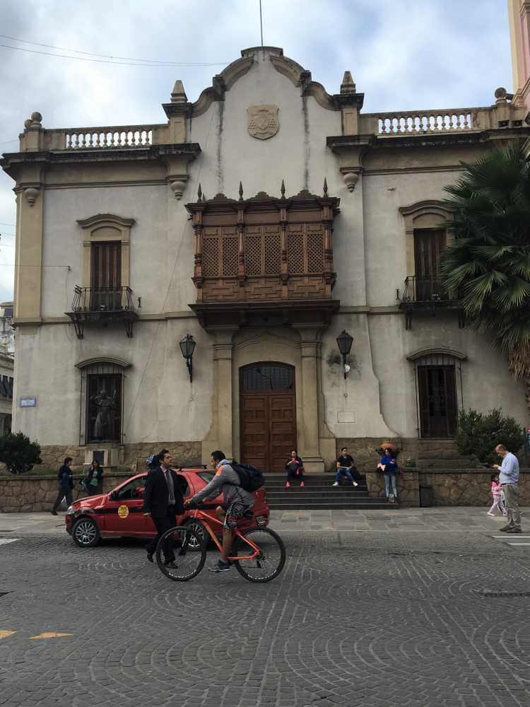
Kacia’s parents, Chuck and Harlowe Kittle, threw caution to the wind and hopped a flight to Argentina to join us for our adventures. The adventure began immediately as we crammed all four of us, and their luggage (some filled with bike tires and other supplies they brought for us) into a small taxi from the Salta airport. We stayed in a guesthouse with a lovely colonial courtyard, and spent a couple of days taking it easy, walking Salta’s historic (and chaotic) streets, admiring the beautiful, but oftentimes tired, architecture.
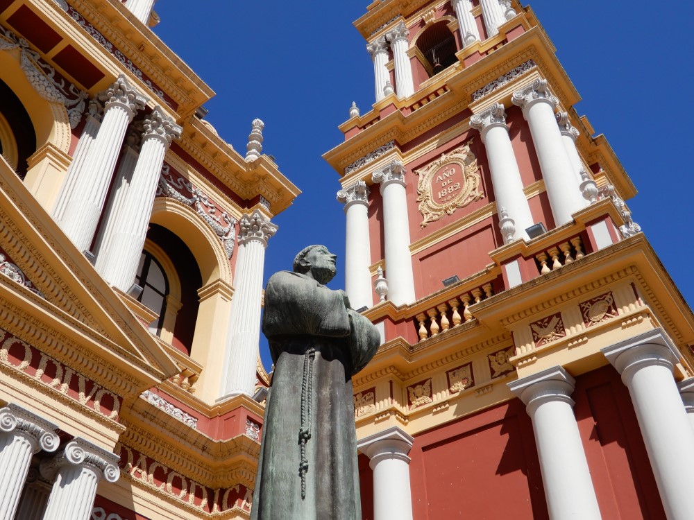


We rode the teleférico to the top of Cerro San Bernardo to get a terrific view of the city, and of the high Andes in the distance that we’d be traversing in the coming weeks. Because the car moves so much faster than the bikes, it was really important not to go too high, too fast… so we reviewed our route plans, making sure that we would be properly acclimatizing as we toured. Then we rented the appropriately named Renault “Duster” and set off.

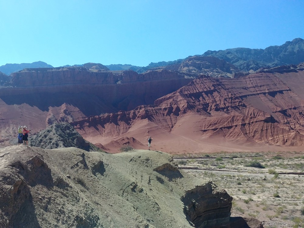
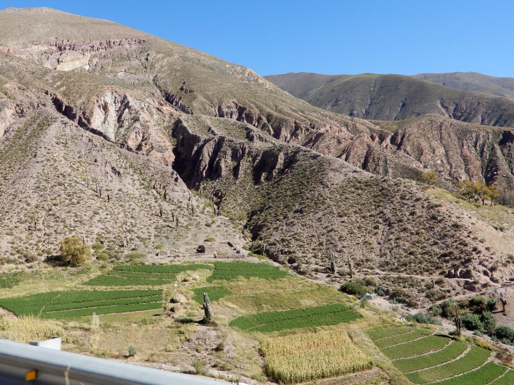
Parque Nacional Los Cardones
We left Salta toward the southwest, initially finding ourselves on a very rural road trying to go over a pass that had actually been closed for years ("thanks", Google Maps!) After this scenic diversion, we enjoyed a picnic lunch and headed over the correct pass to Los Cardones National Park.


This park is dedicated to the iconic Cardón cactus, and like its North American cousin, the Saguaro, it lives in harsh, dry conditions, at very specific elevations. It is the first national park dedicated to cactus habitat outside of the United States. Our first high pass (~11,000 feet) with a chapel at the top, was completely fogged in, making for an eerie transition, but as we descended into the beautiful (and much drier) valley, we got an introduction to the geologic wonders we’d be seeing over the coming days, as well as our first views of groves of healthy Cardones, freshly plumped-up thanks to the recently completed rainy season.
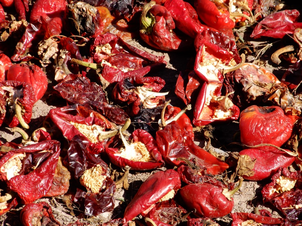
We overnighted in the small town of Cachi, then spent the next day back in the Park, marveling at the cactus, a variety of birds, an old section of Inca Trail now paved over, and spectacular, layered views extending from the valley all the way to the high peaks. In the valley, it was chile pepper harvest season, so fields, empty lots, back yards and hillsides were covered with drying chilies glimmering in every shade of red imaginable.


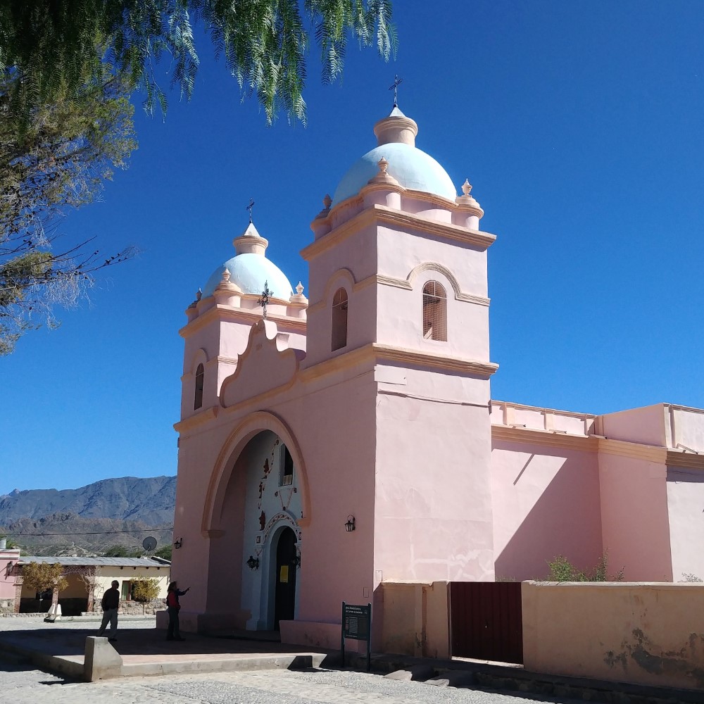
Cachi (elev 8,303 feet)

Driving with your headlights on is obligatory in Argentina. We were alerted by another driver that one of our Duster’s headlights was out, so the next morning we got a replacement bulb from Cachi’s auto parts store, (which interestingly sold automotive lubricants and fluids in bulk), and within minutes, Kacia and her dad had it fixed.

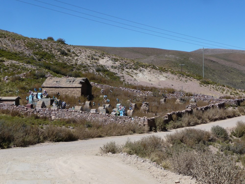
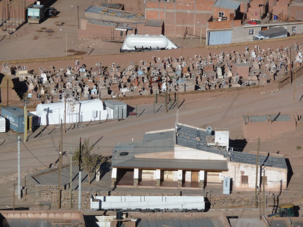
We hiked up quite a hill along the town’s Stations of the Cross trail to the cemetery, full of color, history, and decrepitude. To our surprise, it was adjacent to a dirt airstrip (which piqued our interest as both Kacia’s dad and brother are pilots).


Valle Calchaquíes
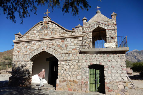

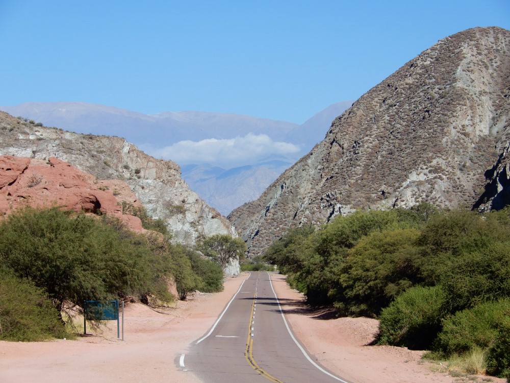
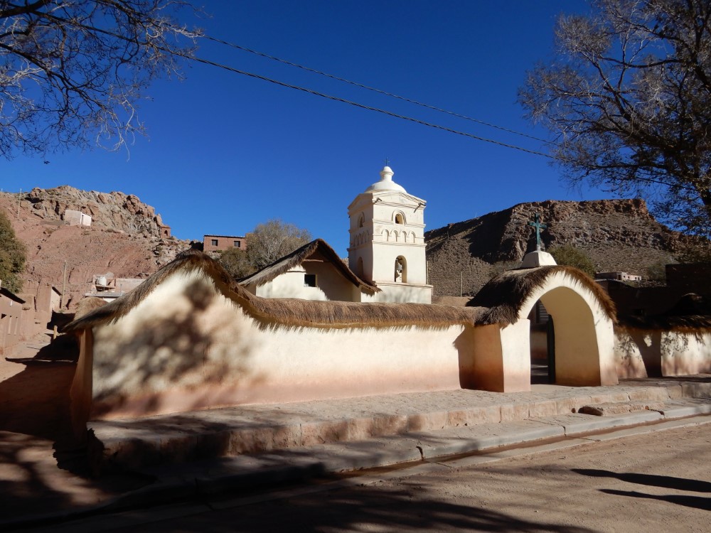
We embarked on our first all-day (80 km, 50 mile) drive on gravel (ripio) roads, and discovered that travelling on ripio can be challenging and exhausting for folks in a car, as well as on bikes! Along the way, we found a stone church, sparkling with glass mosaics embedded in its stucco trim, being spruced up by locals for the upcoming events of holy week.
We were a bit confounded by the typical roof construction in this area: mud spread directly over bamboo-like reeds. The area is very arid, but there are also clear signs of periodic and intense rains, signs that included massive streaks of mud from the roof running down the whitewashed adobe walls, on lots of buildings. Odd.


The artisans here are weavers. In the beautiful village of Seclantás, we found an artist in his home with a rug that Mom could not pass up. In nearby Molinos, the interior of the adobe church dating from 1692 was adorned with unique, contemporary hand-made tapestries depicting the stations of the cross, something we've not seen before in the myriad Catholic churches we’ve visited.
Further south, we drove through the geologically distinctive Quebrada de las Flechas (Canyon of the Arrows). There we were amazed to encounter some bike tourists on a horribly sandy road, who turned out to be a couple from the U.K. that we’d met weeks before on our bus ride to Ushuaia (2,000 miles to the South)!


Cafayate and Palm Sunday


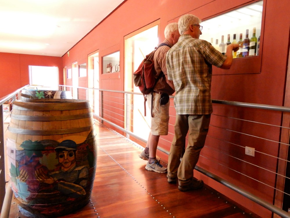
The town of Cafayate (regionally pronounced “ka-fa-ZHA-tay”) is the heart of a significant Argentinian wine region, though lesser known than Mendoza. We arrived in time for Palm Sunday. Mass was held outside the cathedral in the central square, which was overflowing with local people holding decorations made of freshly woven palm leaves. It was a privilege to see their community on one of their religion’s most important days.
Cafayate was a great place to walk around, with lots of public art, colonial buildings and good food. The city’s wine museum taught us little about wine making, but its incorporation of technology, art and poetry into the exhibit was surprising and fun. We checked out the massive desert arroyo (wash) that borders Cafayate - the volume of debris is a testament to how much water can move through the area when it does rain.


Quebrada de las Conchas
Heading back north toward Salta, we took a short hike through the amazing colored layers of the Quebrada de las Conchas. Farther up the canyon, we entered a natural red sandstone amphitheater, with its resonant acoustics highlighted by local folk musicians.


San Salvador de Jujuy (elev 4,130 feet)

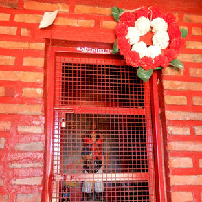
Blazing past Salta, we stopped for the night in San Salvador de Jujuy (pronounced “hoo-HOO-ee”), staying in a rustic historical home that is now a guesthouse. In the city center was a dramatic sculpture of Gauchito Gil, the beloved Robin Hood character of Argentina, rebelling against the military, which he deserted to fight for the poor. Roadside shrines to the Gauchito are common throughout Argentina, and are always draped in red flags.


Purmamarca (elev 7,625 feet)


Back in the mountains, it was a short drive to the colorful village of Purmamarca, settled amidst some beautiful painted hills. We lucked into a delicious “disco” lunch, served on an outdoor patio, complete with live folk music. “Disco” refers to meat and vegetable stews that are prepared in metal pans that historically were old discs from plows. The meal is sometimes translated as a “plow”.
The village is touristy, but has charm, with two 700 year-old algarrobo (carob) trees shading the plaza adjacent to the modest little church. We circumnavigated on foot the Cerro de Siete Colores, astounded by the variety of minerals, and the showy colors they produce, now exposed by uplift and erosion.


Tilcara (elev 9,880 feet)


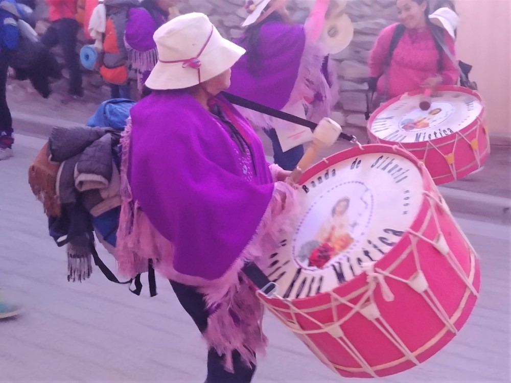
We arrived in Tilcara on Ash Wednesday, one of the village’s most special days of the year: the procession of the Virgen de Candelaria. We checked into our spartan rooms, which turned out to be residences for visiting performers in a community theater!
People from Tilcara and surrounding communities were erecting floral archways over the main street, each laden with food or other products produced by the community, to welcome the pilgrims.
Beginning in the late afternoon and continuing until well after dark, a steady stream of thousands of bedraggled pilgrims marched into town. They were organized into dozens and dozens of individual bands of 20-50 people. They were arriving in town after a two-day 50-km round trip walk, carrying full backpacks and loudly playing sikuris (pan flutes) and drums, to escort a statue of the Virgin of Candelaria down from its home high in the mountains. Most were exhausted, many were drunk, and all were still playing persistently when they arrived. The party concluded late at night with an outdoor mass, a light show on the church, and a free hot meal for all the pilgrims.


The next day all ornaments from the festivities were removed from the town and the church after Maundy Thursday mass. We enjoyed live music during lunch that included many different costumes, and instruments (some a bit dangerous!) We also visited the Pucará de Tilcara, a pre-Inca hilltop city that may have suffered some over-enthusiastic restorations, but still illustrated the extensive scope of the ancient city.


Humahuaca (elev 9,882 feet)
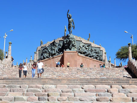
Humahuaca is the namesake town for the high mountain valley, the Quebrada de Humahuaca, that we were traversing. In the town, there is an outsized sculpture and plaza at the top of the hill, dedicated to the Heroes of the Independence Movement. The indigenous peoples' role in the movement is clearly celebrated here.
At the main town square we found a group of sculptors making large clay sculptures, one for each station of the cross, to be displayed only temporarily during Easter weekend.


The town hall building at the square features a tower with a door that opens each day at the strike of noon, followed by the (very slow) appearance of a mechanical San Francisco Solano which then blesses the eager crowd.
Iruya (elev 9,120 feet)

Continuing up the long high mountain valley, we turned off the main road at a road marked by a full building shrine dedicated to…
You guessed it: El Gauchito
Probably the most epic dirt road of the trip, it took us over a 4,000 meter (13,120’) pass, which then offered incredible views of high Andean peaks, but still no snow. We switchbacked down, down, down into a river valley along a cliff-hanger road that ended up in Iruya, tucked into the valley’s cliffs. The drive up the town’s very steep (>20% grade), one-lane, two-way, cobbled street was the most adrenaline-pumping of the trip.


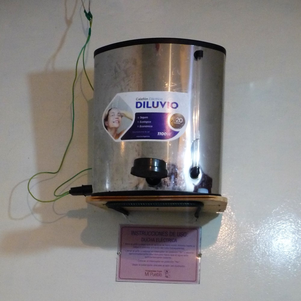


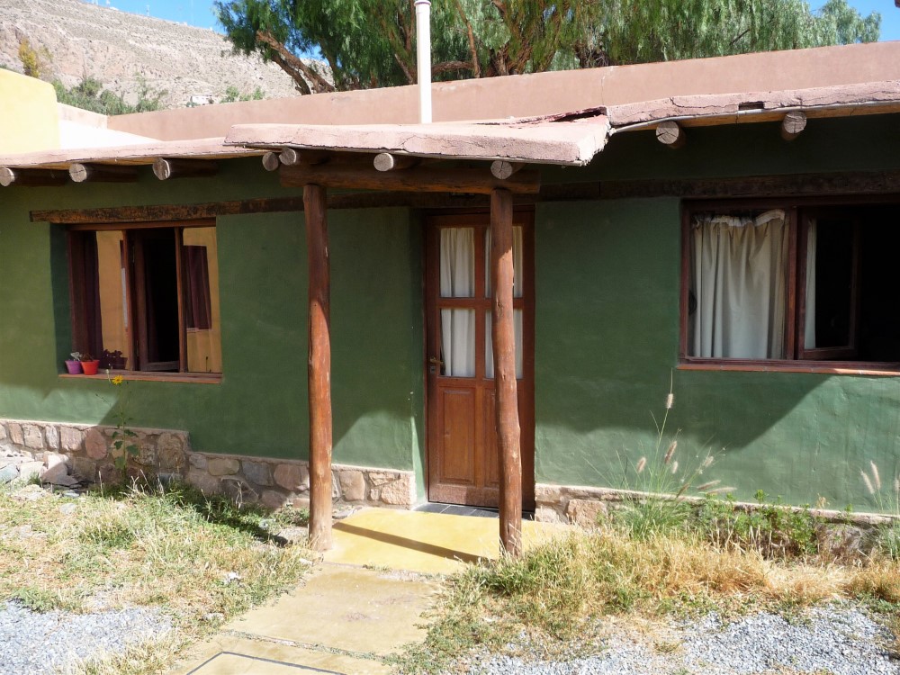
Our spartan guesthouse was clean, had a patio with a great view, and was equipped with tiny electric hot water tanks that were also the actual shower head. Note the wiring is right there in the shower with you!?! (Dad learned the hard way that the cold-water faucet in this poorly grounded setup was energized.)
We spent the next day walking around the town, which had many people out enjoying the Saturday at the town’s dirt fútbol pitch which held multiple matches between teams from several communities throughout the day.


Maimará (elev 7,657 feet)
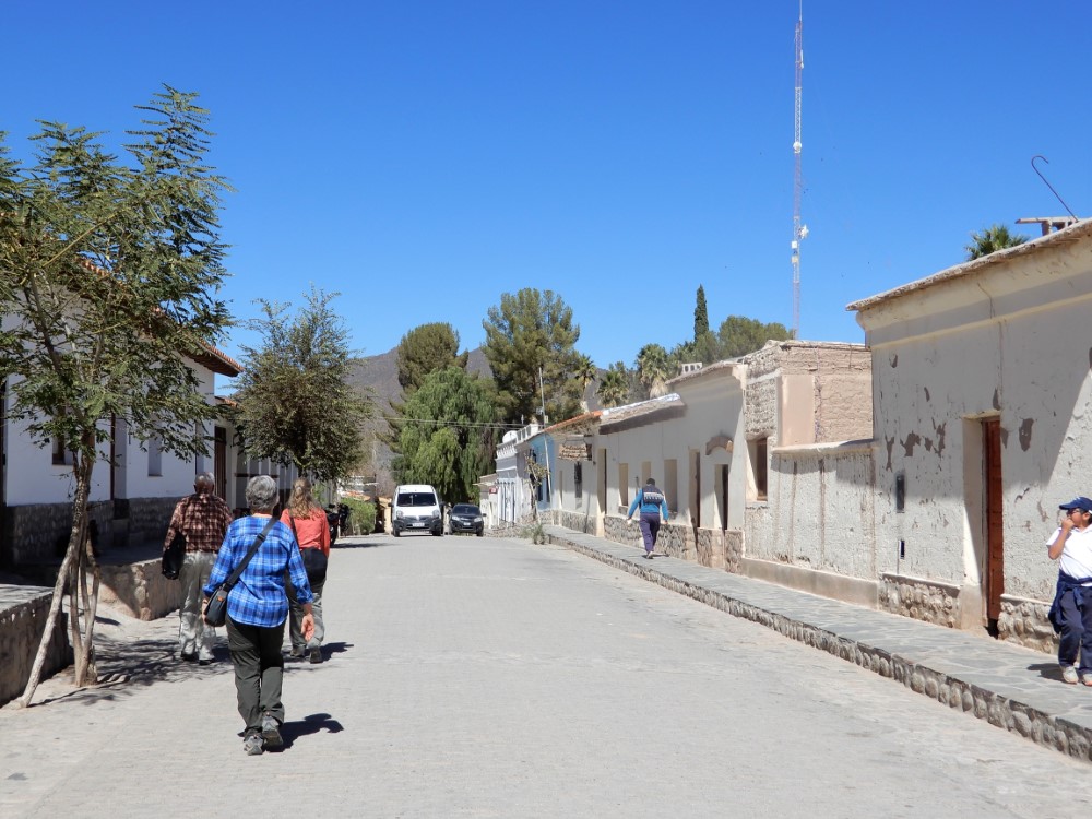
We headed back down the Quebrada to stay in the small, non-touristy town of Maimará, just south of Tilcara. Its setting is also dramatic, flanked by still more painted hills. It was fun and relaxing to be the only gringos in the village where we walked the streets, and tried some chicha morada (sweetened purple corn drink) with fried bread. It was Sunday and the town’s few restaurants were closed, so we cooked dinner for ourselves in the hotel and spent the evening played cards.


Cuesta de Lipán (elev 13,681 feet)


Turning our sights westward, over the Andean continental divide toward Chile, we headed past Purmamarca up over Cuesta de Lipán, where at the top of the pass, there were indigenous vendors selling jewelry, wool clothing, pottery and stone carvings.
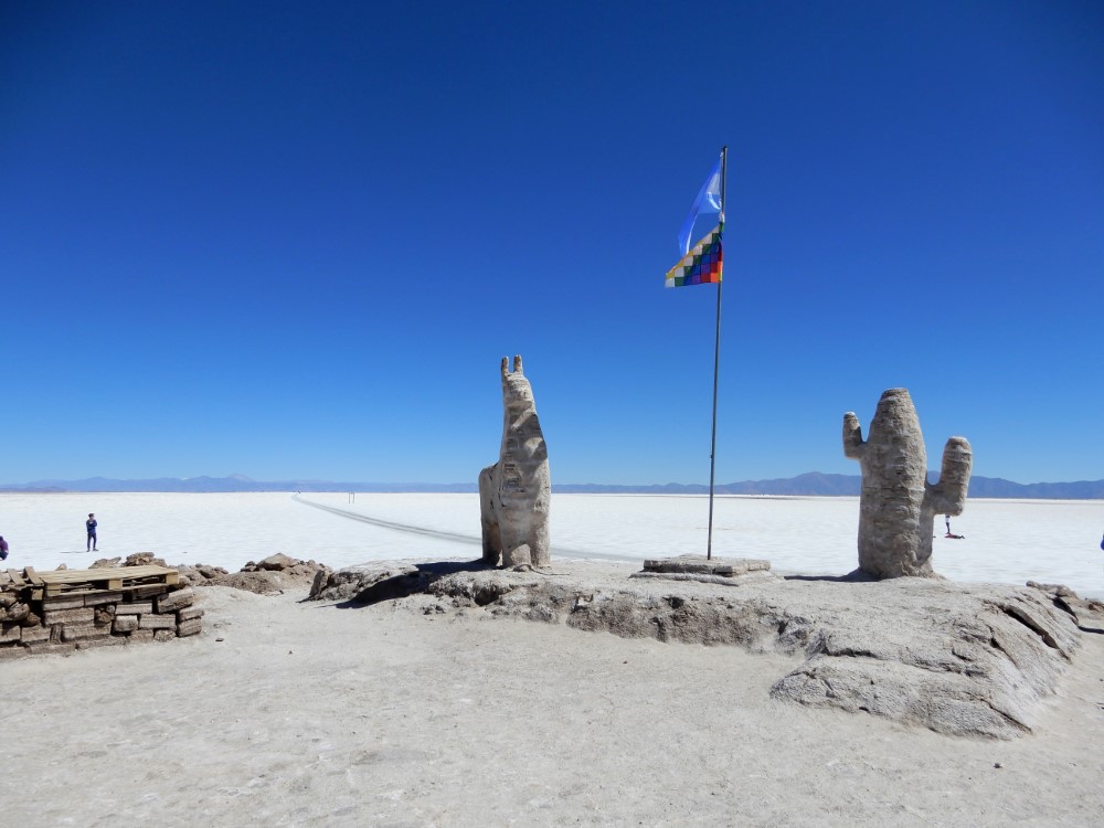
Coming down the other side we saw our first vicuñas, and saw far below us the Salinas Grande, the first salt flat of the trip. We stopped on the vast white plain, at elevation 11,300’, having a little fun with the camera and admiring sculptures and small buildings made entirely of bricks of salt. There is a large lithium mine here (think of the vast quantities of lithium batteries our electronic devices and electric cars use) which is being protested by the local indigenous people, saying it’s encroaching on their lands and water supplies. It is always eye-opening to see the ripple impacts of our modern way of life on faraway places and peoples like this.


Susques (elev 12,780 feet)


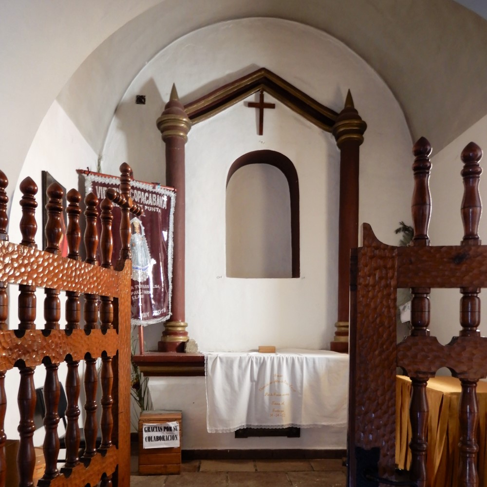
We climbed upward again to the small village of Susques, our highest overnight location of the car trip. The highlight of the town is their beautiful thatched roof chapel which dates from 1598, complete with the original frescoes inside.
Despite the elevation, we hiked to over 13,000 feet on the village’s stations of the cross trail, demarcated by sloppily whitewashed rocks. The next day we gassed up and headed west to the Chilean border.


Paso de Jama (elev 13,780 feet)

The next pass, Paso de Jama, is a(nother) border crossing between Argentina and Chile, but for the first time in our 6 crossings between these two countries, the border facilities here are co-located in one building, with their flags (and their staff) right next to each other! Maybe there’s hope for cross-border cooperation yet!
Interestingly, the road didn't descend after crossing the pass. Instead, it headed out onto a very high plateau at about 14,000 feet, and then slowly started going up as we approached Volcán Licancabur, a Mount Fuji-esque peak that would dominate our horizon for days to come (and appear again later during our journey in Bolivia).


The climate and the landscape are distinctly drier here, and we got our first views of the Altiplano region of the Andes. But still we found pockets of relatively fresh water which attracted vicuñas.
As we drove over the southern flanks of Licancabur we reached nearly 16,000 feet and passed within 2 km of Bolivia, and then descended precipitously to the Atacama desert basin, all the way down to elevation 7,900 feet.

San Pedro de Atacama (elev 7,900 feet)


We navigated to our cabaña on the outskirts of San Pedro de Atacama, down a narrow dusty dirt road tightly bounded by adobe walls crowned with sharp sticks. We were very dubious when the driveway led us into a construction site with heavy machinery, on-site adobe brick manufacturing, and numerous derelict cars, but we found our cabaña at the back of the site, and it proved to be a beautiful and quiet house — a perfect and centralized place for us to spend a week seeing the many sights of Los Flamencos National Reserve and the surrounding area.
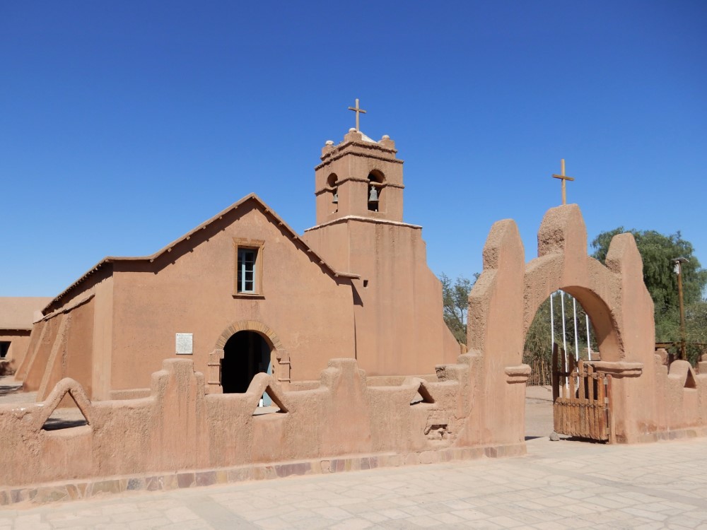
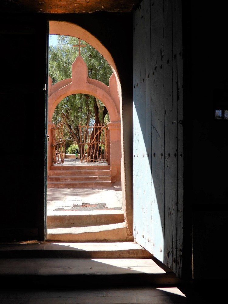
San Pedro is a touristy/hippie town set in the Atacama desert, one of the driest places on earth -- with many parts of it receiving less than 1 mm/rain/year. It was founded here because of the presence of a spring. Off of its town square is a beautiful old and rustic adobe church, complete with cactus wood ceilings and leather lashings still holding the roof structure together.


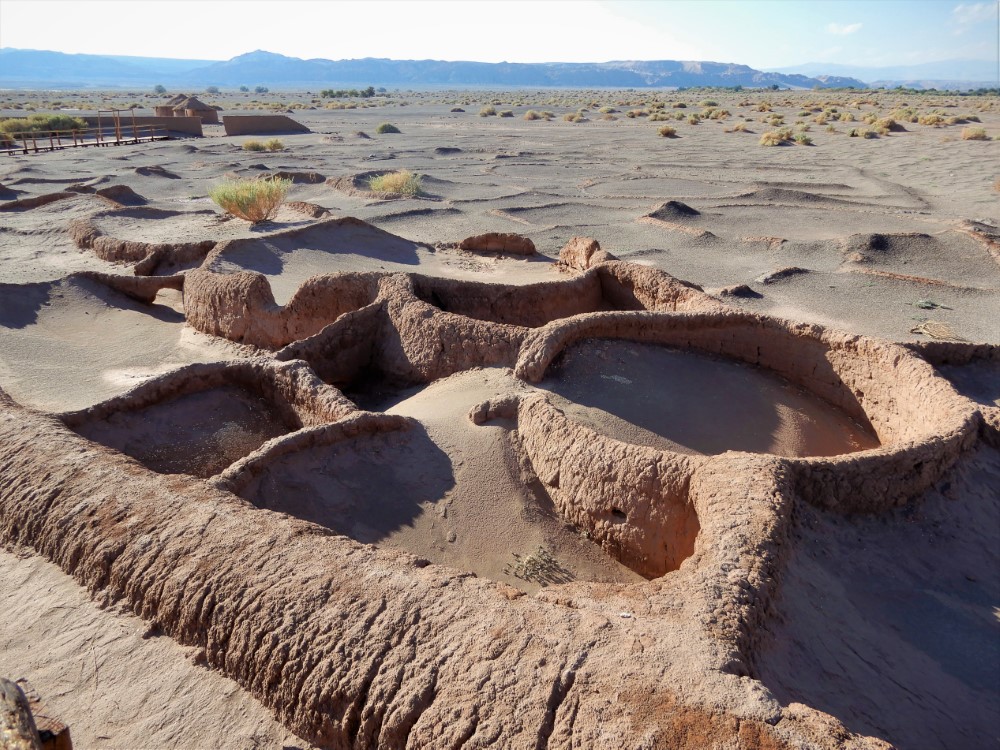
Tulor ruins (elev 7,900 feet)
The remains of round houses are what makes the ruins of Tulor unique. We were told that the community had to relocate because the river re-routed, forcing them a few kilometers away to where San Pedro de Atacama now is. The local indigenous community that manages the site is working to develop tourist infrastructure and protections for the rapidly eroding building remnants, but it remains one of the most threatened archaeological sites in the world.


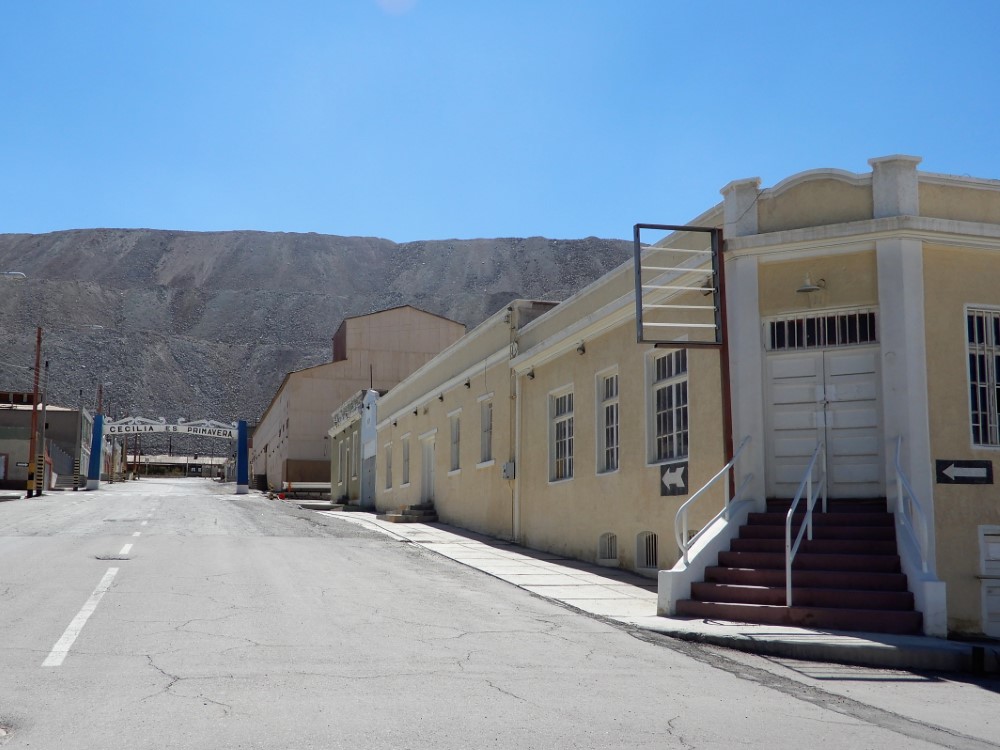
Calama, Chuquicamata copper mine (elev 7,410 feet)

We took a 100 km field trip northwest to the town of Calama to see the Chuquicamata open pit copper mine, the world’s largest (by excavated volume), and responsible for over 5% of the world’s new copper supply. On the way the road passed through a sizeable wind farm.
Calama is a serious company town, with the town’s street signs clearly showing they were provided by Codelco, Chile’s nationalized mining corporation. While in town, waiting for the company-provided tour to start, we happened upon a Dominican restaurant run by a warm and chatty family.


The tour began by visiting the Chuquicamata ghost town, which used to house 18,000 people, and is now being progressively covered up by new mine tailings!
We saw half of the old hospital and modern power lines just poking out of the new hill - surreal! Our tour guide said the whole town was moved to address health concerns for its residents, while others say it was to reduce costs of hauling away the tailings. After being there, we think both are probably true.
If you have an extra 5 minutes, this 2007 article: “The City That Was Eaten by a Copper Mine” is quite an interesting read.
The scale of the mine is boggling, as you can see in these images from space. At the edge of the immense pit (4.3 km long, 3 km wide, 0.85 km deep) we were passed by an endless line of MASSIVE trucks, which operate 24/7, removing 140,000 tons of material per day! Another reminder of the distant effects of our electrified and electronic society.


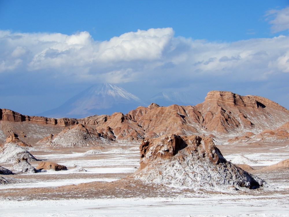
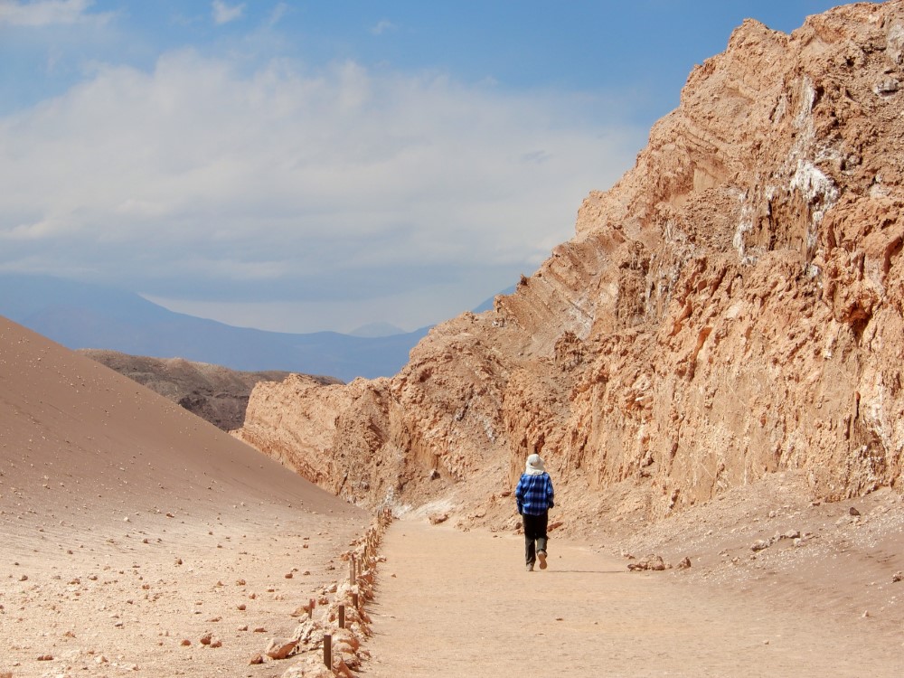
Valle de la Luna (elev 7,900 feet)
Just 13 kms from San Pedro lies the well-named Valley of the Moon, a salt encrusted landscape interspersed with pristine sand dunes, with views of Volcán Licancabur and other peaks in the distance. The salt manifested in lots of ways, including some formations being comprised of solid (and tasty!) rock salt.


Stargazing in the Atacama (8,200 feet)
We stayed up late one evening stargazing with an indigenous star tours group. After a quick introduction, they gave each of us a heavy wool blanket, and we went out to a terrace with 5 or 6 telescopes set up to take advantage of the very clear and thin Atacama air. They also have an observatory that houses a large telescope through which we observed a globular cluster in the Large Magellanic Cloud. Definitely one way to feel very small.

Tatio Geysers (elev 14,170 feet)
A spine of high Andes with both dormant and active volcanoes delineates the border between Chile and Bolivia, making for a scenic drive to the Tatio Geysers. The rough and mountainous road included lots of animal life, especially small groups of vicuñas and their young.


Fueled by nearby volcanism, the geysers are dynamic, ranging from slow bubbling latte-like pools, to high pressure steam vents, to cyclical vents that keep you in anticipation for the next blow!


Laguna Chaxa (elev 7,550 feet)
Laguna Chaxa is vital habitat, especially for three species of flamingos (Andean, Chilean, and James') and the brine shrimp they feed on, as well as many other birds and reptiles. It is set within a completely different kind of salt flat, with incredibly sharp and jagged formations that would be dangerous to walk through if not for the pathways provided in the park. The salt water table was just inches below the crusty surface.


Toconao (elev 7,950 feet), Paso de Sico (elev 15,030 feet)


We stayed the night in the village of Toconao, then set off the next morning for Paso Sico, taking us over the Tropic of Capricorn and back over the Andes to the Argentinian altiplano. Along the way we were treated to views of volcanoes, stone retaining walls of Inca farming terraces, freshwater and saltwater lakes, more vicuñas, spectacular arid landscapes and even some Darwin’s rhea next to the road.
San Antonio de los Cobres (elev 12,385 feet)
After crossing from Chile to Argentina through another joint border crossing, we saw signs that we were crossing back into civilization, from high tension power lines connecting to a new solar farm under construction, to the historic Tren a las Nubes rail line that connects San Antonio de los Cobres (where we stayed the night) to Salta.


Returning to Salta through the Quebrada del Toro


We continued to gape at geologic marvels to the very end of the trip, descending through the scenic Quebrada del Toro, where we happened upon a historic train engine at the town at the bottom of the canyon. Our dusty Duster looked the part as we returned it in Salta.
It was an amazing three weeks and we are so thankful that Chuck and Harlowe traveled all the way down here to share this time, and these amazing experiences with us!
Our time in Salta before/after the Kittles


We spent over 3 weeks in Salta, before and after the Kittles were there, more time than we’ve spent anywhere else on the trip. Which means we actually got to know the place a bit. We spent over a week each in 2 different apartments, watching the weather change, getting to know those neighborhoods, and sensing the ebb and flow of the city.
We treated ourselves to some sightseeing, nice meals out and home cooked meals, yoga every day, catching a movie, and soccer watching. We also got our teeth cleaned and caught up on bike maintenance.
A particularly memorable moment was the benefit folk music outdoor concert for the Salta Police, which is a massive and annual affair. There were thousands of people there, in a carnival-like atmosphere, with 8 musical acts by groups of all ages from all over Argentina, and people dancing in the aisles. It’s such a big deal they broadcast the concert live to the whole country! The start time was supposed to be 8:00 pm, but the first band didn’t begin until well after 9:00 (Argentinians stay up really late!) so we bailed out after 1:00 am, as the last act was just setting up.

Resurrecting the “soundtrack” section of our blog, we've included some video links for some of the groups we really liked:
(Note - The Alma Chaqueña video includes a representative example of the folk dancing)
We are now back on our bikes in Bolivia, winding our way north towards La Paz.
To find out where we are at any given moment, check our Track My Tour page, where we post a photo and blurb every day that we’re on the move. Also, you can get more up-to-the-minute, spontaneous updates if you follow Clark's accounts on Instagram and/or Facebook.