In many ways, the first three month of our travels through the Andes of Colombia, Ecuador and Northern Peru have all been preparation for this part of our trip - riding to, and through, Perú’s Cordillera Blanca, the world’s second highest mountain range (after the Himalaya). The range has 84 peaks over 5,000 m (16,400’), which makes for some jaw-dropping biking and hiking scenery.


Challenging roads
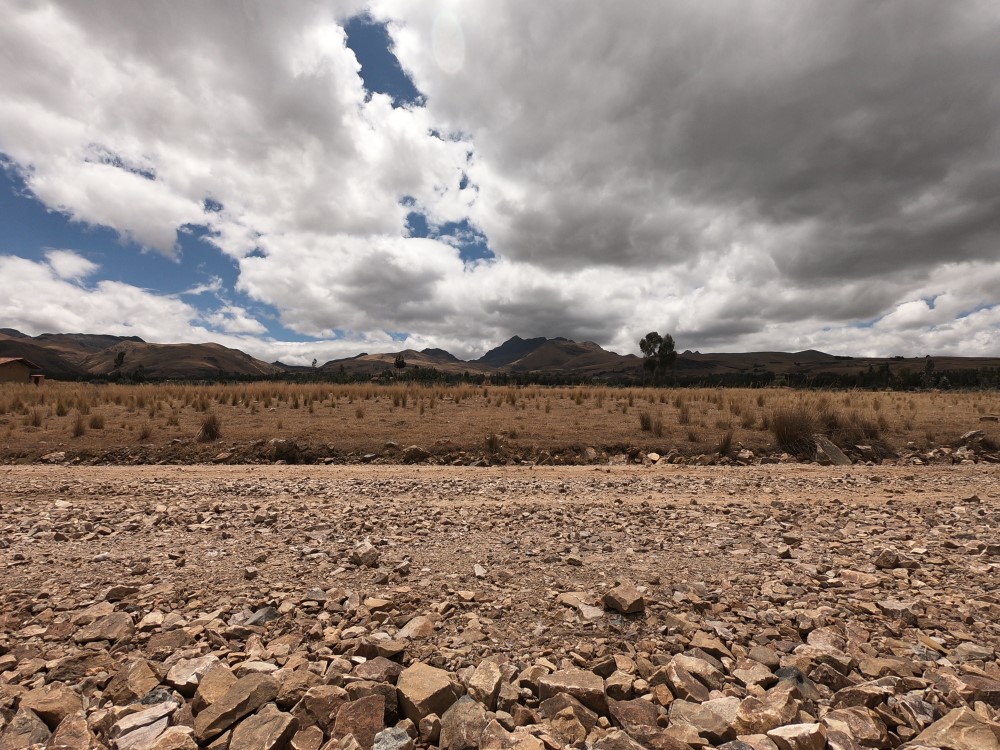
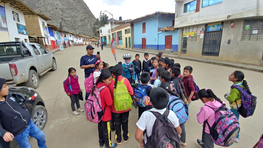
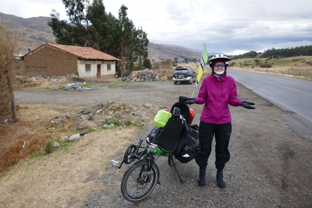
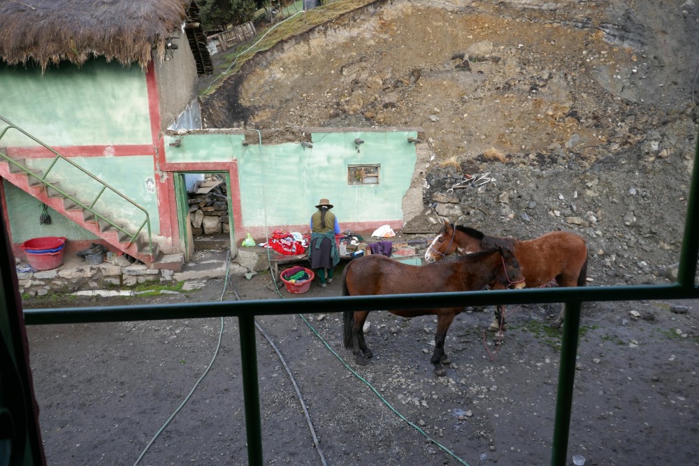
Before we could revel in the Cordillera Blanca’s grandeur, we first had to get there, and riding through the ever-higher ‘’foothills’’ (i.e. peaks <5,000 m) was our final training, exposing us to long climbs and descents, each with dozens of switchbacks, and many of them on dirt roads, which we have found to be quite challenging on our heavily-laden, smooth-tire recumbent bikes. Second only to growling packs of dogs, unconsolidated sand and gravel is our biggest nemesis, forcing us to move quite slowly, even downhill, to avoid having our bike’s front wheel dig into soft soil and threaten to topple us. The week of riding to get to the Cordillera Blanca did much to increase our skills in this regard, while also testing our fortitude, yet the challenging conditions were more than rewarded by the ever-changing and ever-more-dramatic scenery, and a big sense of accomplishment at the end of each day. The most challenging day was a brutal descent on a steep, rutted-out-to-powder road into Angasmarca, but we forgot all about it, as we entered the village just as school was getting out, and throngs of children engulfed us as we made our way through the town.


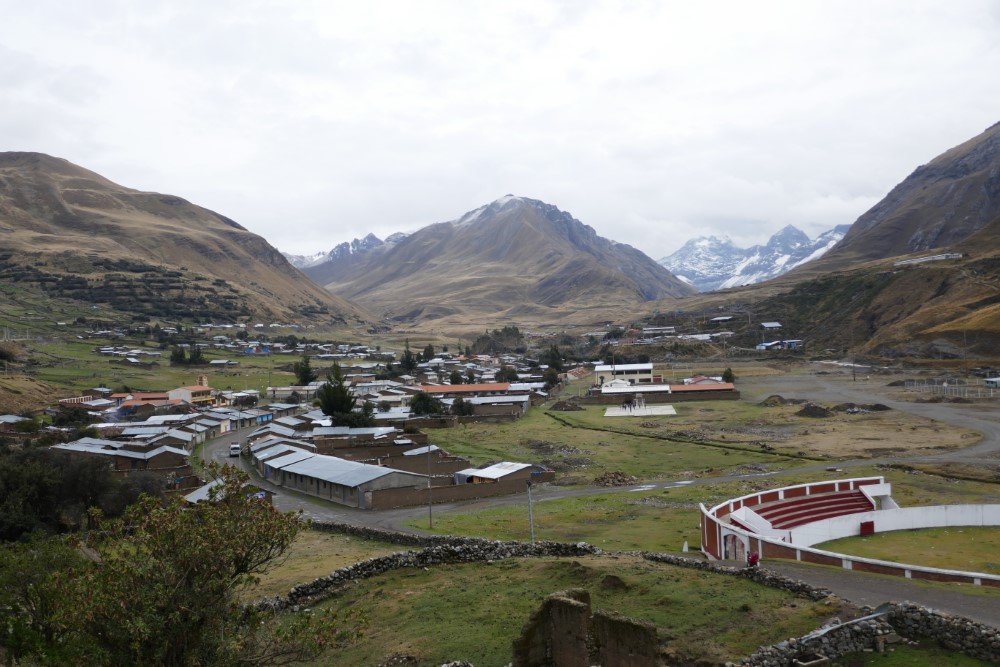
Our sixth day of riding was from Mollebamba to Pallasca, two small towns, both high in the hills, above 3,000 m, separated by a deep river valley more than 1,100 m below. It’s not often that one’s whole day of mountain riding is laid out in full view, but this day was, allowing us to view Pallasca in the morning, across the vast valley, 4-5 hours before we would actually arrive. The morning’s view also included many of the 30+ switchbacks - both down and then back up - we would need to traverse to get to this town just across the way. It was awesome, and the giddy chatter on our helmet intercoms was pretty much constant for the whole ride. Days like this are exactly why we love mountain riding!
We ended up getting waylaid in Pallasca for a day due to Clark’s first bout with “intestinal malaise” (we both ended up getting it twice by the time we left Peru), but then we embarked on our longest descent ever, in all of our years of bike touring (including our ride in the Himalaya) - 3,200 m (10,500’) down to Chuquicara at elevation 530 m, just 60 km from Peru’s Pacific coast. The ride was extraordinary, as you can see in the video, with huge vistas from a cliff hanger of a road, all the way down through millions of years of colorful geology to the river below. We had to do this to get to the Río Santa, which became our roadside companion for the next few weeks.


Chuquicara itself is really just a grim truck-stop, providing us with the definitive low-point of our guesthouse/hostel experiences (thus far), including a door that didn’t latch, a “window” without glass, used bedding on both single beds, and vicious guard dogs that we had to pass on our way to the toilets that didn’t flush. Definitely a contrast to the nice places we’ve gotten to stay in, even in very small and out-of-the-way towns, but we were still glad it was there.
Up the Río Santa
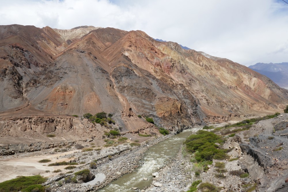
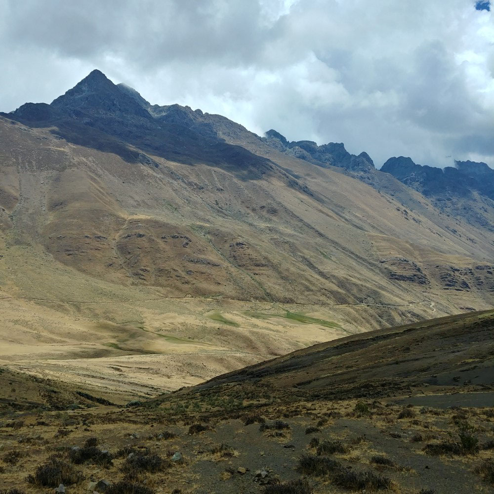
The Río Santa is the dividing line between the Cordillera Negra (“Black Range” {or without snow}) to the west, and the Cordillera Blanca (“White Range” {or with snow}) to the east. The river is fed by the melting snow and 722 glaciers that cover the Cordillera Blanca. (Note: climate change caused the area of permanent ice cover to shrink by about one third, from 1970 to 2006!) This river became the geographic constant for us for the next month of our riding and hiking in the region - we would return to it after each foray into one of the cordilleras, and we traversed it from near its base (Chiquicara) all the way to its headwaters at Laguna Conococha.


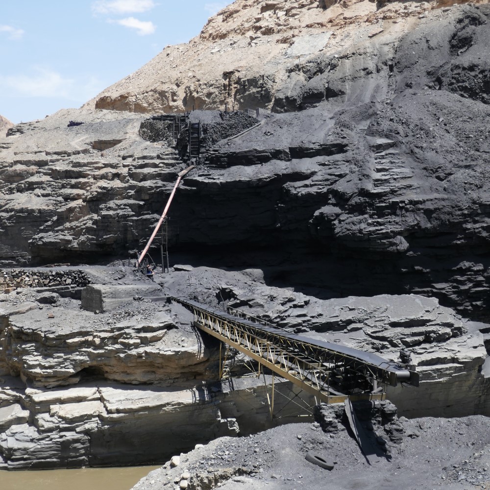


Our first day to Huallanca was up through desert hillsides accented by riverside agriculture transitioning to solid rock geology (and small scale coal mining), becoming more and more colorful as we went up. Along the way, the road was blocked for some critical, post-landslide road repair. A van pulled up behind us, and out piled 11-12 members and entourage of the band Dharma Perú, a contemporary folk band who was on its way to a gig in a mountain town. They were an energetic bunch, quite enthused by our trip and our bikes. After taking lots of pictures with us and our bikes, they performed for us in the video below. After the performance, one of them climbed up on the roof of the van, and rifled through their luggage to give us one of their CDs! Here is a link to them performing earlier this year (we’re sorry we couldn’t re-route and go see them!)

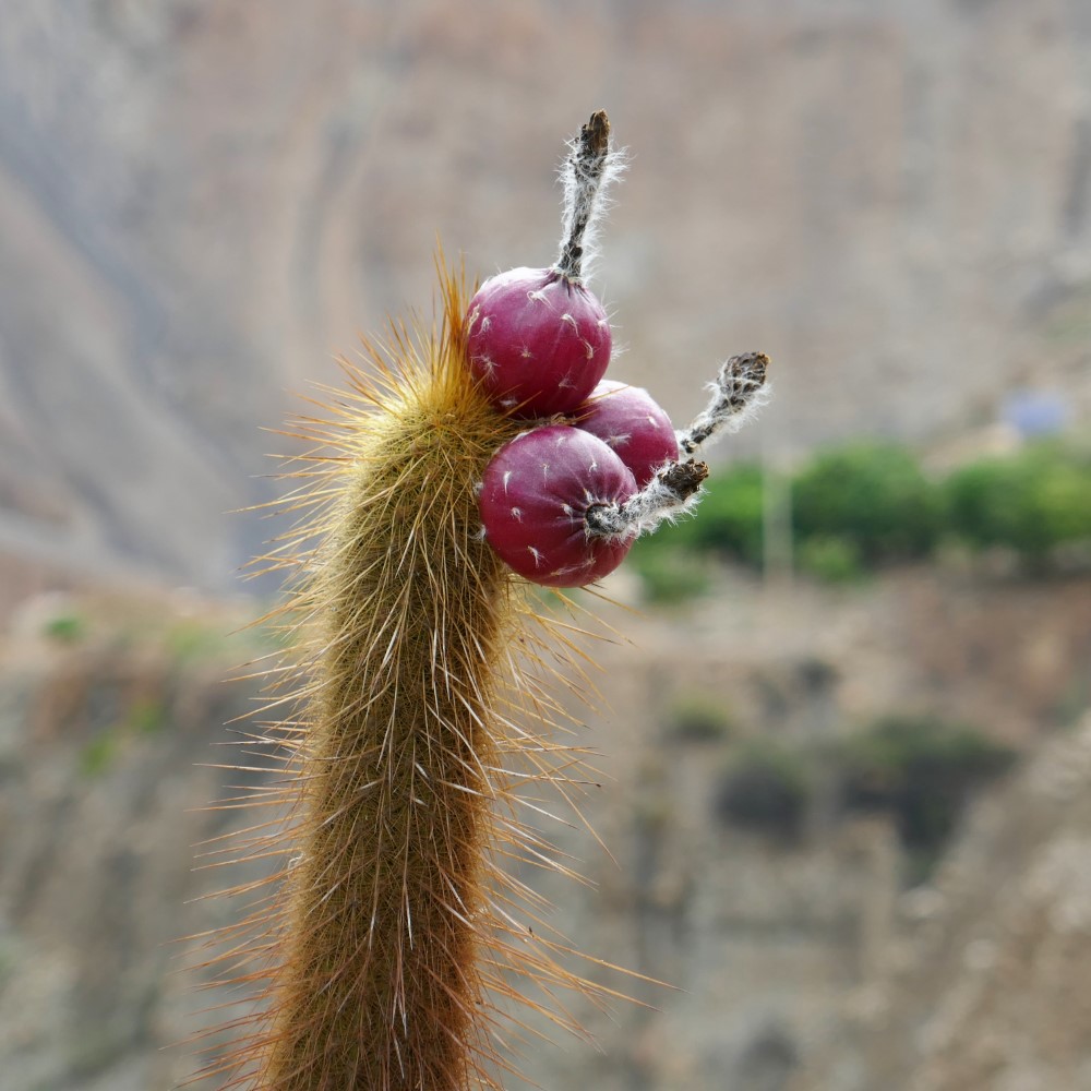
Once we were back above 1,000m we started to see multiple large-scale farms of big prickly pear cactus which (we think) are for two different crops: first, the cactus “pears” are sold as a tasty fruit throughout Peru, second, the cactus is the breeding ground for cochineal, a special bug that lives in a fluffy white wax on the prickly pear pads. The bugs are bright red when you squeeze them, and are the base for natural red dye used in peruvian weaving and food. Peru is the world’s largest exporter of cochineal.


Roadside drama


Leaving Huallanca, we immediately started heading up some switchbacks, and were among the first, along with a policeman, to come upon a semi tractor trailer that couldn’t make one of the sharp turns, and was now completely blocking the road, even for the passage of two small bikes. Over the next 45 minutes, cars and buses accumulated uphill and downhill from the truck, and the crowd of onlookers, and helpers, grew. They ended up performing some major excavation/road engineering on the corner, all with picks and shovels provided for the cause by one of the waiting buses, until at long last, the truck was able to precariously negotiate the turn. It was quite unexpected roadside entertainment!
Cañon del Pato
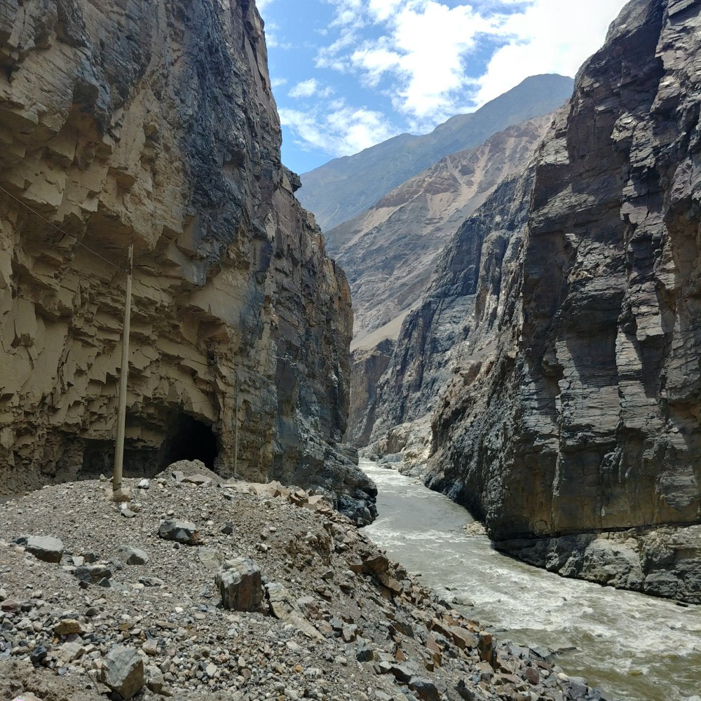
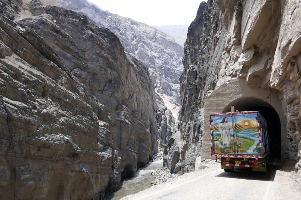
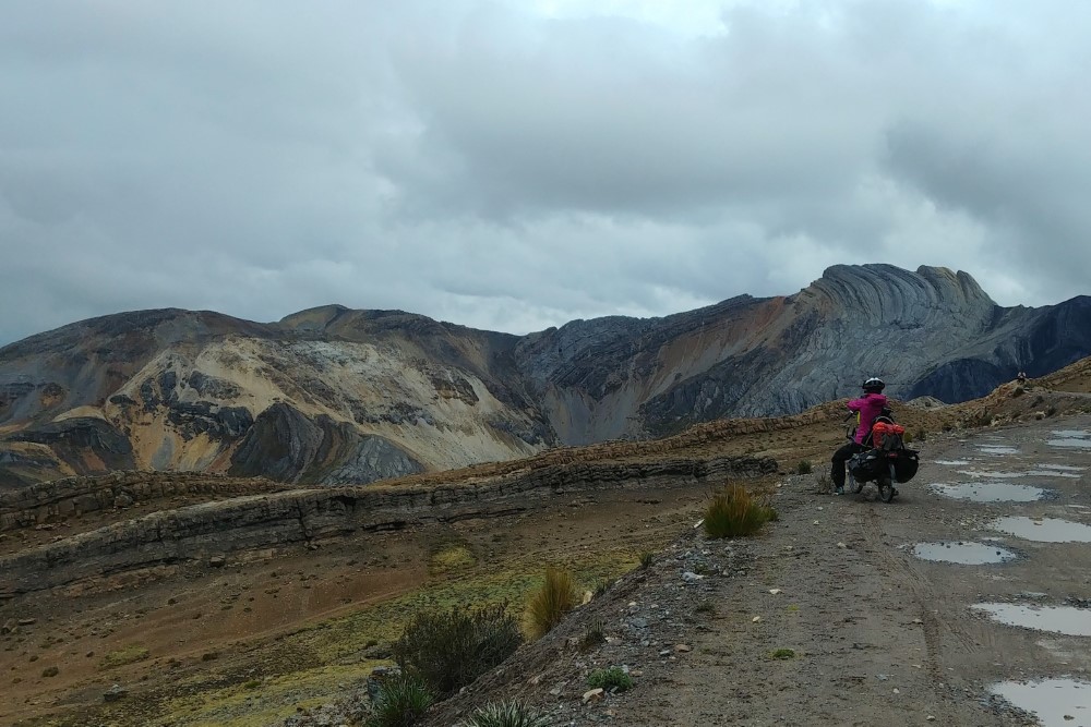
The switchbacks led us up to Cañon Del Pato, considered to be the point where the Cordillera Negra and Blanca meet, and where the road is carved out of (and through) almost solid marble. The road has 35+ tunnels (a feature that is not usually a plus for cyclists) but the tunnels were mostly short, lightly trafficked and afforded new and exciting views each time we exited one, making for another extraordinary day of riding! Water is also tunneled through the rock to multiple hydroelectric facilities.


Viewing the Blanca from the Negra


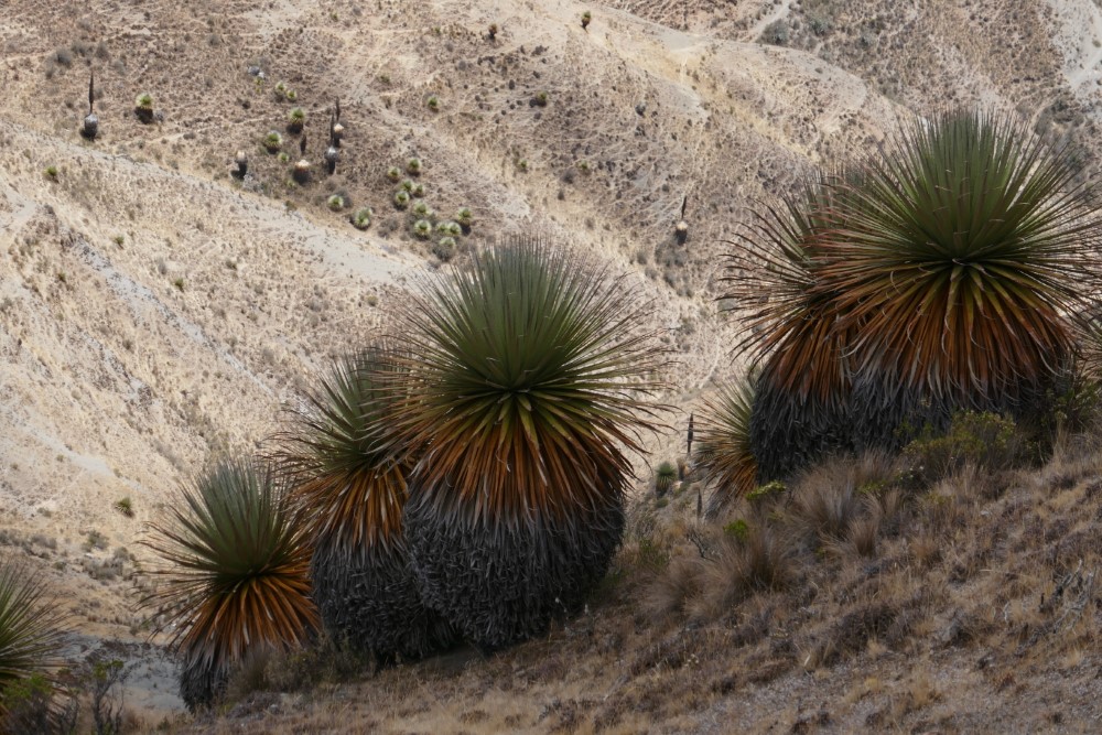

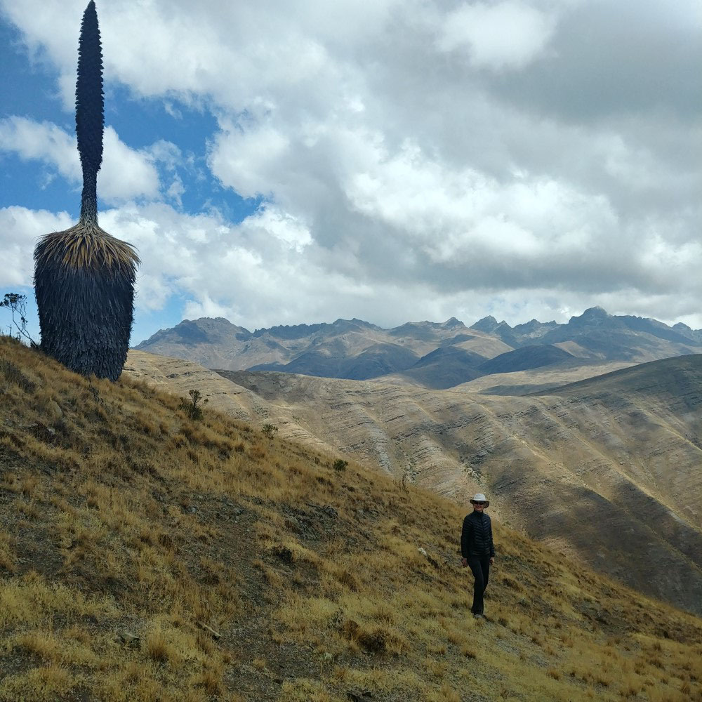


We arrived in Caraz to peek-a-boo views of a few of the peaks in the Cordillera Blanca and unobstructed views of the Cordillera Negra, so we chartered a taxi to take us along the top of the Negra to get our first views of the whole Blanca range, as well as to see one of the few remaining stands of Puya Raimondii, a majestic plant endemic to this part of the high Andes (which reminded us of the equally distinctive, but completely different, frailejón plant that we went on about in our blog on Colombia’s Natural Beauty).
Intrepid French family
For those of you who think we are adventurous, check this out: In Caraz at the supermarket, Clark met a French family of six (with four children between the ages of 5 and 12) traveling on 3 fully-loaded tandem bicycles! They stop at village schools where they have a cultural exchange with the students, and camp for the night. You should definitely check out their website to learn more about their truly amazing adventure!


Huascarán Circuit
Note: All of the rides and hikes we took in this region were informed by “Peru’s Cordillera Blanca & Huayhuash” by Neil and Harriet Pike (a.k.a. The Pikes on Bikes) published in 2015 and still considered to be the definitive guide for bike touring and trekking in the region. We couldn’t have planned this part of the trip without it.


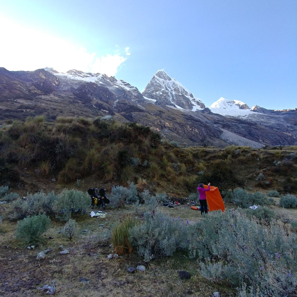


We made our way up-valley to Carhuaz, where we sorted through our gear and removed everything non-essential (e.g. locks, laptop, spare parts, summer and city clothes, etc.) to lighten our load for this epic ride around Nevado Huascarán, Perú’s highest peak at 6,768 m (22,205’). Leaving the non-essentials at the guesthouse we’d return to, we began riding with morning clouds - the first we’d seen in Perú - a portent for things to come. The clouds built over the morning and finally rained on us as we passed through the narrow glacial valley that marked the entrance to Huascarán National Park. By the time we’d gotten to our campsite at 4,000 m (13,100’) the skies were beginning to clear, offering our first glimpses of the array of snow-capped peaks that now surrounded us. As night fell, we were treated to our best view of the Milky Way yet, and were surprised to find ourselves surrounded by hundreds of fireflies congregating around the riverside vegetation!
Punta Olímpica
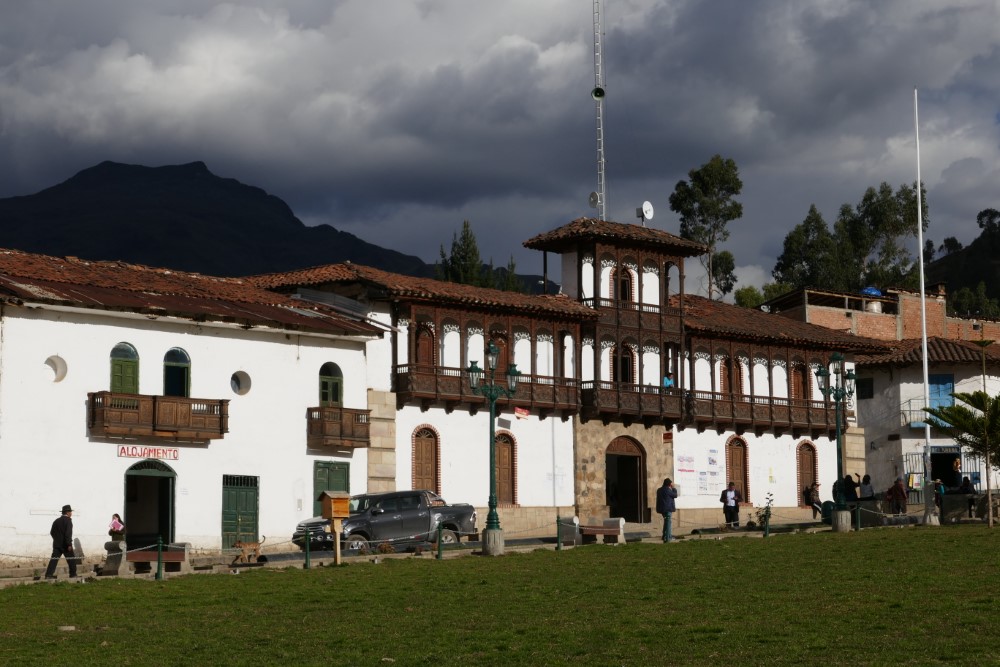
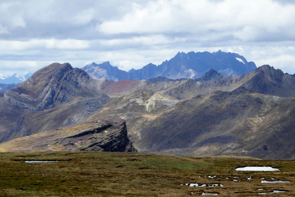
This day began with 37 switchbacks up to Punta Olímpica with clear, unobstructed views of of all of the peaks around us as we headed up the beautiful paved road, eventually finding ourselves parallel with nearby glaciers. At elevation 4,732 m the paved road dives into a 2 km tunnel through the mountain, but we instead turned onto the old, abandoned dirt road and pushed our bikes up and over the actual pass (elevation 4,950 m, 16,240’). At the top, we pushed through the pad of snow in a small, anti-climatic notch, coming out on the other side to yet another spectacular view of peaks, glaciers, turquoise lakes and wait for it… 36 switchbacks down the next valley to the lovely town of Chacas, which is distinguished by Italian woodworking adorning many of the buildings in the town.


Dirt roads and changing weather


The southeast portion of the circuit put us back on dirt roads for what would prove to be one of our toughest days yet - not for any particular moment, but just for the sheer distance and elevation gain over the day (49 km, 1350 m ascent). It took us ALL day to reach the pass, and we bumped down into Yanama as the sun was setting.
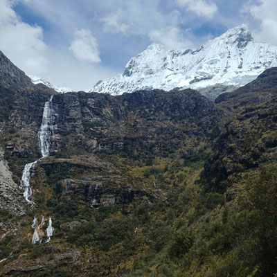
We took a much needed “break day” and hiked 12 km to a glacial lake tucked high up a valley above the town at 4,600 m. As we approached the lake, a chunk of the glacier above it broke away and cascaded down the granite face!


The next day, when we were supposed to be riding up to Portachuelo Pass, we awoke to steady rain and a cloud ceiling that was all the way down to Yanama - not the conditions we were hoping for to tackle the last big pass of the circuit. It was now clear that the Andes’ rainy season was arriving, making our riding here much more challenging, and frankly, less fun and rewarding. The weather forecast for the coming days was pessimistic at best, so we made the painful decision to hire a van to take us over the last third of the circuit and back to Carhuaz to regroup. Even socked in by clouds, the drive over the pass was dramatic, but seeing the wheel tracks in the rutted dirt road full of running water, cascading down through 34 switchbacks, confirmed that this day was not a good day to ride.


Tourists around Huaraz


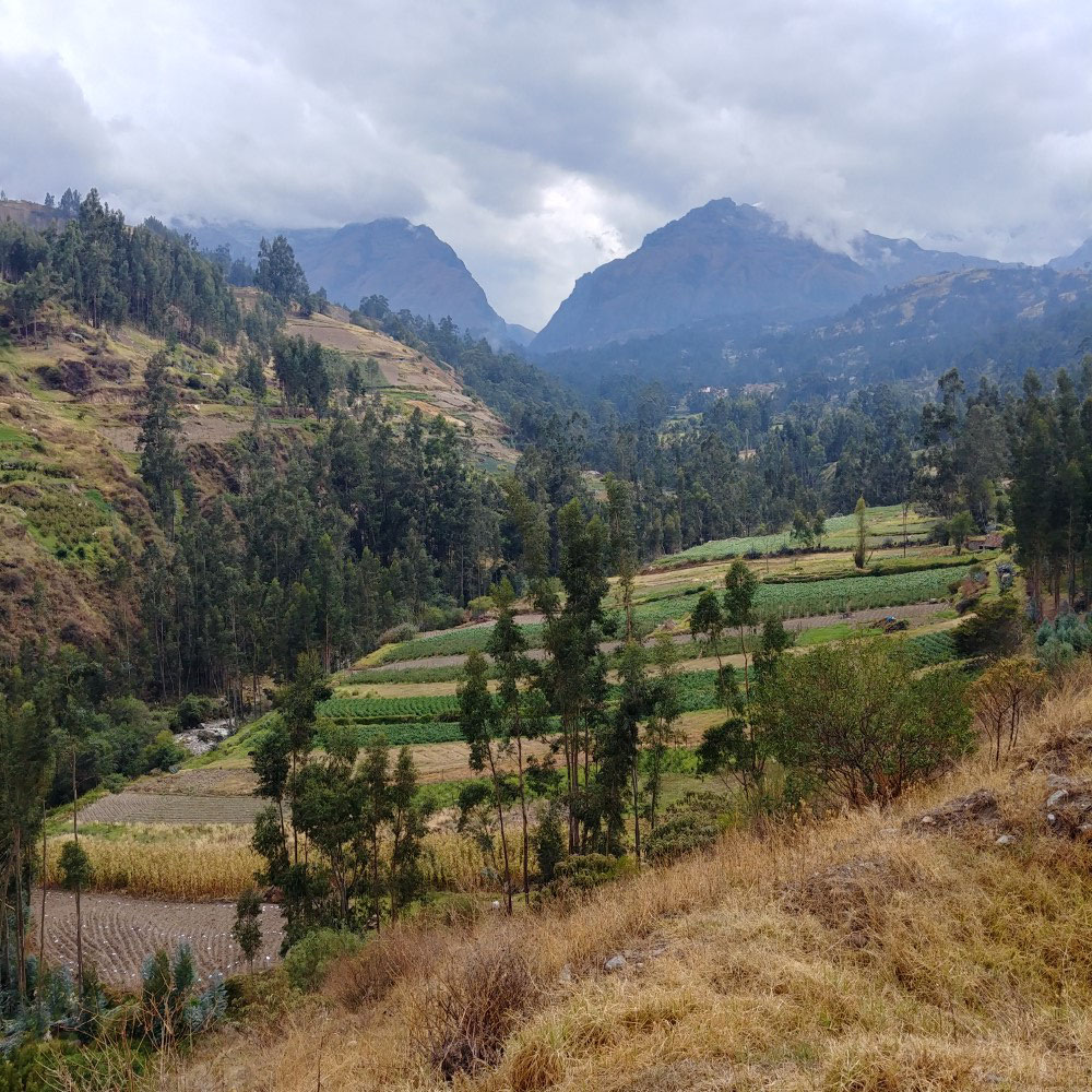
We continued upriver for 34 km to Huaraz, the epicenter for tourism in the region, and the place we had been focused on getting to for months. Perks of tourist centers like this include: rooftop patios with amazing views, craft beer, salads that are safe to eat, peanut butter, access to high quality outdoor gear, etc. We ate well and stocked up, including replacing Kacia’s sun buff and gloves, as hers got eaten by an aggressive cow at our Huascarán campsite!
We also met up with Jan (an old friend from our Ultimate Frisbee days in Boulder, CO) and her husband Rick, who became our travel companions for the next week. We started by taking another drive up into the Cordillera Negra, but this time we got dropped off at the pass above Huaraz and we walked down a 14 km section of an Inca trail back to Huaraz, passing through farm fields, pastures and small villages, all the while enjoying amazing views of the Cordillera Blanca across the valley.


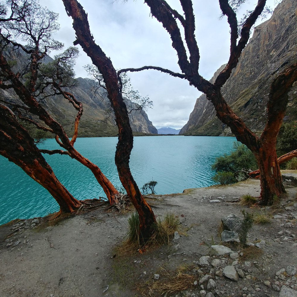
The next day we traveled to the beautiful, off-grid Llanganuco Mountain Lodge at the base of Nevado Huandoy, allowing us to stage a hike to Laguna 69, one of the most picturesque glacial lakes in all of the cordillera. The hike was amazing and Charlie Good, the effervescent and committed british owner of the lodge, was also a trip highlight.
Finally, we took an all-day tour of the Chavín de Huantar archaeological site, yet another stunning, extensive example of how Perú seems (to us) to be a kind of ‘cradle of civilization’ for the Americas. The sheer number and scale of sophisticated civilizations that existed here leading up to the apex of the Inca continues to boggle our minds!


The Huayhuash Circuit

We said goodbye to Jan and Rick, and set out on our last circuit (for now) in Perú’s high Andes - through the Cordillera Huayhuash, the mountain range immediately south of the Cordillera Blanca. This time we knew the weather was changing, and not in our favor, but wanted to see if we could get a few more peeks at a few more peaks before we headed to the coast. ;-)
Rain slowed us down and prevented us from making it to the national park entrance before dark, so we stopped at a local’s house and paid her 2 Peruvian Soles (65 cents) to fill up our 6-liter water bag for a night of camping. The rain subsided and we made our way up the river valley to camp in a cow pasture, just 50 meters from the road. We woke again to building clouds, knowing that meant a day of climbing a dirt road in the rain, but we also knew that these cordilleras are dramatic even when shrouded in clouds.


We lunched under cover at some protected pictographs, passed numerous shepherds’ stone huts with grass roofs, and rode through groves of Puya Raimondii, all as we climbed and climbed in ever-cooler, sporadic rain and snow. Needless to say, the pass (Punta Huarapasca) was visually anti-climatic (i.e. socked-in by clouds) and so cold that we couldn’t stay long, but on the other side of the pass the clouds opened up, and we were treated to our first rewards for the day’s arduous climb. Glacier-capped peaks near and far surrounded vast scenic valleys full of wetland areas, illustrating how these high alpine areas function as regional sponges, detaining the water that is so critical for Perú’s populations and agriculture on the Pacific coast. We camped at the highest (elev 4,618 m 15,150') and arguably the most dramatic campsite we’ve EVER had, at the base of Nevado Huarapasca - a fine ending to a long day.
The scenic drama continued the next day as we rode a long, high traverse to another pass, complete with 360-degree views of both cordilleras at our lunch stop! Mountain after mountain illustrated extraordinary geologic history in colors and rippled layers, with beautiful valleys stretching in all directions. Our decision to squeeze out one more week of mountain riding was validated on this day!


This descent through pelting sleet proved to be the darkest, wettest and coldest of the trip, so we were ecstatic to find the only guesthouse in the mining town of Pachapaqui had two free beds in their (rather spartan) dorm room, which we accessed via their very muddy stable yard in the back!
With the weather outlook to the south getting worse, we decided to take the mid-circuit “shortcut” on pavement, as opposed to the full circuit on dirt roads, which still meant an 1,150 m climb through copper mining country (the reason for the paved roads). We stopped at the top for a selfie and then looked down-valley to a dark and growing storm.
Leaving the Cordilleras


We were wistful the next day, knowing that this would be our last pass, on our last day of riding through these amazing and challenging mountains. We decided to re-route away from our original plan of riding south through the Andes, and instead head west to the coast - we’ll have to wait to ride to Cusco and its surroundings until next year when we may elect to return during the dry season. It was another beautiful ride, but right up to the end, the mountains reminded us why we’d made our decision, as that day’s storm front almost caught us at the pass, forcing us to race down the flanks of the mountains buffeted by an extreme crosswind, where we had to lean into it, just to keep going straight. We got to Laguna Conococha (the Rio Santa’s headwaters) just an hour before the rain did, once again finding the only (and spartan) accommodations in the town.
Heading to the Pacific Coast
This descent was even bigger than our last record out of Pallasca, this time going downhill, continuously for 4,100 m (13,500’) over 122 km (75 miles)! We’ve never had a day like this before and guess we never will again. The ride was memorable, going through many different ecotones and dramatic changes in climate and geology. We finished in the coastal town of Barranca, sad that we have left Perú’s Andes behind us, yet excited that just days away is Lima, from which we will fly to Santiago, Chile, to begin the second phase of our trip, down through Patagonia, hopefully to the southern tip of the continent!


An update on where we are now: We’ve left Perú and are now in Santiago, Chile, where we’re embarking on Phase 2 of our trip, cycling southward through Chile’s wine country, lake region and Patagonia. To find out where we are right now, check our Track My Tour page, where we post a photo and blurb every day that we’re on the move. Also, you can get more up-to-the-minute, spontaneous updates if you follow Clark's accounts on Instagram and/or Facebook.