Apologies for some technical difficulties: This blog was very delayed because we suffered a cascade of electronics failures. First the charging cord for our laptop fried, then our camera froze up from too much dust, and finally the memory chip onto which we had saved all our Patagonia photos became corrupted. We have finally replaced the power cord and camera, but the photos of the northern half of Patagonia were permanently lost. This blog contains photos taken with our phones or previously shared via social media.
Entering Patagonia
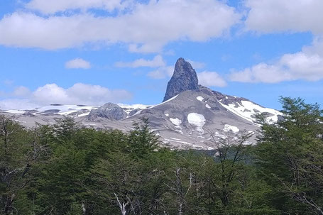
We knew we had arrived in Patagonia when we spotted a tall, grey, rocky spire jutting above the horizon. We were at the top of a pass crossing from Chile into Argentina on December 3rd, the beginning of the southern hemisphere’s summer. In planning this trip, we had been told there are only two seasons in southern Patagonia: winter and February.
Therefore, our only deadline for our entire bike trip has been to arrive in Patagonia in time to ride south to the tip of the continent by the end of February.
Crossing borders along the Patagonian divide

Chile and Argentina have long disputed their border in Patagonia. Through an original 1884 treaty followed by facilitated negotiations in 1902 and as recently as 1998, the border was established largely, but not entirely, to follow the Andean continental divide, giving Argentina control over the water that flows from the Andes eastward across the dry Patagonian steppe to the Atlantic Ocean, and Chile control of the water that flows west to the Pacific. That means the border is often at the top of a pass.
This border crossing was the first of what will be numerous crossings back and forth between Argentina and Chile as we snake our way south through Patagonia along the southernmost Andes.
This border crossing was a new experience, but typical of those to come. After showing our customs paperwork to Chilean immigration to be allowed to take our bikes out of the country, we traversed 40 km of no man’s land before passing through Argentinian immigration, crossing the actual frontier in the middle, near the top of the pass.

Argentina
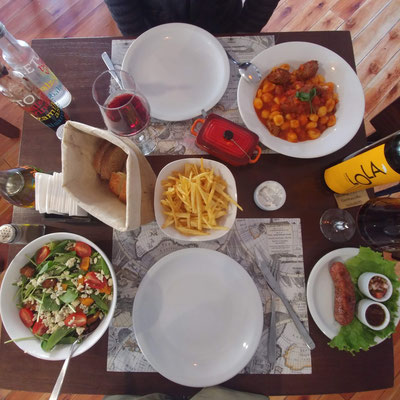
Upon crossing the border, we immediately heard a dramatic change in the spoken language, both in vocabulary and pronunciation. Chilean Spanish was fast and not clearly enunciated, making it challenging for us to understand. Argentinian Spanish softens its consonants and has a musicality similar to French, so we’ve had to learn all over again to be able to identify the new sounds. In Chile, we had felt many similarities to the U.S. In Argentina, the similarities seem to be more with Europe. Guesthouse bathrooms have bidets. Restaurants open for dinner at 8:30 pm (late for us, dinner time for them) and there is an appreciation of fine food, especially Italian. Recent inflation in the Argentinian peso makes the delicious food wonderfully affordable for travelers, but unfortunately not for locals.

Patagonia tourism
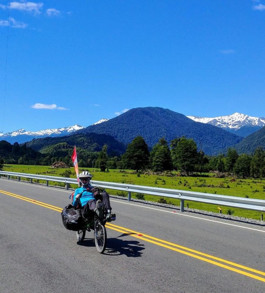
Despite the different charms of Chilean and Argentinian cultures, it’s become clear that this part of the trip is less about being exposed to those cultures, and more about being in Patagonia -- a global tourist destination for outdoor experiences. All the towns have significant tourist infrastructure, English is widely spoken, and for the first time during our trip, it's high season (early summer) here so most people we see are visitors like us, wrapped in colorful Gore-Tex and wearing hiking shoes. Every day on the road we encounter multiple bike tourers from all over the world, including from the big cities of Chile and Argentina.

Following the "yellow brick road"
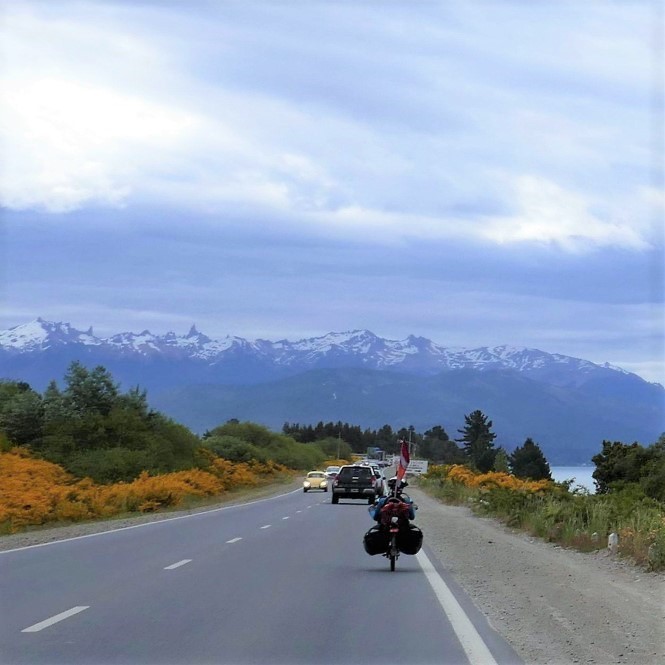
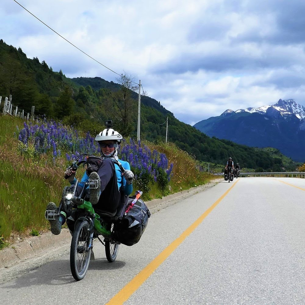
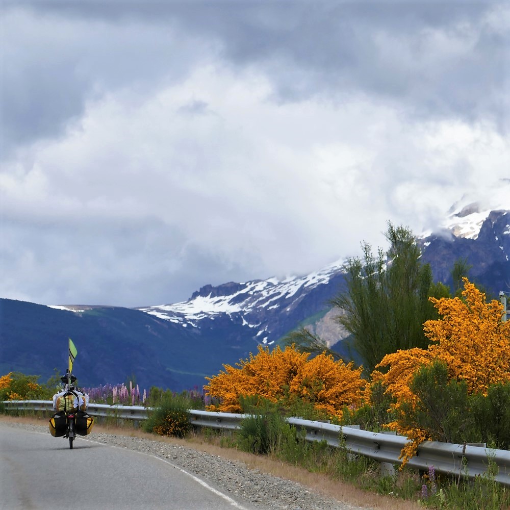
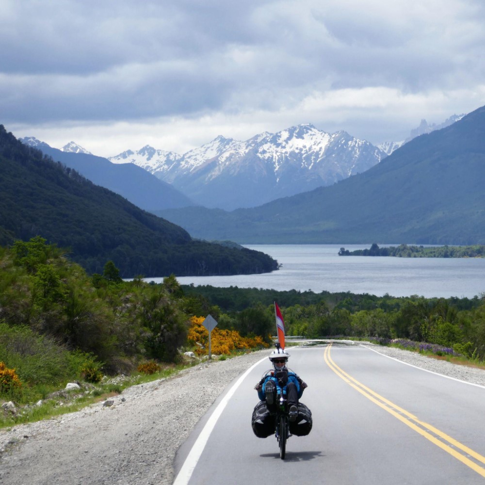
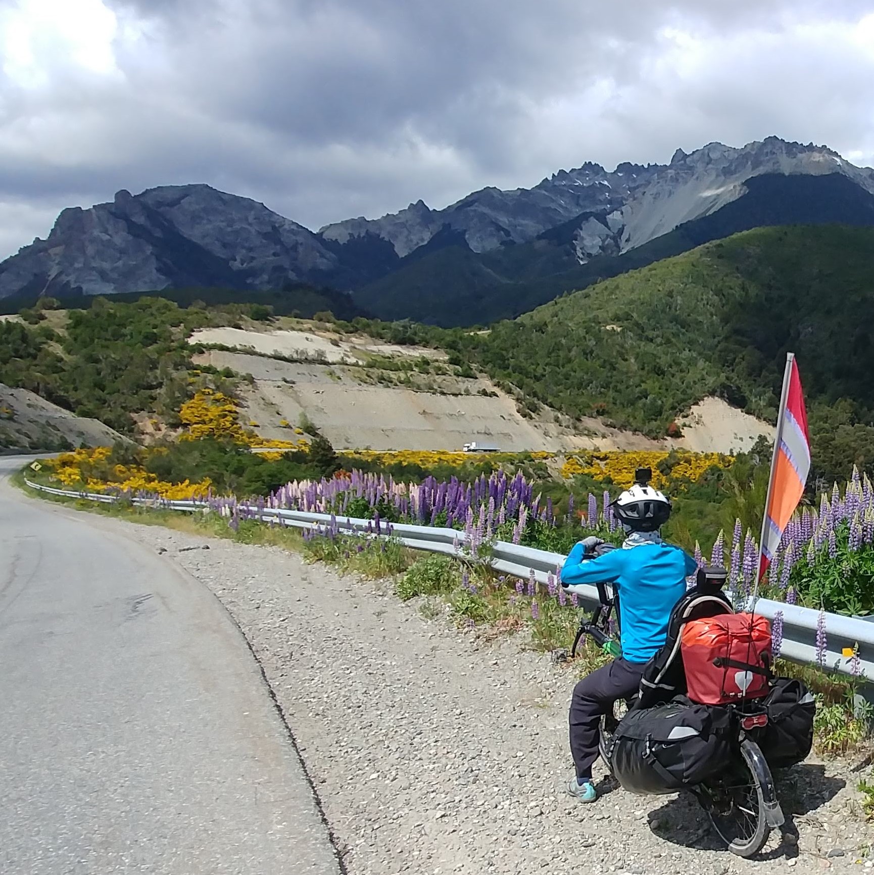
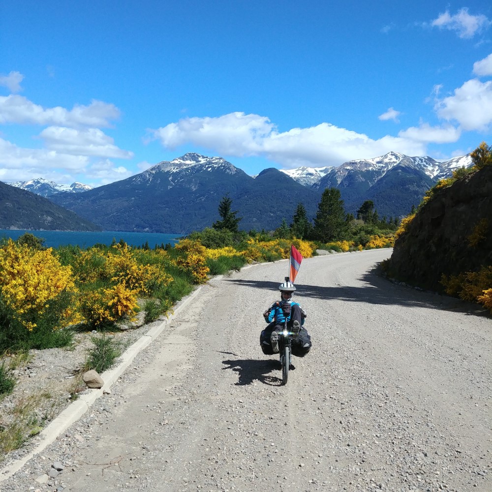


After our first crossing into Argentina, we pedaled around Lake Nahuel Haupi, following what we called “the yellow brick road”. The road was lined with scotch broom bushes in full brilliant yellow bloom, and therefore it was always easy to spot our route from across a valley or lake.
Also in roadside bloom were sweetly fragrant lupines of all colors -- from white to blue to magenta. It was interesting and a bit nostalgic to see both of these flowering plants here, as they are very familiar to us from springtime in the Pacific Northwest.
The ride south to San Carlos de Bariloche was scenic and paved, but nerve-wracking due to a lot of fast-moving traffic on the 2-lane road with no shoulders.
Hiking at Bariloche
Bariloche is a tourist town known for chocolate shops and ski resorts, but also has a nice museum that we photographed and then used as our flora/fauna guidebook for Patagonia. After replacing our hiking shoes in Bariloche, we took our first Patagonian day hike up to Refugio Frey on the shore of a small lake surrounded by stunning steep crags popular with rock climbers.

While in Bariloche, we discovered a brand new website, www.bicyclepatagonia.com, that provided us with amazing detail for the route we had planned through Patagonia. It gives elevation profiles and road surface quality — two things that determine how far we can go in a day — plus potential wild camping spots with access to water and shelter from the wind. It was incredibly helpful — a clear benefit of modern travel! We learned that towns become fewer and farther between as we head south, and that we would often need to camp between towns with accommodations.
Fútbol in El Bolsón
In the hippie town of El Bolsón, we drank craft beer and watched a historic fútbol game on TV. Two rival teams from Buenos Aires were in the finals of a big South American tournament. It was big news (and a disgrace for Argentina) that the game was played in Spain instead of Argentina to protect players from overly fanatical supporters in Buenos Aires. In El Bolsón, 1700 km from Buenos Aires, after the River Plate team won, the street filled with an impromptu parade of red and white-clad cheering fans and honking cars.

The gang
Farther south, we passed the short-lived hideout of Butch Cassidy and The Sundance Kid, a log home in a verdant valley surrounded by snow-capped peaks, where they apparently tried, but failed, to live a law-abiding life.
There we met two other “mature” (over 50) bike touring couples (Swiss and Dutch), whom we ended up leap-frogging over the next couple of weeks as we all pedaled south.

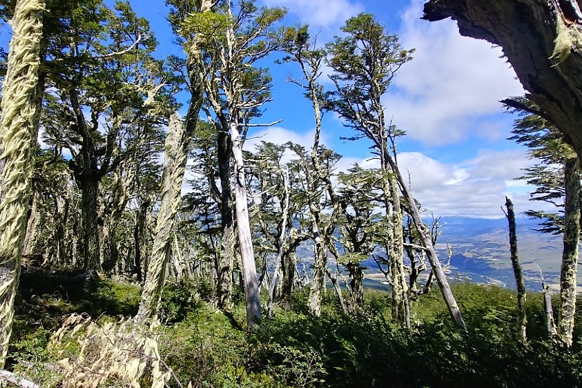
The southern beech forests


In the tiny town of Cholila we bought a couple of days’ worth of food and headed out on a dirt road into the Alerces National Park. The alerce is a sequoia-like tree that can live for millennia, but unfortunately we didn’t see any because they turned out to be in a location accessible only by boat.
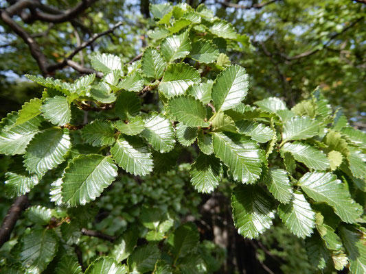
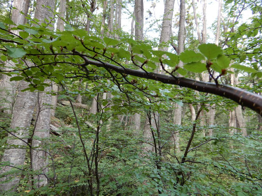
We were surrounded instead by, and fell in love with, the beautiful forest of Coihue trees (southern beech). Coihue is one of several similar varieties of beech (including Lenga and Ñire, which we can’t seem to tell apart) that grow prolifically in a range of climates and elevations, so it has become our constant companion. It has cherry-like bark when it’s young, thick oak-like bark when mature, and small dark green leaves that grow on sturdy, sculptural branches. A spherical orange edible fungus called “pan de indio” often grows as a parasite on the tree, creating a large burl in the wood.
Tea in Trevelín
The next town of Trevelín was settled by Welsh immigrants in the late 1880s to make their fortune growing and milling wheat. The crops and mill didn’t survive, but the Welsh heritage did. The municipal signs are dual-language (Spanish and Welsh) and a bike tourer can enjoy a proper afternoon tea service with loads of cakes, scones and breads.


Back to Chile

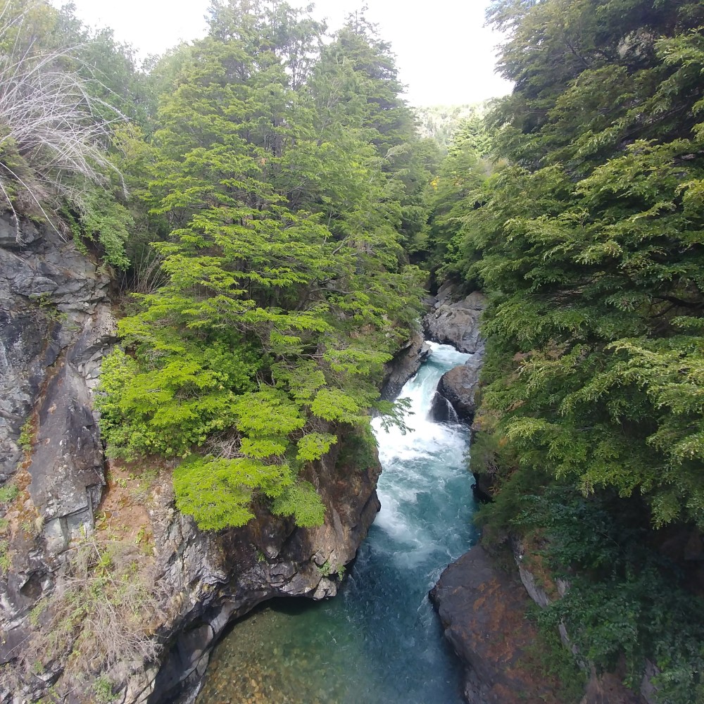
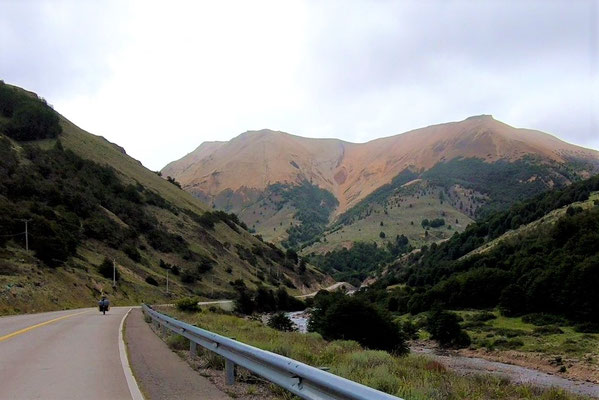
Once again we crossed the Andes, this time from Argentina back to Chile, over a shockingly low, flat pass of less than 400 m elevation. We left behind the drier open range of Argentina’s Patagonia as we pedaled along the fast-flowing turquoise-colored Futaleufú River (the Fú), known as some of the best whitewater in the region, into the wetter, greener forests of Chilean Patagonia. Before the border crossing, we stopped and ate all the food that Chile won’t let us bring into the country. At the actual frontier (again midway between the two immigration offices), we were pleased when the road changed from Argentina’s rough, loose gravel to Chile’s smooth pavement. But the paved road proved nearly as challenging, since we were quickly reminded how unafraid Chile is of steep roads. We’ve coined the term “Chile hilly” to describe the short, but leg-busting, 13-16% grades that define our riding days.
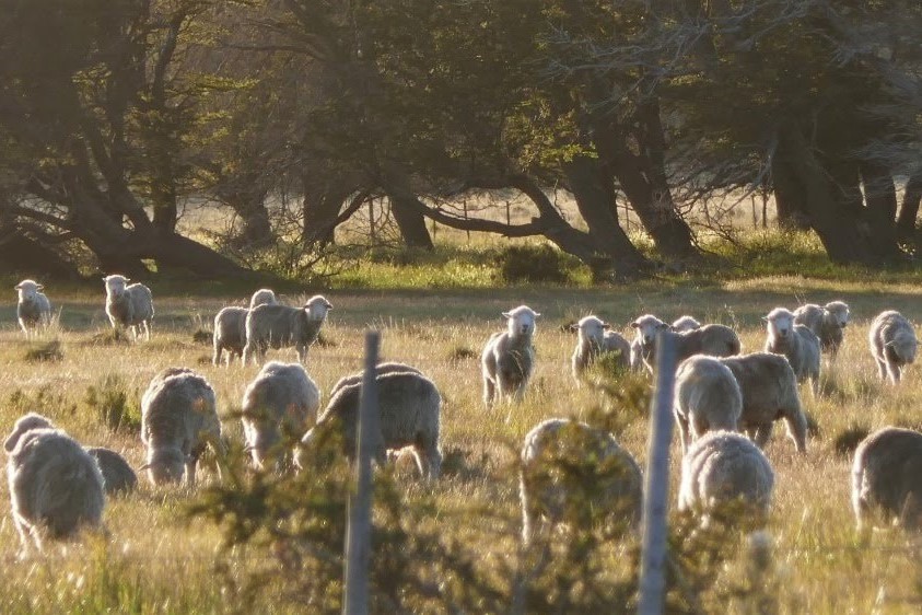
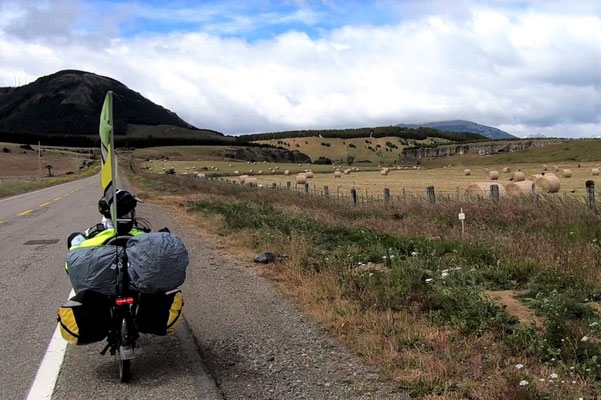
We rode past fields that had long ago been cleared of trees for pastureland. Rather than using the wood for lumber, the whole felled trees had just been piled up, often to form fences. It’s clear that sheep and cattle — not timber — are the valuable resources here.
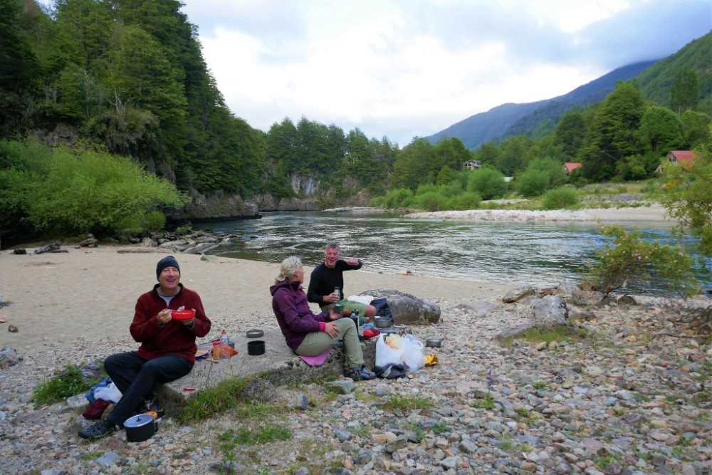
Roadside wild camping
After the Chilean town of Futaleufú, the road turned to dirt again, and we followed the Fú River to where it emptied into Yelcho Lake. We wild camped on the lake’s edge, sharing the site with a solo bike tourer from Brazil, and enjoyed views of snow-capped peaks across the lake.

Devastated Villa Santa Lucía

Farther west, much of the small town of Villa Santa Lucía was crushed by a massive mudslide just over a year ago in 2017 when torrential rains caused a slope failure at the tongue of a glacier above the town. The devastation was incredible and the losses this tiny community suffered are hard to imagine. 21 people from the town's population of about 130 were killed. A memorial to those who died has been constructed in the midst of the rubble.
At the local market still in business there, we stocked up on empanadas, all the supplies we needed (and even things we didn't) for a town needing all the economic help it can get. In a somber mood, we then turned south onto Chile’s Carretera Austral.
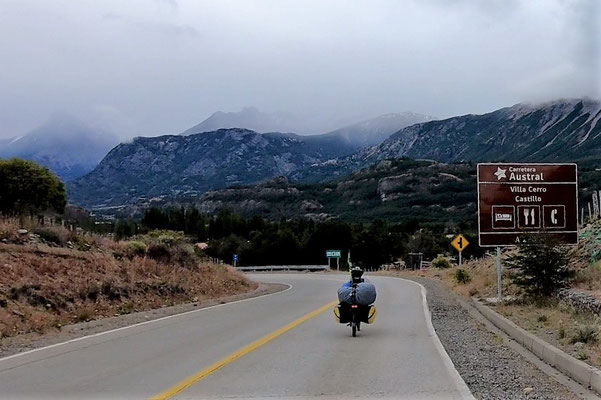
Carretera Austral
The Carretera Austral (“Southern Highway”) is legendary among bike tourers. It is a mostly unpaved road, 1,200 km long, with several ferry crossings, that travels through Chile’s northern Patagonia from Puerto Montt to Villa O’Higgins along mountains, rivers and fjords. It was built by Augusto Pinochet to integrate into Chile the small towns of rural Patagonia that were previously accessible only by horse, boat, plane or in a few cases, by road from its rival, Argentina. Road construction started in 1976 and the last segment to O’Higgins opened in 2000. Paving efforts continue bit by bit.
While intended to solidify Chile’s claim to its Patagonian territory and improve commerce for the southern communities, the Carretera has also clearly become a tourist attraction. Most of the vehicles we see, including bicycles and motorcycles, are carrying tourists like us.


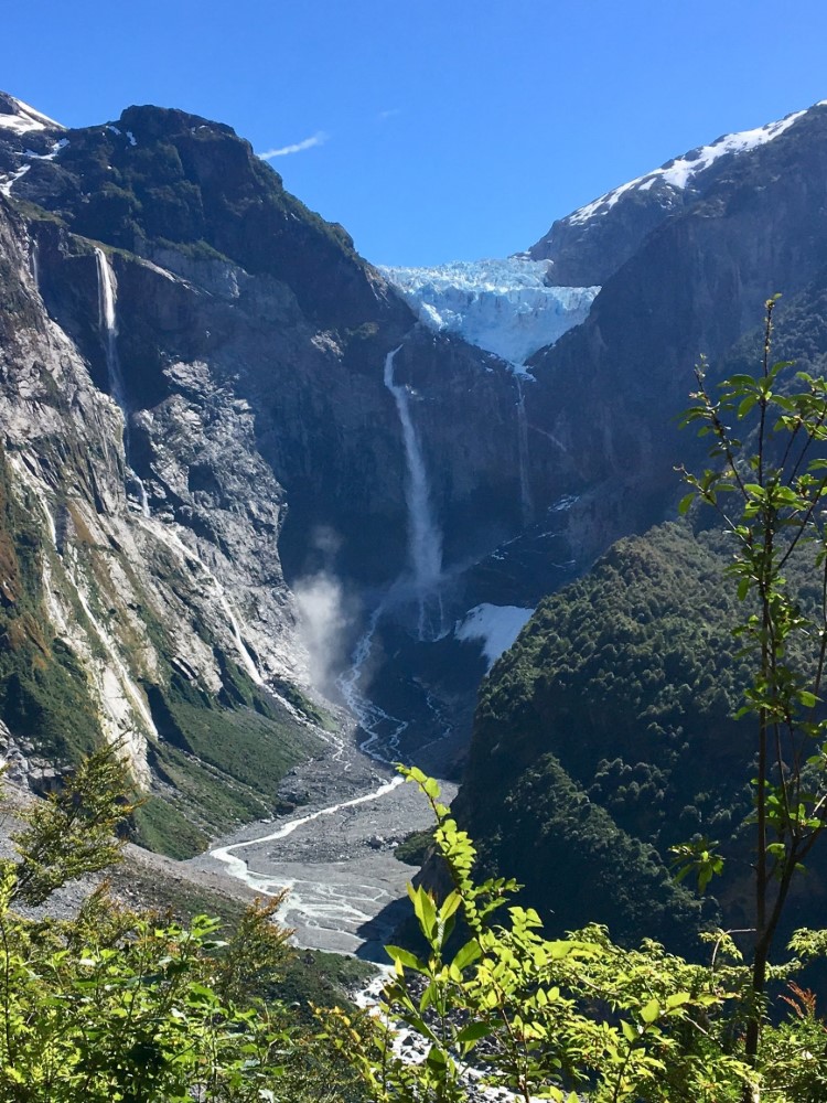
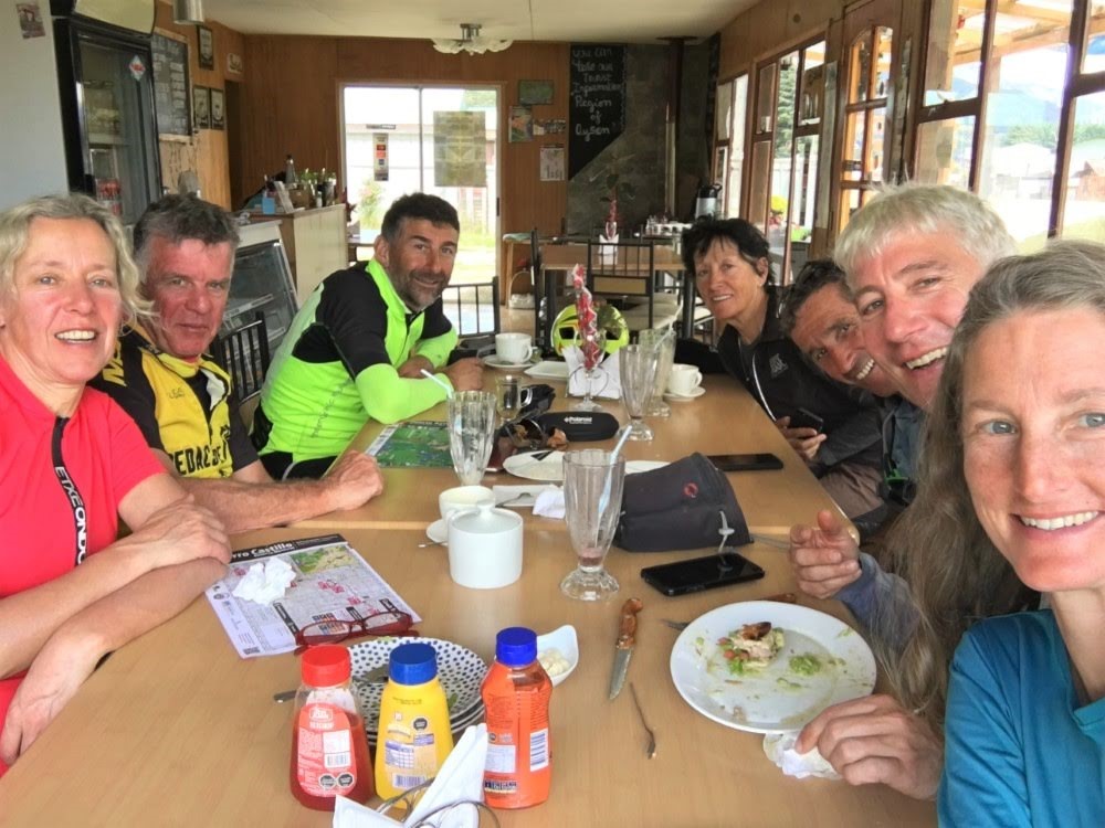
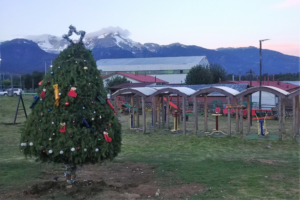
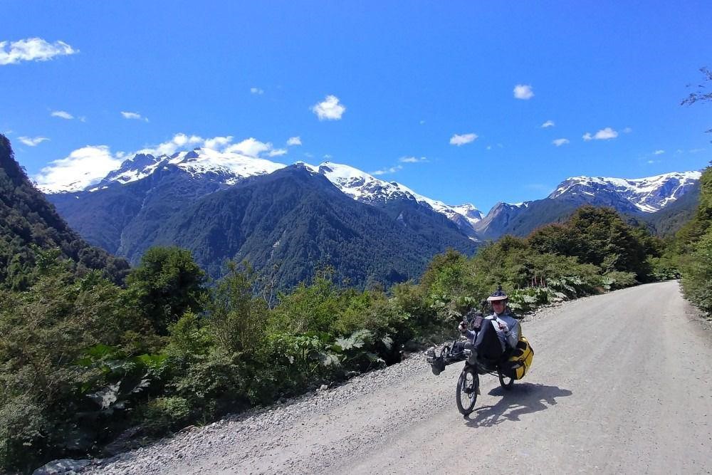


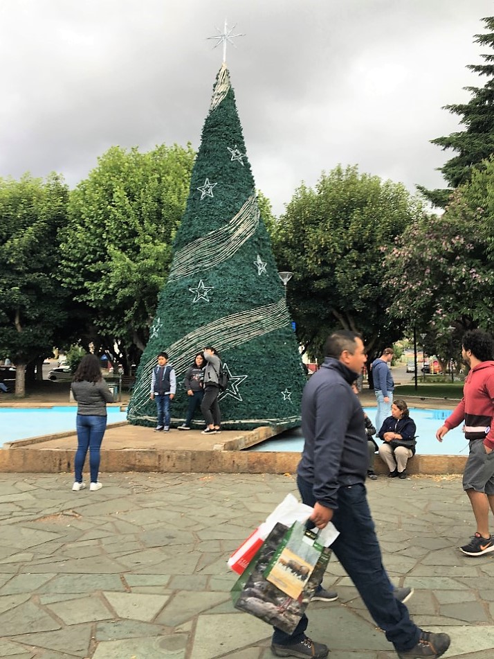
Our introduction to the Carretera was easy sailing under blue skies, with pavement where we had expected dirt. Along the route, we arrived at the Pacific Ocean and rode along the Puyuhuapi fjord, camped in Queulat National Park and hiked to a hanging glacier, shared campsites and cake (“keke” here in Chile) with fellow cyclists, met up again with Jonas Diechmann (the crazy German cyclist who rode from Alaska to Ushuaia in 97 days), put up our tent in a small village baker’s backyard, and watched the Christmas decorations go up in the villages.
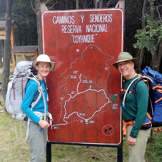
Christmas in Coyhaique
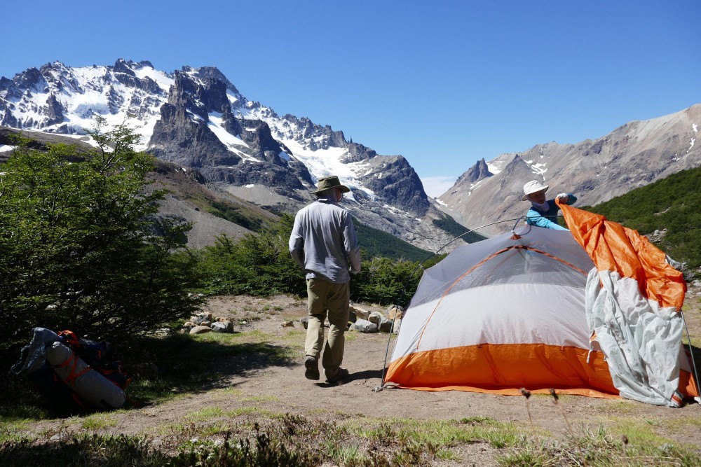
We arrived in Coyhaique, a city of 50,000 people and the second largest town on the Carretera, to a frenzy of Christmas shopping. We took advantage of the last-minute deals and purchased ourselves a couple of large backpacks that would enable us to do some multi-day trekking in Patagonia. Our first hike would be 4 days in Cerro Castillo National Park. After hearing stories of dangerous winds and no visibility from others who did the hike, we spent a whole week in Coyhaique waiting for a 4-day window of perfect weather. While waiting in Coyhaique, we tested our new packs, fully loaded, on a day hike and finally encountered the infamous Patagonian winds.


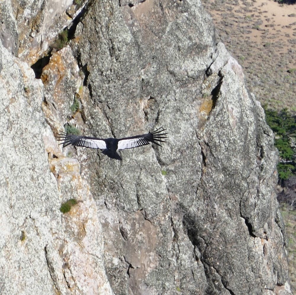
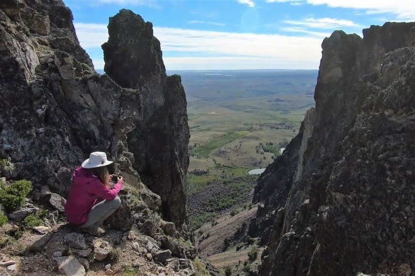
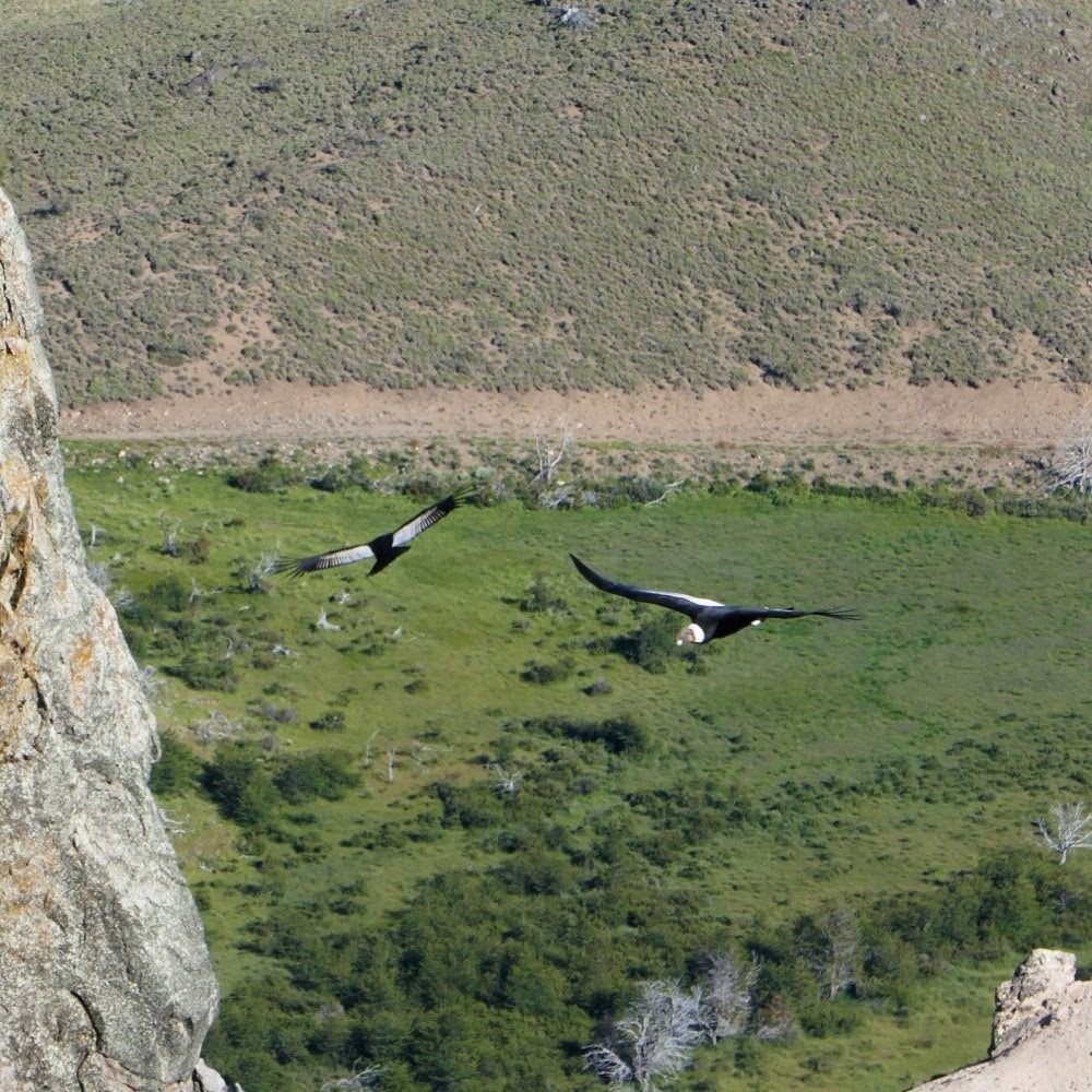
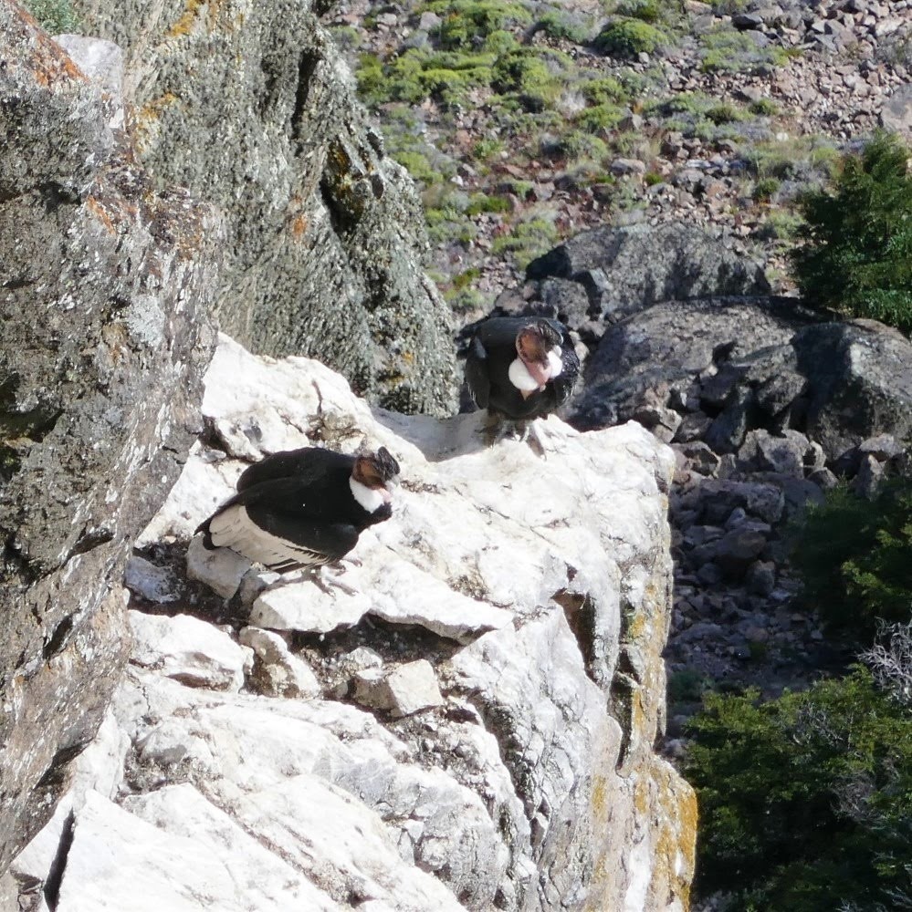
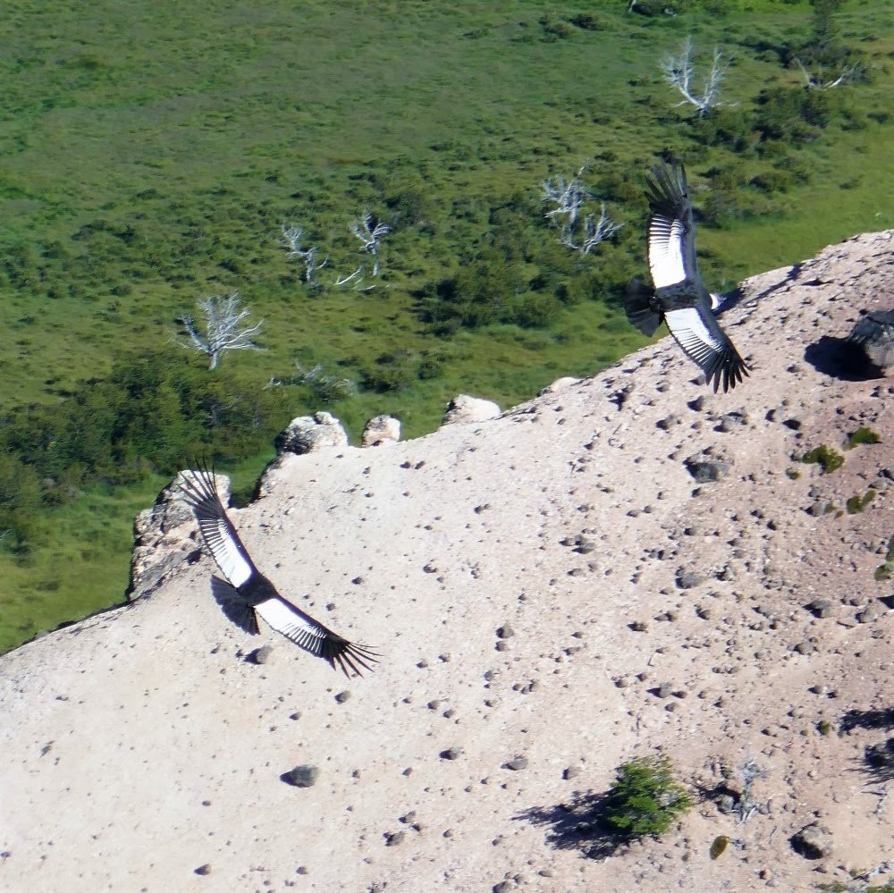
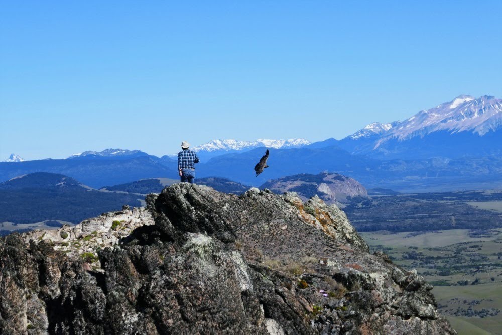
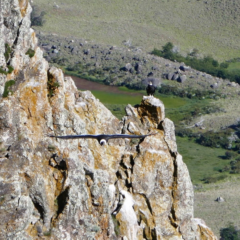
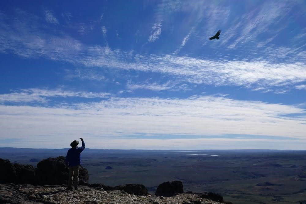
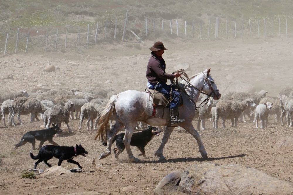
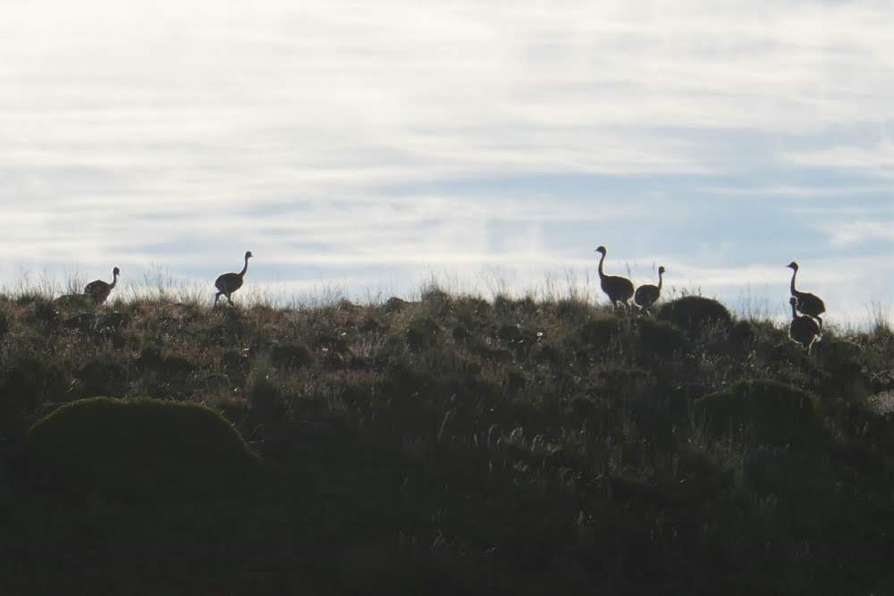


We also visited a sheep ranch (Estancia Punta del Monte) on a high plateau to watch Andean condors wake up and take flight from their cliffside perches. It was a magical experience to see the huge birds launch effortlessly into the rising thermals, circle a few times without a wingbeat, then soar away over the valley in search of carrion. Note: The last picture of the ostrich-like birds are Greater Rheas (we think), a "near threatened" species in Northern Patagonia.
Christmas Eve came and went, celebrated quietly in people’s homes until midnight, when a speeding, honking parade of cars chased a lighted Santa’s sleigh roaring through the streets.
On New Year’s Eve not a single bar or restaurant was open. Instead, people rang in the new year at home. Our hostel threw a party that lasted all night — long after all the guests had gone to bed.

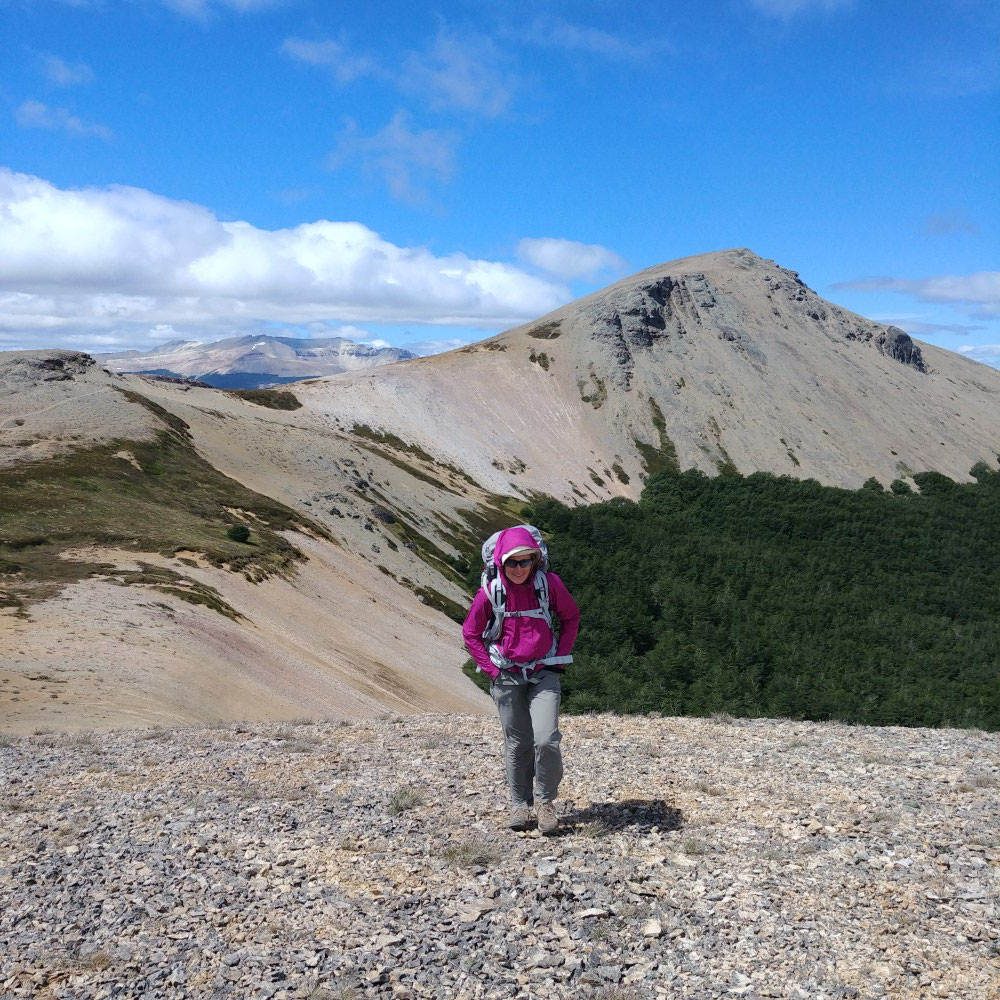
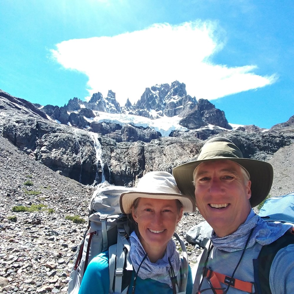
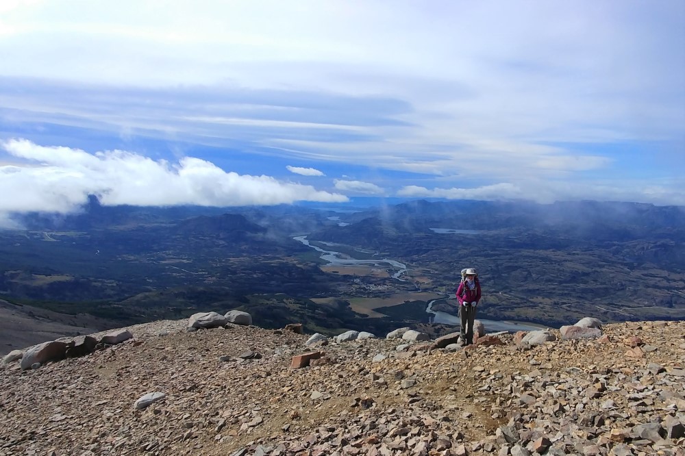
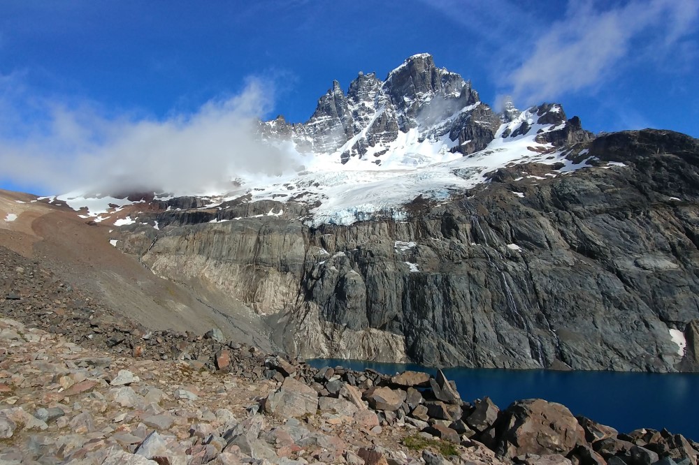
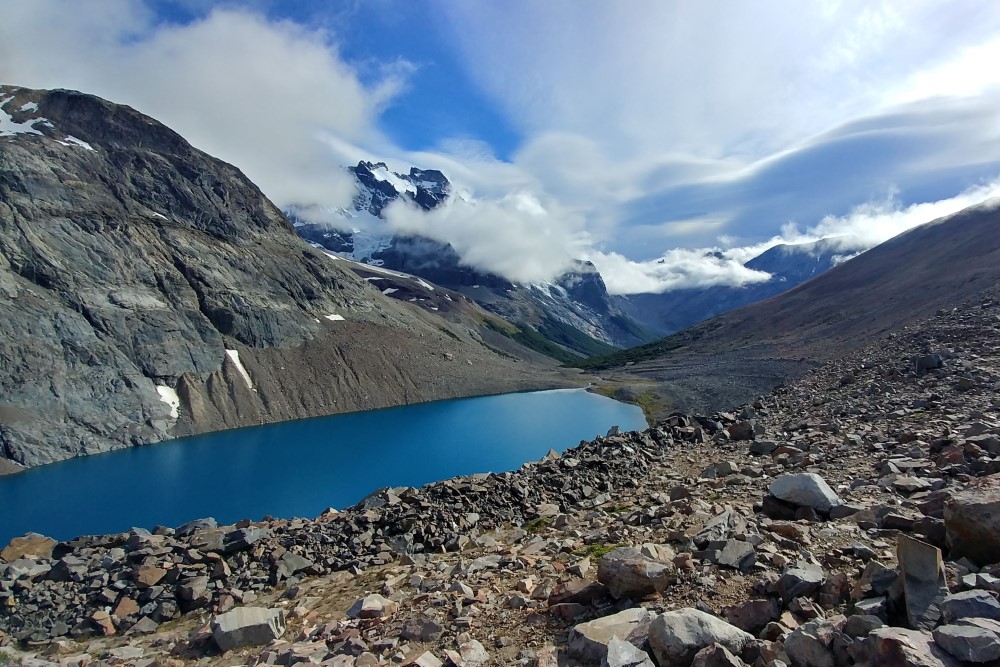
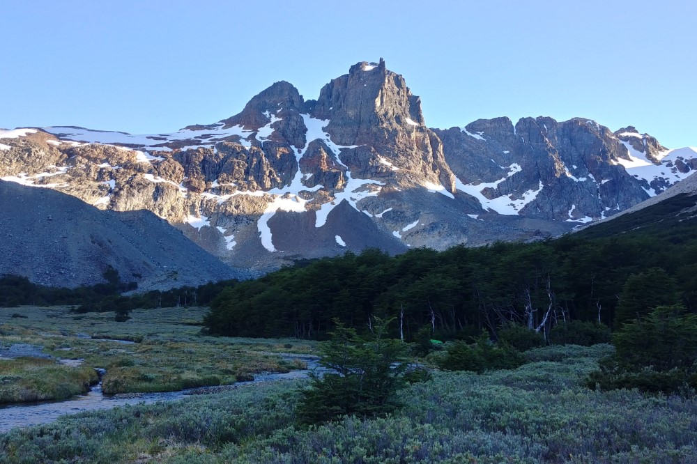
Trekking Cerro Castillo
Finally, the anticipated good weather arrived and did not disappoint. During our ride to the village near the national park, we passed the 5,000 km mark on the trip odometer!

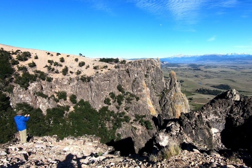
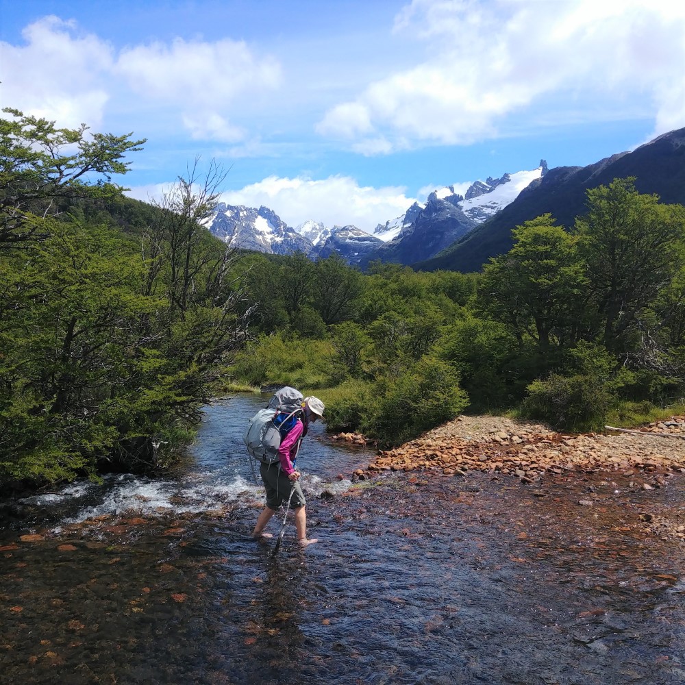
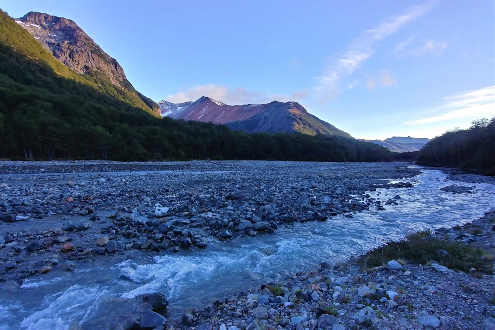
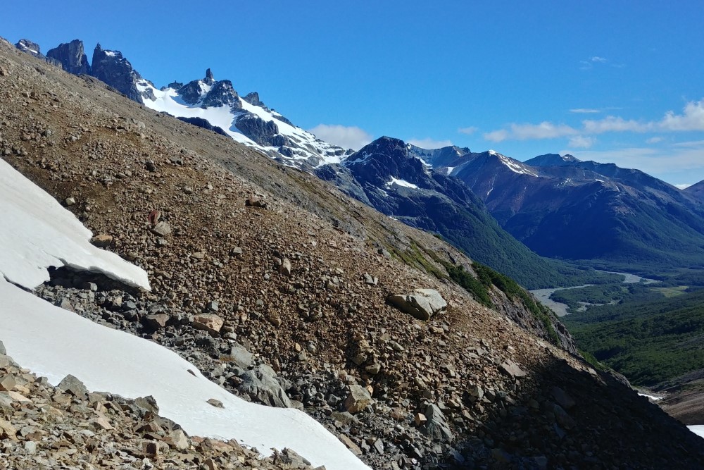
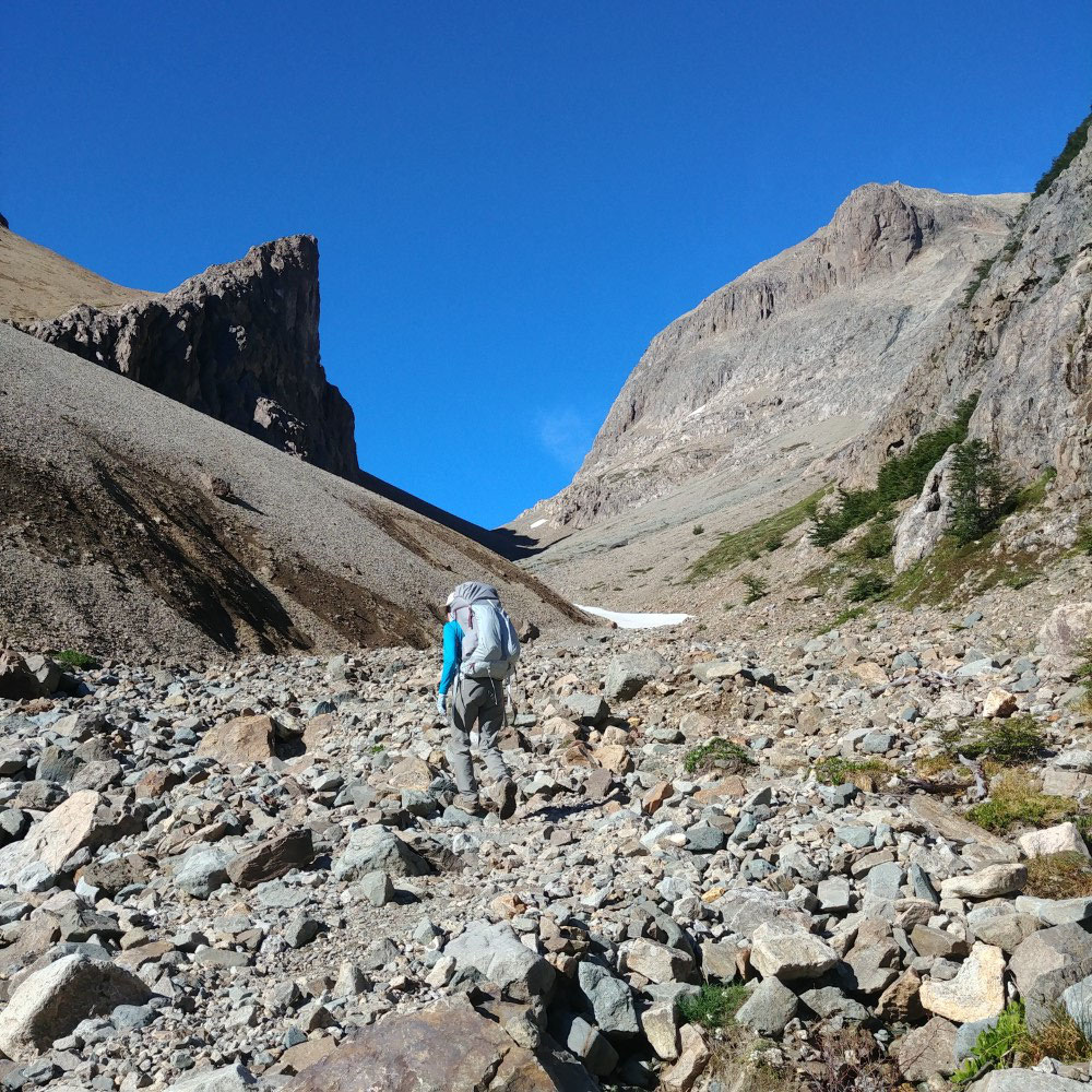
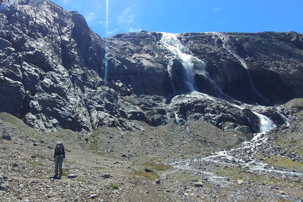
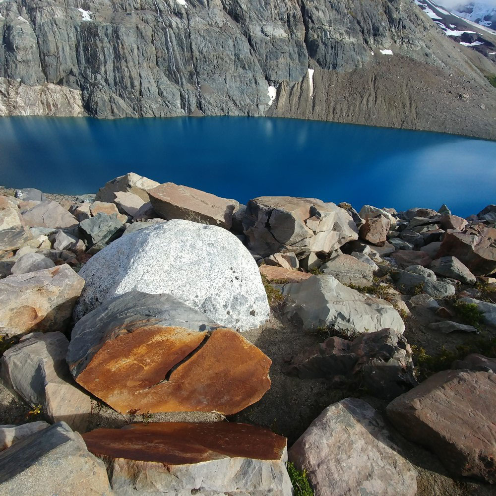
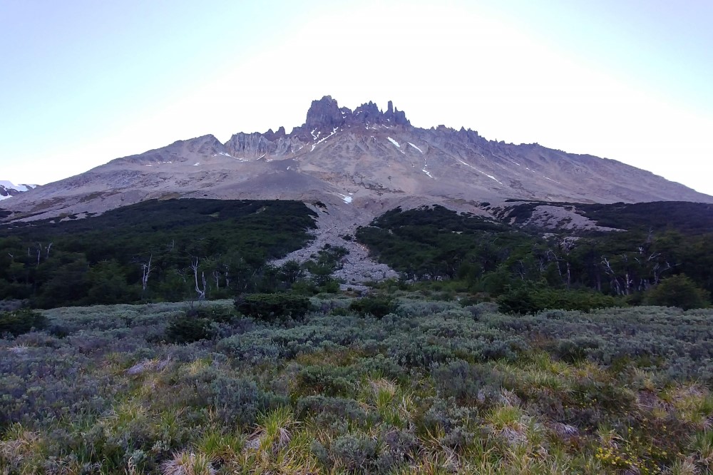
During the 4-day hike, we circumnavigated Cerro Castillo (Castle Mountain), getting breathtaking views of the hanging glaciers, lakes, pointy rocks and cliffs on all sides of the peak. The trail traversed beech forests, broad glacial river valleys, scree passes and boulder fields.
We drank water directly from the streams and lakes, as there is no giardia here. We had to do barefoot crossings of several frigid streams because, although we are carrying water sandals, we didn’t bring them on the hike. Oops.
As we crossed the high pass at the foot of the crags, the horrific winds we had heard about were nonexistent. It was so calm we could hear the quiet tinkling sound of our footsteps on the small rocks — fragments of boulders that had long ago disintegrated into shards after countless freeze/thaw cycles.
We lingered at the pass to enjoy sweeping views of our upcoming bicycle route south along the Carretera Austral, and to revel in our excitement for what was yet to come.


Now we are at the end of the earth, and will post more stories and photos from Patagonia and Antarctica soon. From here we fly to northern Argentina to continue our journey. To find out where we are at any given moment, check our Track My Tour page, where we post a photo and blurb every day that we’re on the move. Also, you can get more up-to-the-minute, spontaneous updates if you follow Clark's accounts on Instagram and/or Facebook.