Patagonia's different faces
In the past 4 months, we’ve found Patagonia to have distinctly different ‘faces’, from north, to middle, to south. This blog addresses the middle part, covering the rest of Chile’s Carretera Austral. A key aspect to this section of the ride is that the road is 100% ripio (Spanish for gravel), with Bicycle Patagonia’s route descriptions ranging from “moderate” to “difficult” to “gnarly”. Our daily ride statistics between Northern Patagonia and Central Patagonia reduced by about 30% in 3 key stats: distance travelled, meters climbed and our average speed. So yes, our progress sloooowed way down here, but our spirits, enjoyment in the riding, and wonder at the landscapes we were traversing remained high. The ubiquity of the ripio and slow going brought about some bursts of creativity for us, with Clark realizing that what we needed each day was to adopt “a ripio state of mind” (inspired by Billy Joel’s “New York State of Mind”), and Kacia crafting new lyrics to the tune. Here’s the result, in a video offering some highlights of our experiences riding the ripio on the Carretera Austral:

Puerto Río Tranquilo
The amazing trek around Cerro Castillo, described in our last blog, tweaked one of Clark’s hamstrings, and the weather forecast called for cold wind, rain and snow, so we elected to hire a pickup truck to take us 121 km to our next destination, Puerto Río Tranquilo, for a couple of days rest, a kayak excursion, and a resupply of our provisions before we set out on the many-days ride to the next town. It was a good choice, as we encountered hard rain along the way and falling snow over the pass, with temperatures just above freezing - or said another way: it was summer in Patagonia.

Río Tranquilo is a port on Lago General Carrera, a huge turquoise glacial lake and a key body of water divided by the negotiated border between Chile and Argentina (Argentina calls it Lago Buenos Aires). This lake includes a remarkable geologic remnant of marble, which has eroded away to become liquid-like sculptures frozen in stone, the so called “Marble Chapels”, which we paddled around and through in kayaks!


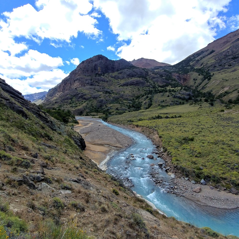
On to Río Baker
The ride along Lago General Carrera was one of the most beautiful single riding days of our entire trip! Surrounded by peaks dusted by the recent snowfall, along turquoise lakes, under a blue-bird sky, and finishing by wild camping on the edge of the raging headwaters of Río Baker, Chile's largest (volume) river - bike touring doesn't get better than this.


Our avian companions
In addition to the Andean Condor (discussed in the last blog), there have been 4 other birds that became our travelling companions in Patagonia. Because we lost all of our images of them with our recent data problems, we’ve included some stock internet pics and videos of each to be sure to carry them in our memories. We list here their Patagonian name, in addition to the common English name.

Bandurria (Black-faced Ibis):
These beautiful curved-beaked birds won our hearts way back in the Lakes District of Chile, with their distinctive harmonic cries as they flew in groups overhead, and their loud/weird mating calls that we heard overhead in trees. We saw one such courtship on a tin roof, nearly identical to the one in this video. We often found the Bandurria near lakes and marshy environments (of which there MANY in Patagonia).

Tero Tero (Southern Lapwing):
We called these birds “squawky birds” and you can hear why in this video. Their beautiful multicolored brown appearance strikingly transforms when they take flight, showing their dramatic white and black wings during their highly acrobatic flight.

Fío-Fío (White-crested Elaenia):
We waited many weeks to actually see one of these little guys, but we heard them in all the beech forests. Their simple, insistent and persistent calls made us feel like they were our constant companions, so we called them “buddy bird” until we finally learned their real name from a park ranger.

Carancho (Southern Crested Caracara):
These regal birds have a striking dark headdress and white collar, and are the size of small eagles. Common in Patagonia, they have an impressive swagger. They go where they want, and stand confidently (even disinterested) when approached. The only time we saw them show any respect at all was when a few massive Condors landed among dozens of Caranchos at a carrion site along the road, and even then, they only backed off a bit.
Parque Patagonia

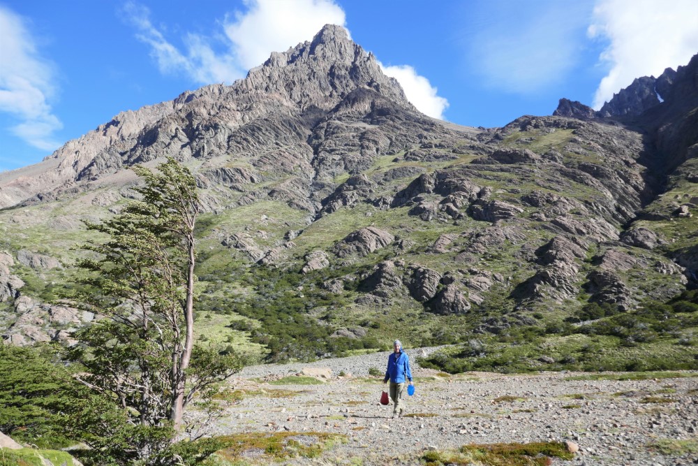
Continuing down the Río Baker, we got a great view of its confluence with the Río Nef, where both rivers carved impressive gorges through solid basalt, and whitewater kayakers were testing their mettle. Later in the day we turned east off Ruta 7 onto more challenging ripio towards Valle Chacabuco, the heart of one of Chile’s newest national parks: Parque Patagonia.
This is a special place. Doug and Kris Tompkins, of North Face and Esprit clothing fame (note: Doug tragically died in 2015 in a kayaking accident on Lago General Carrera) spent decades acquiring and returning to a natural state the huge sheep ranch in the beautiful Chacabuco Valley that separated two existing national natural reserves: Jeinimeni to the north and Tamango to the south. Kris then spent years partnering with the Chilean government to combine all three places into Parque Patagonia. In 2018 a new national park was born, with a large contiguous area that provides much greater ecological conservation.
The park headquarters area was overrun with guanacos -- large, curious llama-like camelids with short brown and white fur, herds of which we saw throughout the park. Juvenile males were frantically chasing females, who eluded them by cutting at high speed through trees, causing the males to violently crash into those trees. While we visited the park’s excellent free museum, we parked our loaded bikes wedged between concrete bollards, just in case the females used them to dodge their suitors. Sure enough, we returned to find fur and mud smudged across a pannier, and a big mess of partially chewed grass all over our seats! (Amazingly, our bikes were otherwise fine.)


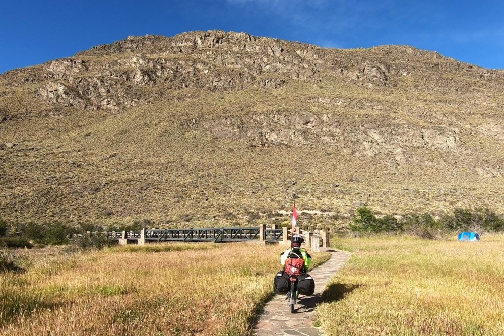
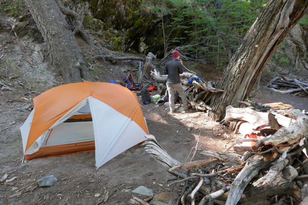
We camped at the aptly named “West Winds” campground, and the next day rode deeper into the park, over multiple 13%+ grades (really “Chile hilly”), to the “Stone House” campground, where we left our bikes and extra gear for an overnight hike north.
We headed up the Avilés trail through the stunning Patagonian steppe landscape, with the trail crossing an elegantly simple suspension bridge over a deep gorge. We awoke the next morning to the coldest temperature on the trip yet, -5° C (summer in Patagonia), with all the plants around us sparkling with hoar frost. This time we remembered to bring our water shoes, which Clark was pretty happy about on the hike back!


The next day was our most vigorous of the trip. We rode the 25 km back to park headquarters in bright sunshine over the ripio and steep hills, eating lunch at the park’s restaurant (because we were now out of provisions).
We then hiked the 23 km/1,300 m Lagunas Altas (high lakes) loop trail, entertained by dramatic cloud formations all day as we passed a series of lakes all perched on the high plateau.
We got back just after 8 pm to enjoy a fancy meal at the restaurant before pedaling in the dark to the West Winds campground to have a very good and deserved rest - it was a perfect day!
Riding to ocean fjords
Now out of food completely, we left the park and continued along Río Baker to the small town of Cochrane, where we took a day off to rest and resupply. We headed out again into more verdant scenery, on very dusty roads to a special wild campsite (dubbed “Paradise2” on the very useful app, iOverlander (screenshot below), a user-populated database of free camping sites all over the world). There we dined on homemade eggplant pasta sauce during a beautiful sunset.


The next day we were on the road around 9:00 am and pulled into our destination of Caleta Tortel around 6:30 pm. During those 9½ hours we pedaled for a little over six hours, yet we only travelled 66 km (41 miles), climbing just over 500 m.
That was some slow, hard-fought progress, but we did it all with a ripio state of mind.
Caleta Tortel
Caleta Tortel is an odd and picturesque fishing/timber village that only got connected with the Carretera Austral in 2003. It is known for a special kind of cypress tree from which they constructed an elaborate network of pedestrian-only boardwalks and stairs to connect the town, which is almost entirely built on stilts over a steep hillside bog. We locked our bikes at the visitor center restrooms above town and carried our overnight necessities down dozens of steps to a cabaña that overlooked the fjord over which the town is perched.


The Google Earth image below shows just how remarkably situated this place is -- more than 80 km inland from Chile’s west coast, nestled in a network of ocean fjords at the end of the Río Baker, stuck between the North and South Patagonian ice sheets. There is so much glacial silt from all of the surrounding watersheds that the ocean water shows as turquoise from space! This image also shows much of the journey along Chile's Ruta 7 discussed in this blog, from Valle Chacabuco in the north to O'Higgins in the south.

Ruta 7 - by ferry


It was here, deep in Patagonia, near the end of the Carretera Austral, where the going got really interesting. As it started to rain we headed up through a dramatic stone gorge, over a pass, then back down to sea level at Puerto Yungay where we took the free ferry 12 km down another fjord to Río Bravo (because there’s no other way to progress on Ruta 7).
At the ferry terminal there were at least 8 other bike tourers waiting to take one of two ferries (the other is a dramatic, 36-hour journey south through Patagonia’s fjords to Puerto Natales). There we met Matt, a fun Aussie that we would encounter again and ride with later in Patagonia. After the ferry, we wild camped in the rain, but we were undeterred as we approached the culmination of the Carretera Austral.
To Villa O'Higgins, the end of the Carretera Austral
The next day was the wettest riding day of the trip, on soft, muddy ripio. Soon our raingear, and every layer underneath, were completely soaked. When the afternoon wind picked up and the temperature dropped, we were ECSTATIC to make it to the “casa de ciclistas”, a small, free roadside refuge built by the Veras family (the local landowner) exclusively for passing travellers (who are largely cyclists, hence its informal name). Inside we built a fire from embers remaining from the previous night’s guests, hung up a line to dry all of our clothes, cooked, and slept cozily as the wind howled outside. What a road angel gift!


We refilled our water bladders directly from one of the zillion waterfalls we passed (there’s no giardia in Patagonia’s streams), and then pedaled under a heavy sky to Villa O’Higgins, a key milestone for us, as it is (literally) the end of the road for the Carretera Austral. A remote outpost since around 1914, O’Higgins was incorporated as a Chilean town in 1966 in Chile’s colonization of Patagonia. It was only accessible by plane or boat until the Carretera Austral finally reached the town in 2000!
We’d planned to take a rest day in O’Higgins, but the weather forecast told us: “keep going” to avoid cold rain on the next, most challenging, leg of the journey.
Going off-road to Argentina
“Keep going” meant taking a 3-hour pedestrian/bike-only ferry down an arm of the very windy, and very scenic, Lago O’Higgins (another shared lake called Lago San Martin by Argentina) to Estancia Candelario Mancilla.


From there we and the other cyclists and trekkers proceeded up a jeep road, exiting through Chile’s immigration office (open to only hikers and bikers) in the first kilometer, then proceeding into no-man’s land for the next 22 km. The first 15 km are on a jeep road that climbs to a pass, the actual border with Argentina marked by a signpost in the woods.


The last 7 km descends along a hiking trail, so we reconfigured our load, carrying one pannier each in our trekking backpacks, and strapping the other panniers to our seats. This lightened and narrowed the bikes allowing us to push them through trees, rocks, trenches and streams on the single-track. The trail ended at Lago del Desierto Punta Norte, Argentina’s immigration office (also only for hikers and bikers), and free camping area with a dramatic view of Mt Fitz Roy.
We couldn´t believe this is a real, staffed, international border crossing, but it is, and we did it, along with a couple dozen other travellers, almost all crazy cyclists, who were traversing this crossing in both directions. We’d been anticipating this hike-a-bike part of the trip for almost a year, so actually completing it was a huge moment for us!
As we wound our way along the Río de las Vueltas towards El Chaltén, the wind picked up for the last 5 km in ways we’ve never experienced, anywhere, ever. Thank goodness it was a perfect tailwind, or we would have had to just duck and cover. Instead, we let the wind push us down the ripio road at over 20 km/hr, while we applied our brakes to keep from going even faster! It was thrilling, scary and a bit intimidating, knowing that Patagonia’s legendary winds would be a defining characteristic of our ride going forward… but that was a concern for a later day, as we quickly arrived at El Chaltén and settled in for what ended up being a 13-day stay.


El Chaltén

El Chaltén is for Argentina what Villa O’Higgins is for Chile -- a construct in the name of sovereignty, colonization and tourism. It is Argentina’s youngest city, founded in 1985 and formally declared Argentinian only in 1994. The town, still very much under construction, is dedicated to tourism, taking advantage of its spectacular location.
The wind blew violently for several days after we arrived in El Chaltén, but in the forecast we saw an upcoming 4-day weather window suitable to undertake the epic Vuelta al Huemul trekking circuit in Argentina’s Glaciers National Park. We fortunately had the time to wait.
Our hopes of catching up on our blog were dashed when our computer’s power cord quit working. We made the best of it by wandering El Chaltén, taking in its Patagonian architecture, eating particularly well (though not cheaply), getting therapeutic massages, catching up on bike maintenance, and day-hiking (with hundreds of other tourists) to the cirque lakes under the hanging glaciers and rocky spires of Cerros Torre and Fitz Roy.


Cerro Torre


Tres Lagos at Cerro Fitz Roy


Cerro Huemul circuit
The Huemul circuit requires crossing two rivers via Tyrolean Traverse (pulling yourself across a steel cable while suspended from a carabiner on a pulley) if the rivers are too high to ford. We had to rent climbing harnesses for this and register with the park ranger. The weather came through: warm, sunny, and, most importantly, calm. The first day had great views with striking cloud formations, and a couple of milky stream crossings. We camped at Laguna Toro, with about 15 other tents. Unfortunately, Clark’s left knee felt mysteriously tweaked and swollen. It was nothing major, but we decided to play it safe and cut the circuit short, instead leaving our camp set, and hiking the next day without heavy packs up to the pass, then returning to camp and hiking out the following day.


The major river crossing was at the beginning of the second day’s hike. Given our lack of experience with Tyrolean crossings, we looked for and found a place to safely wade across the knee-deep glacial river where it gently flowed into Laguna Toro. We watched the other hikers navigate the Tyrolean crossing we had just avoided - it was thrilling to watch!


Climbing toward a pass, we walked along the tongue of a glacier where small rocks frozen into its ice surface provided us with necessary traction. Then it was up a long, steep scree slope to Paso del Viento (Windy Pass) where it was beautifully calm, just as we had hoped.


Campo de Hielo Sur


As we crested the pass, the view took our breath away. We were overlooking Patagonia’s Campo de Hielo Sur (southern ice sheet), the world’s 3rd largest freshwater reserve, behind Greenland and Antarctica! It is really beyond description, but we had the sense that it was the biggest ‘thing’ we’ve ever seen, outside of the ocean. We stayed there for a long time, just taking it in, awed by nature and privileged to witness it.
We hiked back down to the river and found that it was 6-8 inches higher than it had been in the morning (due to melting from the warm day) and that the place we’d crossed was quite submerged, so we did some scouting and found a new path that was at least twice as far as the morning’s crossing with the water up to our thighs, but it worked. Brrrr!
The next day we retraced our steps back to El Chaltén, treated to the clearest day yet and spectacular views of the entire range of craggy peaks and glaciers above this special little town.
We’re glad we had the time to be patient, seeing Patagonia on her terms. Full-up from this experience, we prepared to ride south into Argentina’s windy pampa, eager for what we would find in Southern Patagonia.


To find out where we are at any given moment, check our Track My Tour page, where we post a photo and blurb every day that we’re on the move. Also, you can get more up-to-the-minute, spontaneous updates if you follow Clark's accounts on Instagram and/or Facebook.