This post describes our last weeks in Bolivia (one of our favorite countries of the whole trip!), all spent in and around La Paz and Lake Titicaca.
But first… a news update on Evo Morales and South America
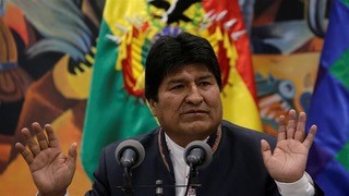
As we posted our last blog in early November 2019, Evo Morales, Bolivia’s (now ex) president had just claimed victory for an unprecedented fourth term, but people immediately took to the streets to challenge the outcome. Now, as of late December, Evo has left Bolivia seeking asylum, first in Mexico, and now in Argentina.
“The election ban marked a definitive end to Mr. Morales’s transformative 14 years in office, during which he lifted millions
of Bolivians out of poverty, made major advances in civil rights and diversified the economy. Mr. Morales’s economic and political successes, however, bred increasingly authoritarian tendencies
that eventually led to his downfall.”
- From NYT article on the OAS’ report on election fraud
The country now has a new conservative interim president while new elections are being organized, but Evo is saying he’ll be back within a year.
As troubling as this is, we’re even more disturbed by the fact that almost all of the countries that we visited and
traveled through freely over the last 18 months are now experiencing some version of political
turmoil and civil unrest.
It turns out we were very fortunate to find South America relatively peaceful and stable during our journey, but now we’re asking ourselves: Were we bad luck, or were we just lucky?
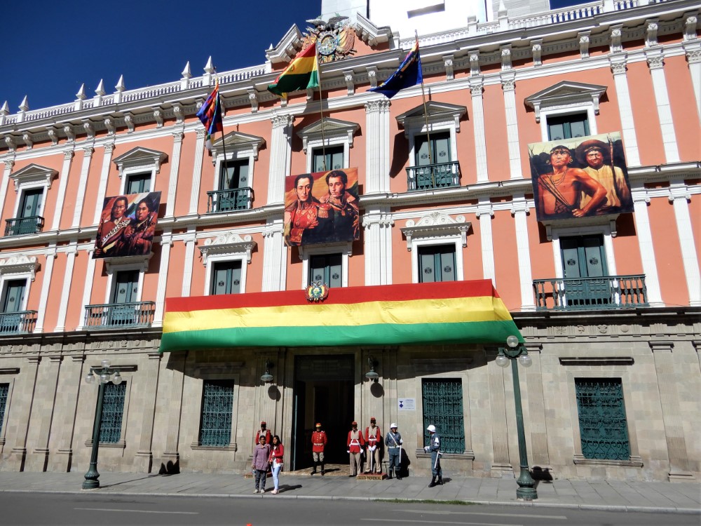
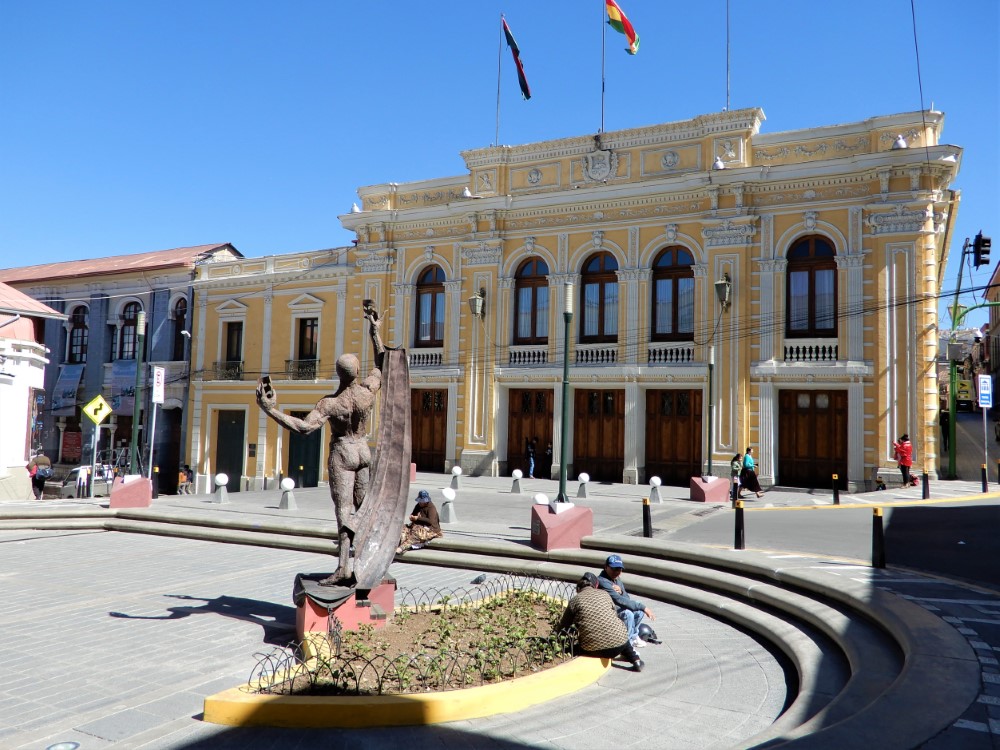
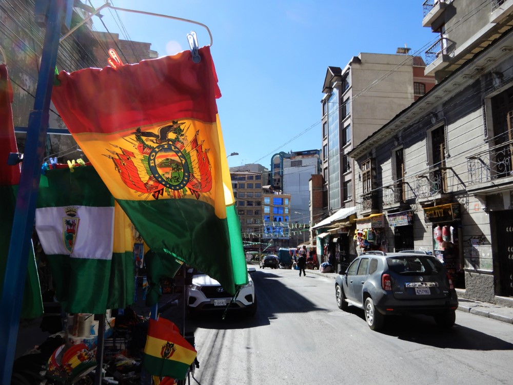
La Paz

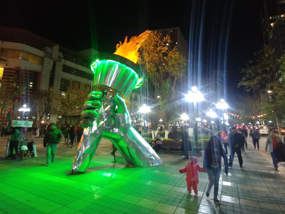
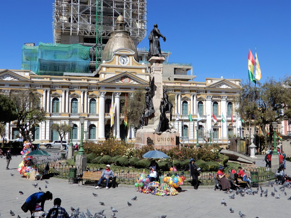
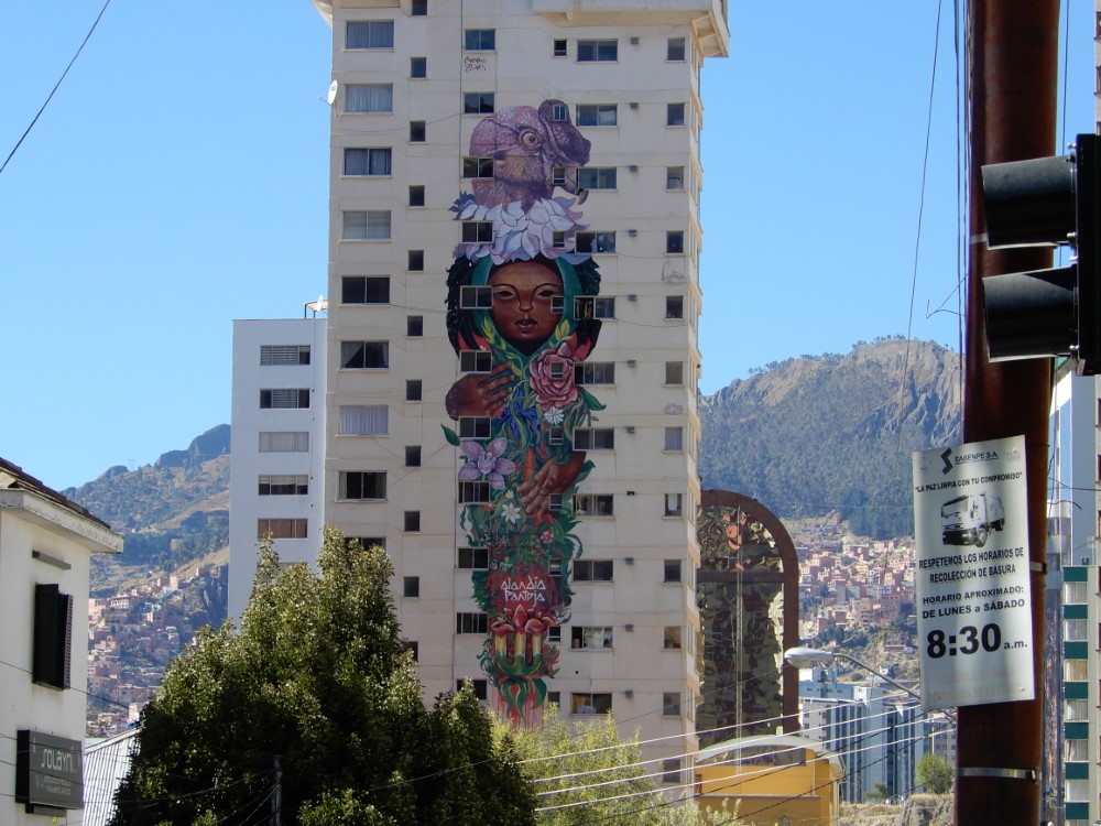
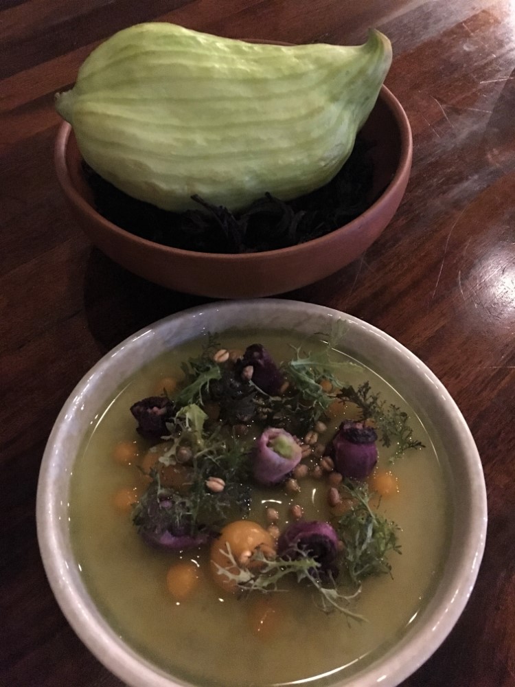
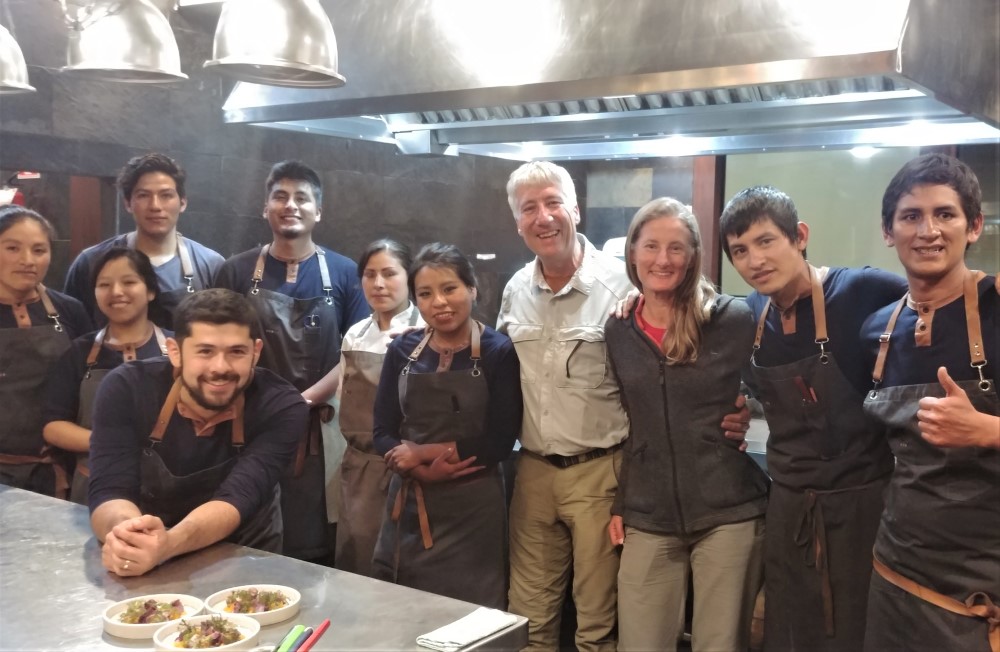
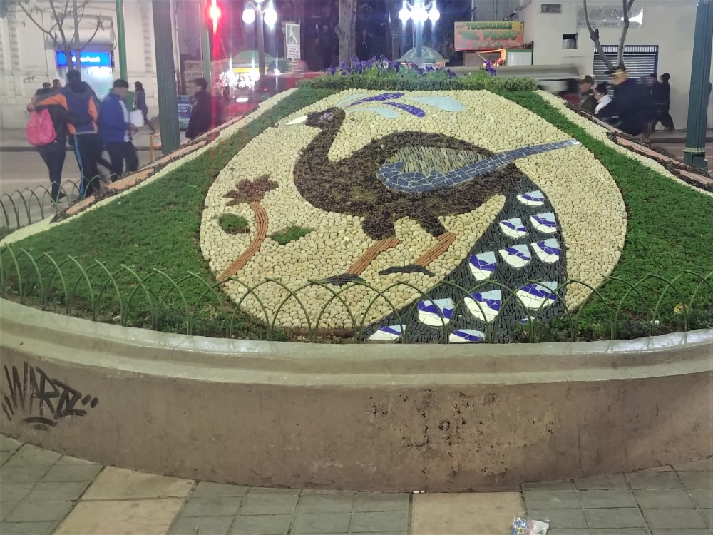
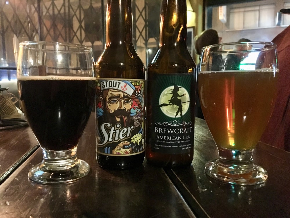
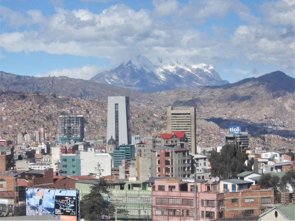
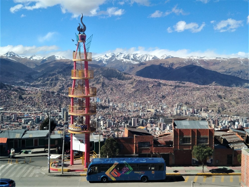
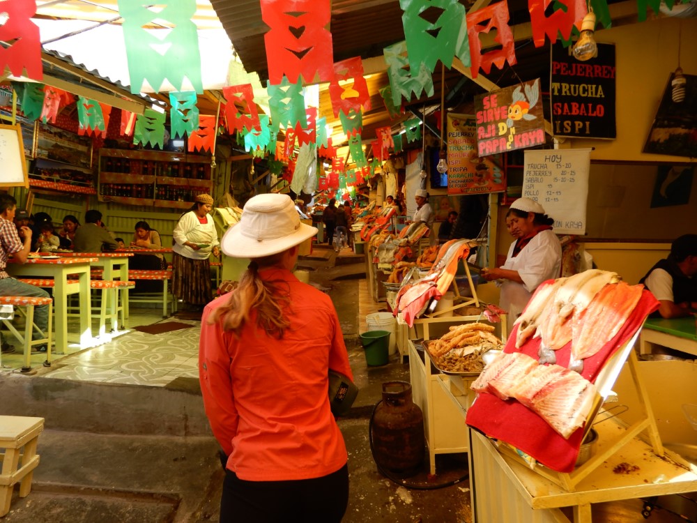
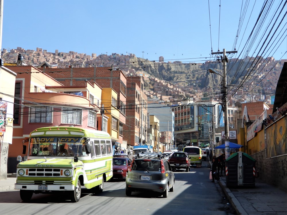
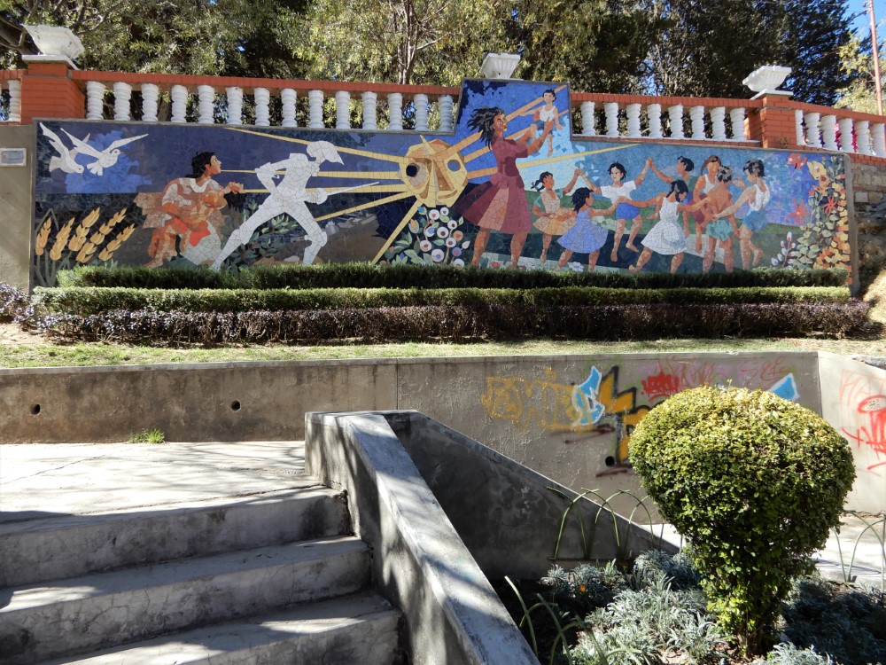
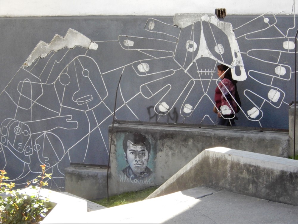
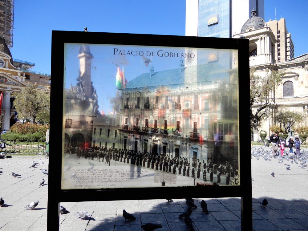
La Paz has one of the highest, and most dramatic city settings we’ve ever experienced. It is densely packed throughout a network of canyons, right at the base of Bolivia’s striking Cordillera Real mountain range. The huge and vibrant city of over one million people ranges in elevation from 3,200 m (10,500 ft) to over 3,700 m (12,000 ft)! And as with other great cities of our travels, it also has a full complement of art, gardens, protests, museums, murals, processions, craft beer, interesting architecture, and fancy local food (including a chance to take a picture with the exceptional kitchen staff!) that we were obliged to experience.


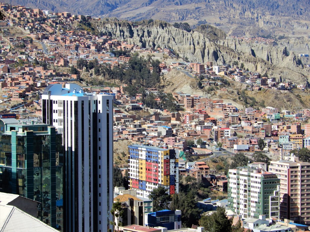


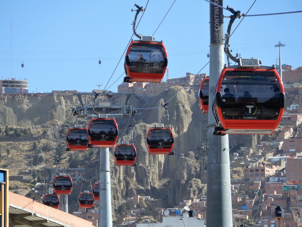


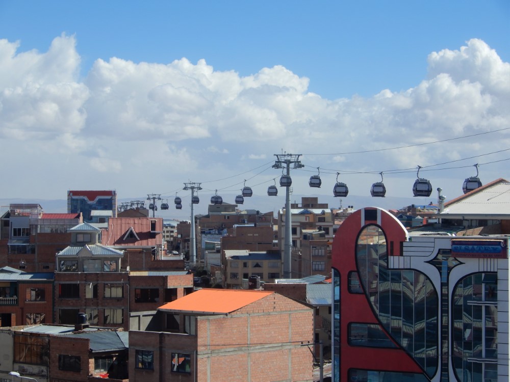
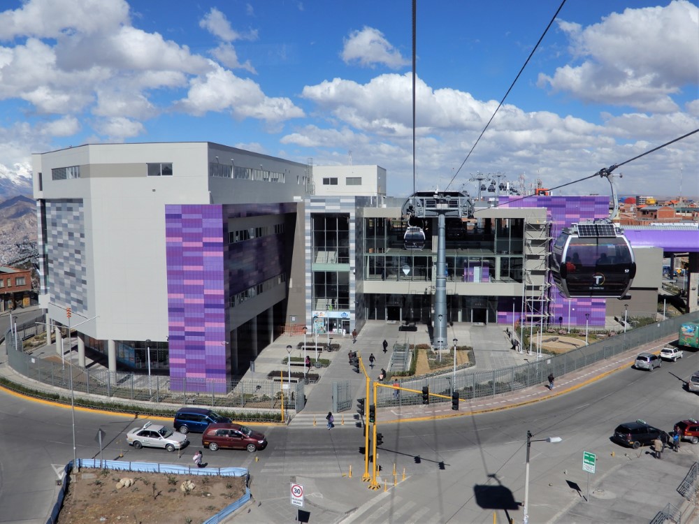
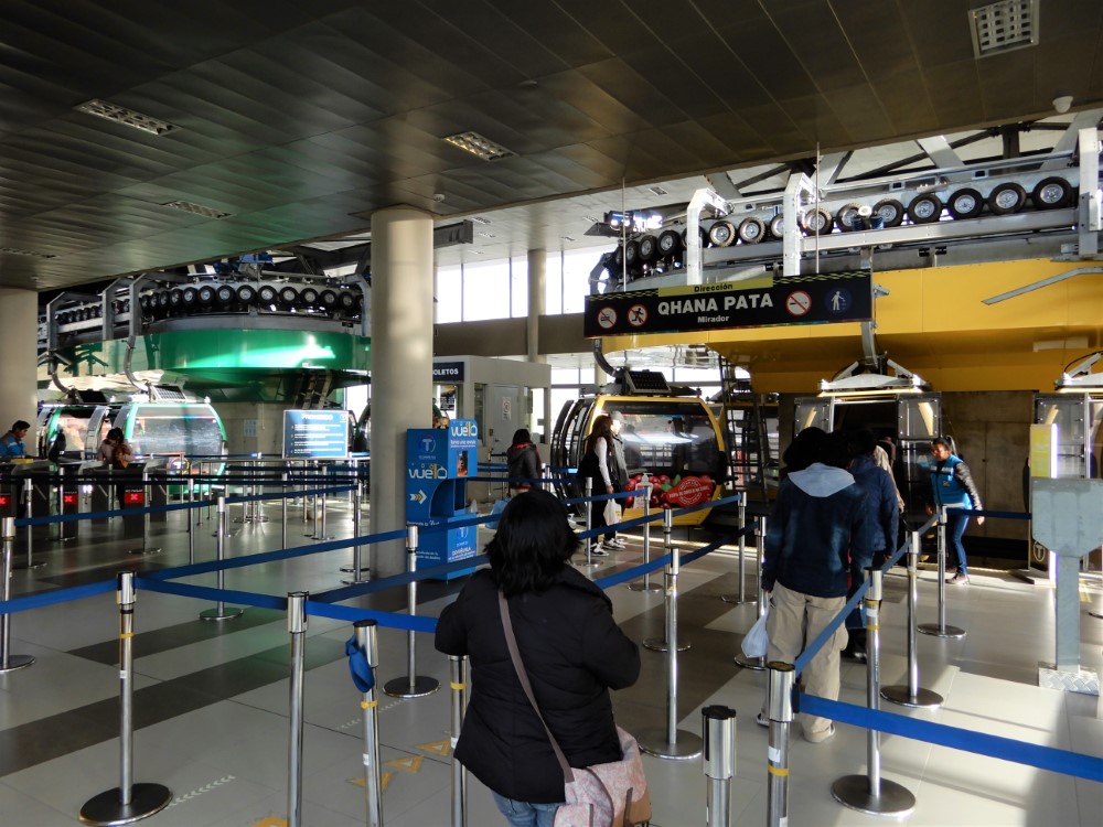
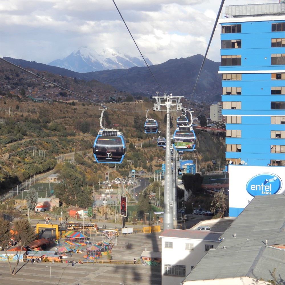
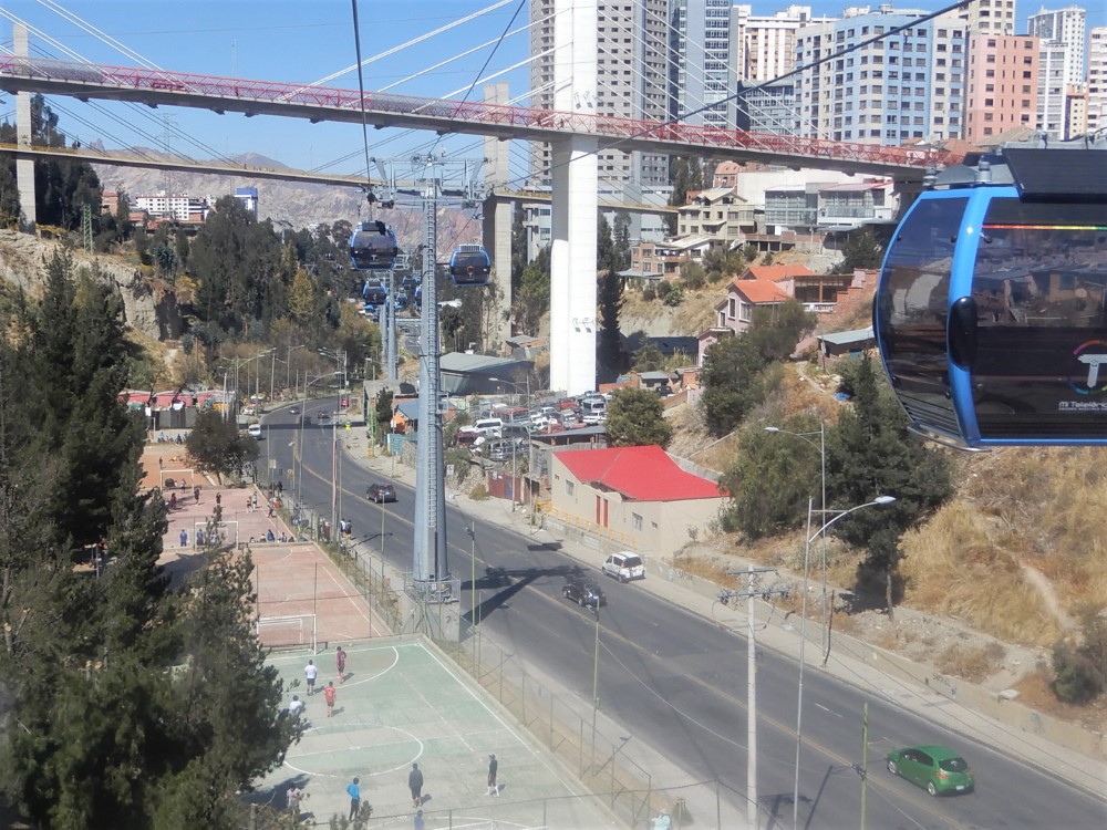


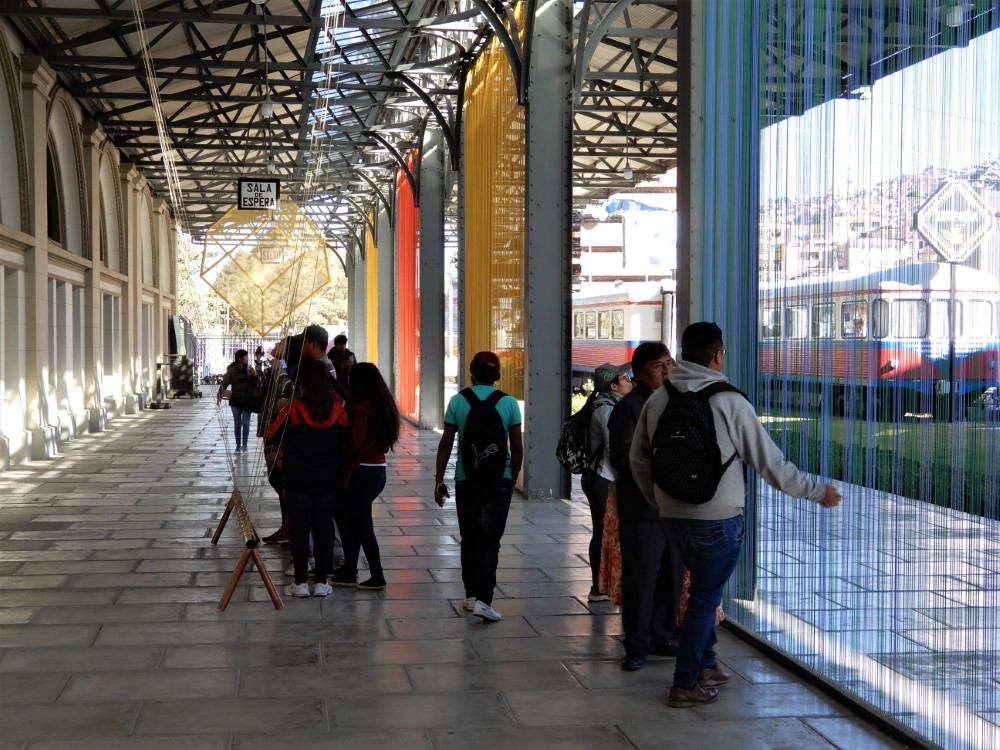
La Paz’s extreme verticality poses significant challenges for urban mobility, but the city’s new tram system seems to be an excellent solution. It’s the newest and most interesting public transportation system we’ve ever seen, and it’s quiet, quick, affordable (for many, but not yet all) and comes complete with fantastic views! Not only is it perfect for La Paz’s extreme grades and elevation changes, but it also requires minimal interventions for its construction within the constraints of a large, existing city. It is clearly a big, visible symbol for Bolivia’s investments in public infrastructure and modernization.
El Alto
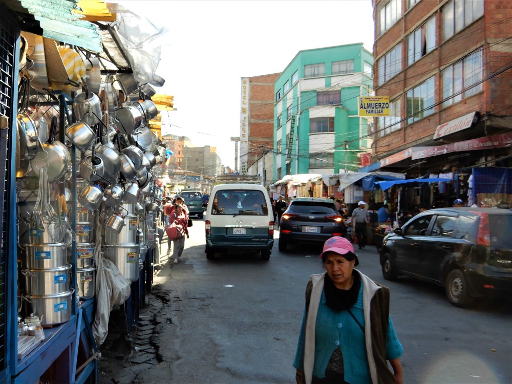
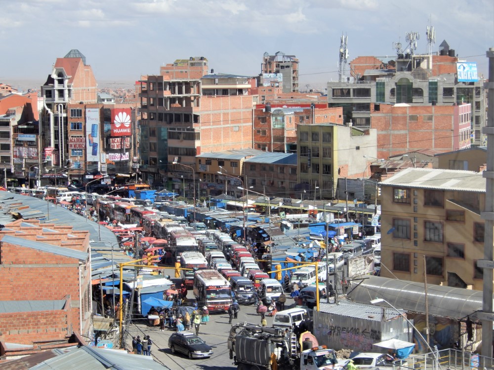
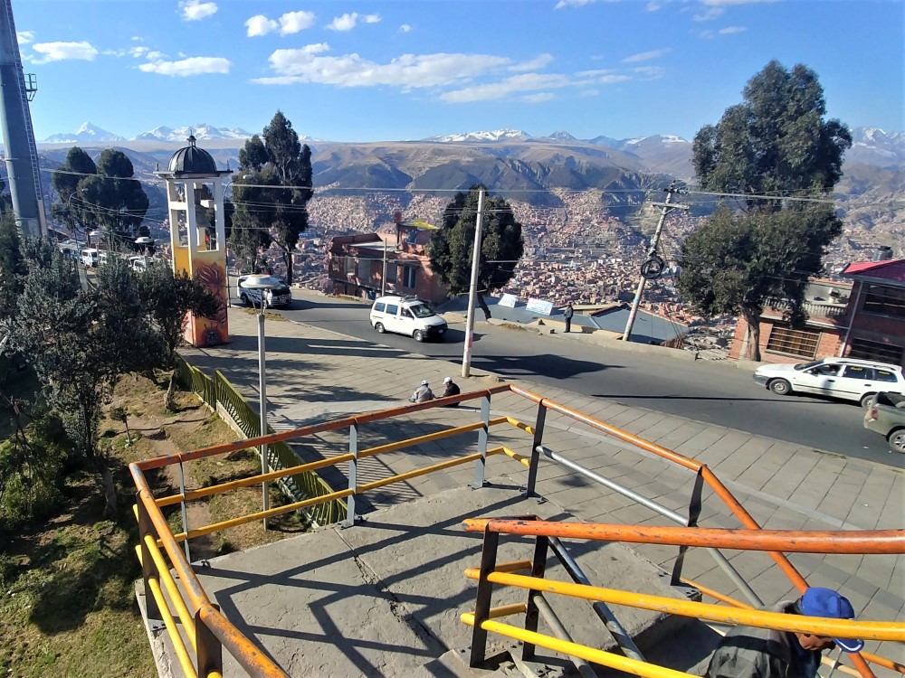
Just above La Paz, on the high, flat, altiplano plateau at elevation 4150 m (13,615 ft) lies El Alto, La Paz’s sister (alter ego?) city, sprawling, apparently uncontrolled, for miles in all directions. It is largely an urban center of indigenous Aymara people (the group from which Evo hails). The interrelationship between these two cities is complicated and fascinating. Bolivians we met throughout the country had told us that El Alto holds significant sway, and sometimes outright control over La Paz, because virtually all roads to La Paz go through El Alto, and the airport for both cities is located up there as well. So El Alto is able to bring La Paz to a halt through strikes and blockades whenever it likes, which apparently is with some regularity.


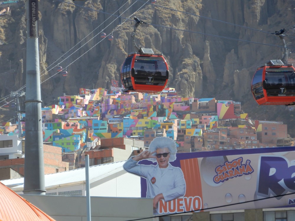
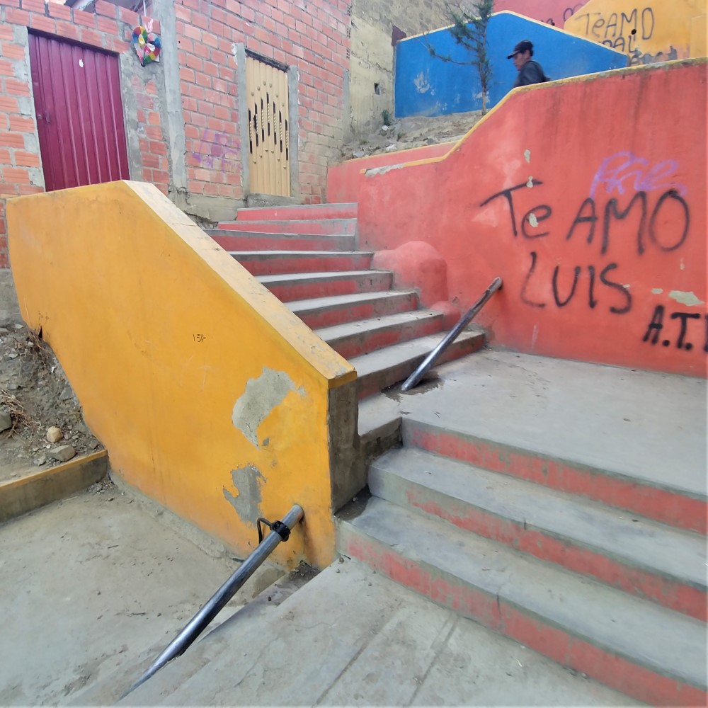

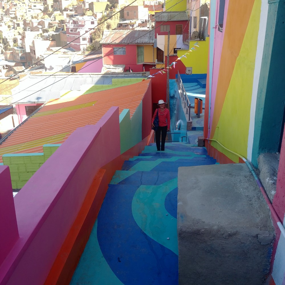

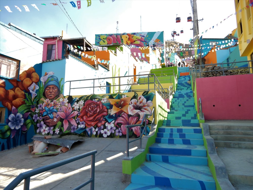

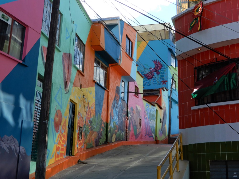


During our tram tour over both cities we noticed a colorfully painted neighborhood accessed by long stairways on the way up to El Alto, so we set off on a walk up the hill, where we were treated to interesting street markets, beautiful murals and lots and lots of stairs.
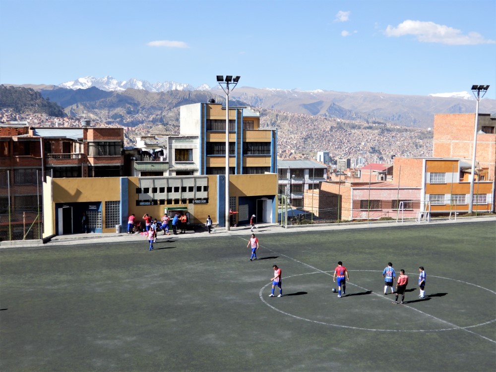
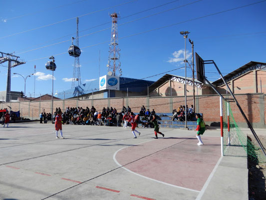
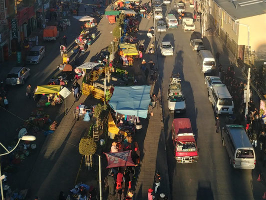
Once up to El Alto we went exploring, first finding lots of street soccer, and later a funeral procession, complete with a band, and family members carrying plaques about the deceased around their necks. We also found sidewalk vendors lined up under the tram line making for an informal market that seemed to stretch on forever.


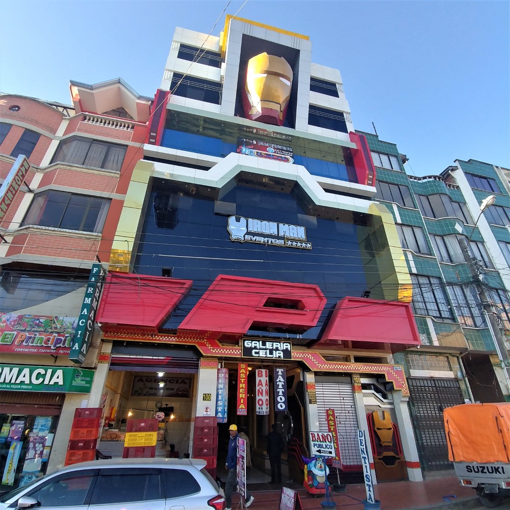
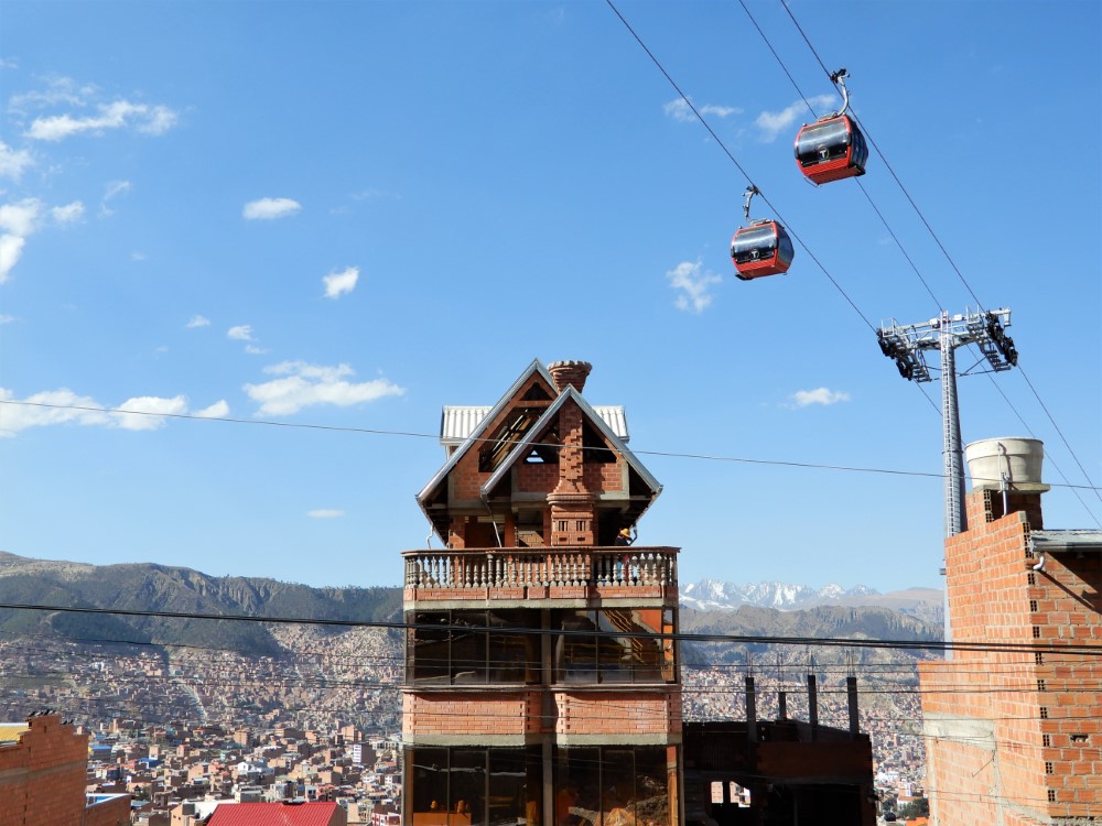
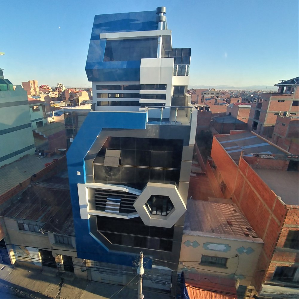
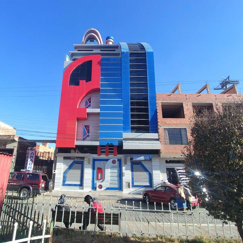

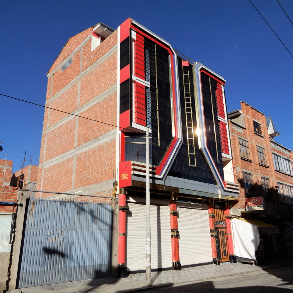
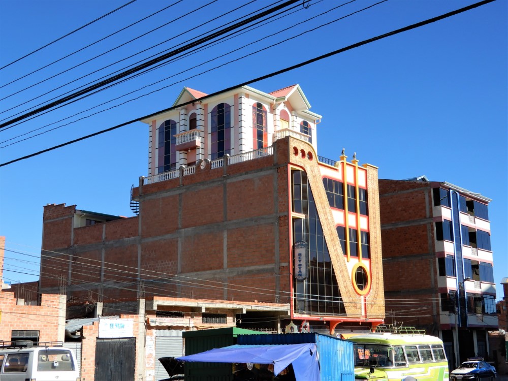
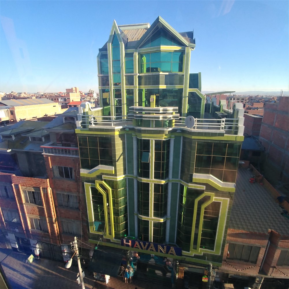
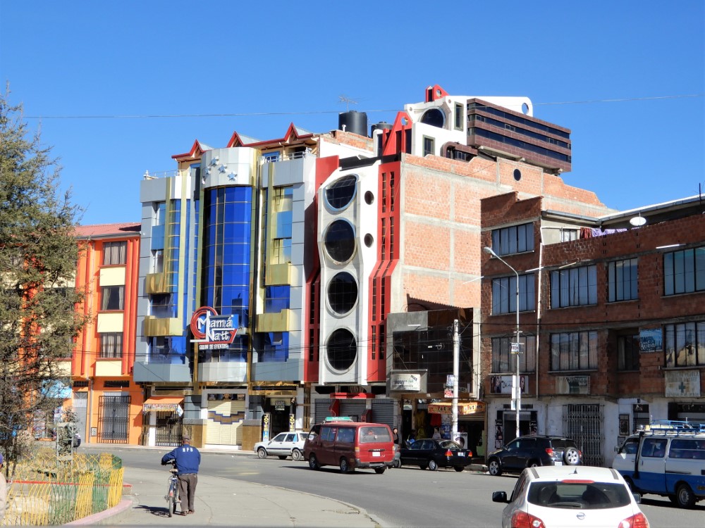


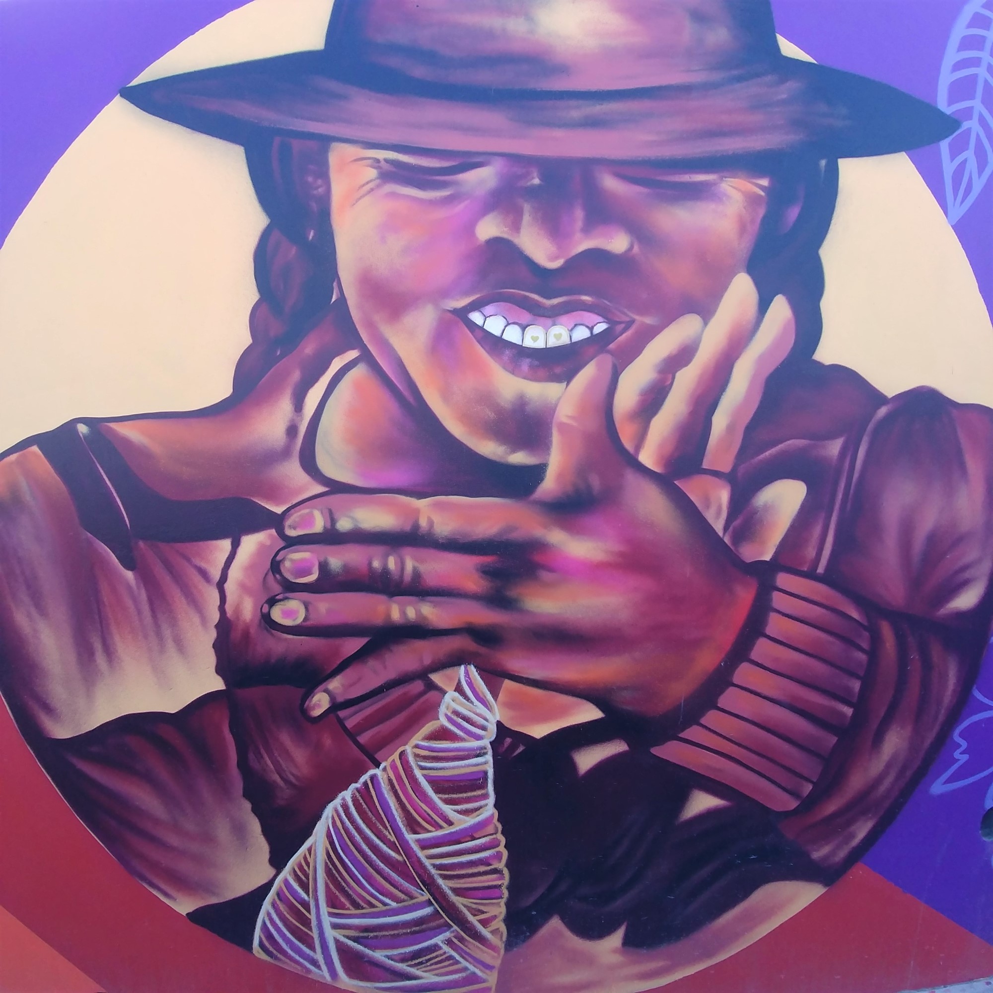
“Cholets” are a relatively new El Alto architectural phenomenon, placing the wealth of the city’s nouveau riche on high display. They are tall, flashy, whimsical pop-art creations, with the owner’s house built as a multi-story penthouse on top of an ornate multi-level event space which in turn may be on top of ground floor retail. One Aymara architect, Freddy Mamani, has led the way in developing this new form of “indigenous architecture”. There is a documentary about him called “Cholet”. The preview shows great shots inside, which we didn’t get to see.
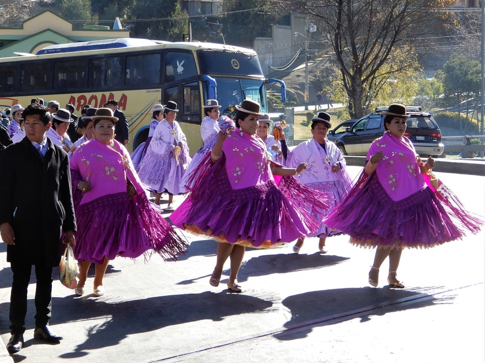
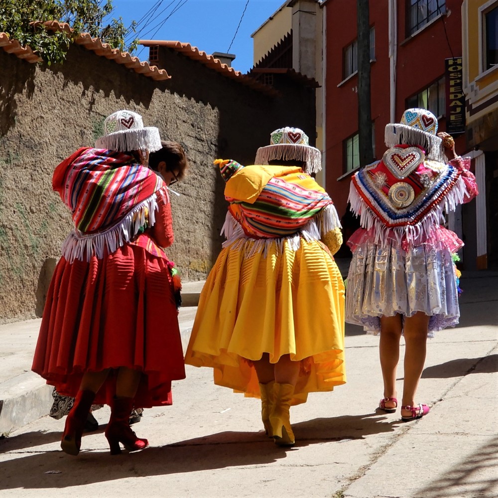
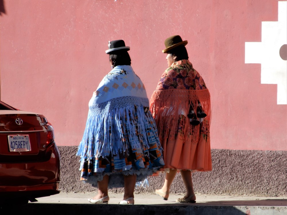
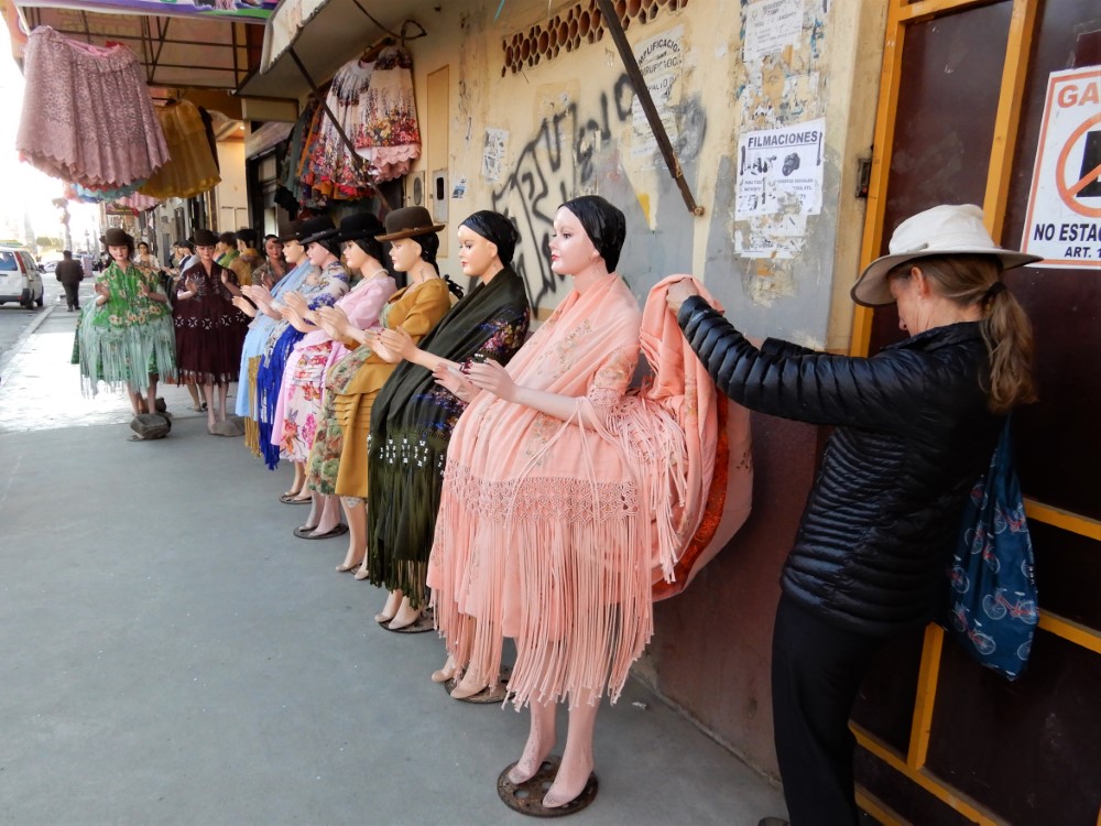
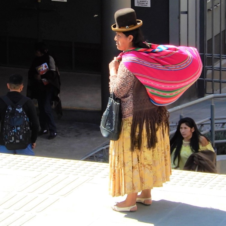
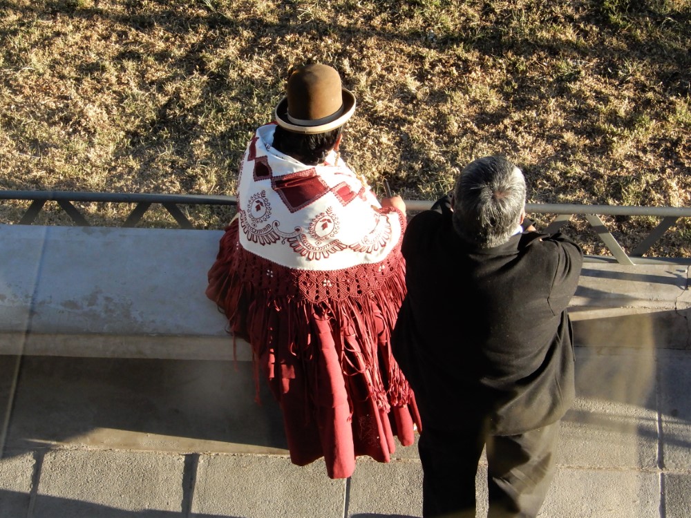
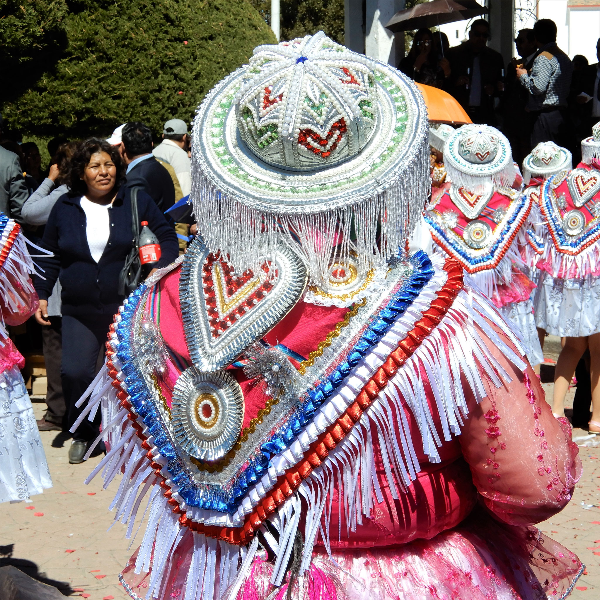
“Cholitas” are indigenous Aymara and Quechua women of Bolivia (and to a lesser extent other Andean countries) dressed in an iconic
fashion which includes wide, colorful and layered skirts, braids with ornamental ends, and bowler hats. You see them throughout the
country, but en masse in El Alto, sporting lots of fringe, bling, and often decorative gold caps on their teeth. At a store specializing in Cholita clothing, Kacia couldn’t help but take a look
at what creates those voluminous skirts!
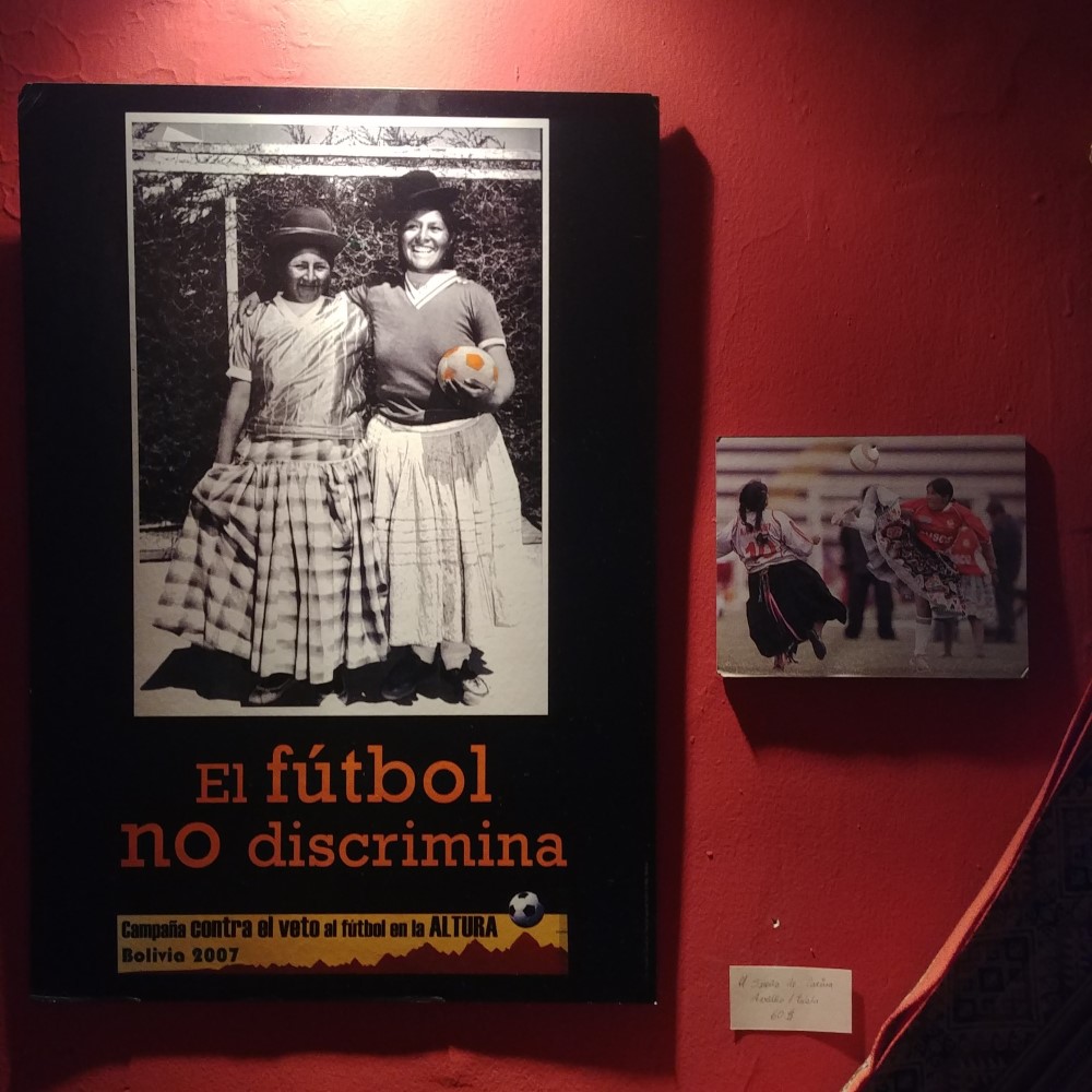
Like other sections of indigenous culture in Bolivia, the cholitas have seen a rise in stature and influence over the last decade, which is beautifully documented in pictures in this article from the
Guardian. In their rise to prominence, cholitas have also asserted their growing independence by taking up professional wrestling --
The Flying
Cholitas are now the hit of El Alto’s wrestling matches!


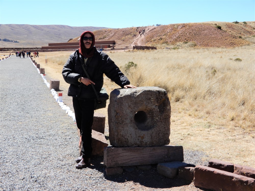
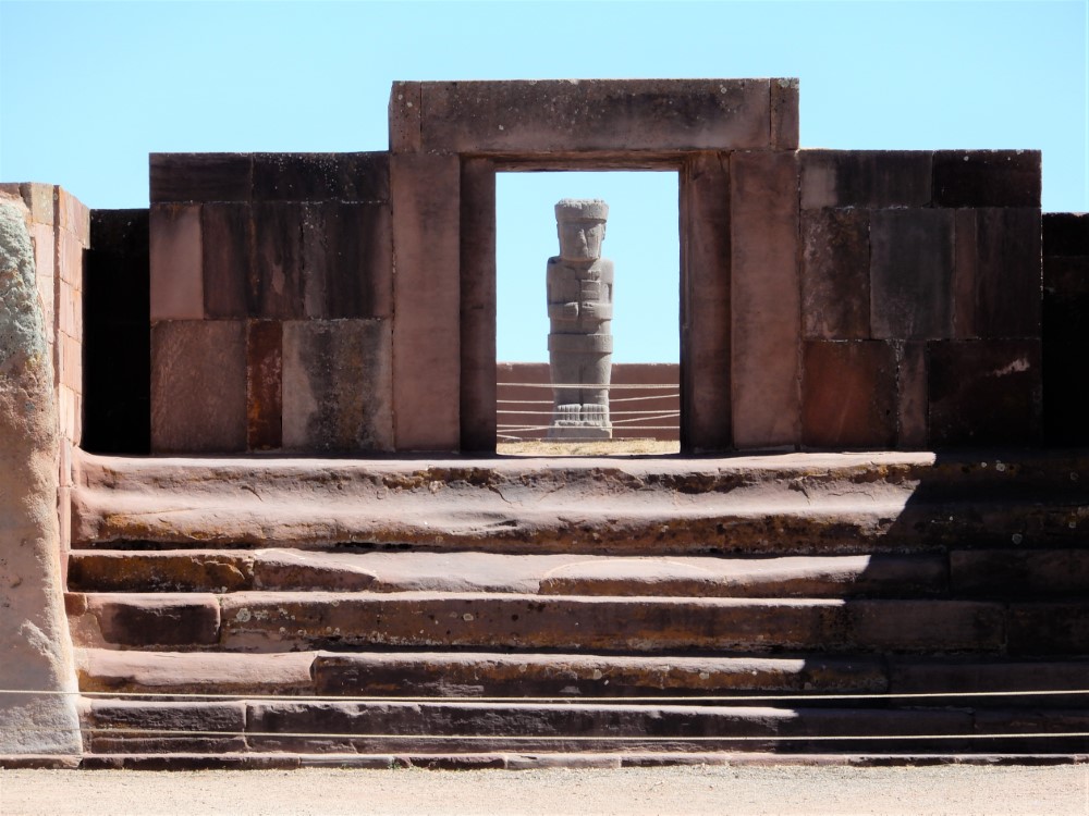
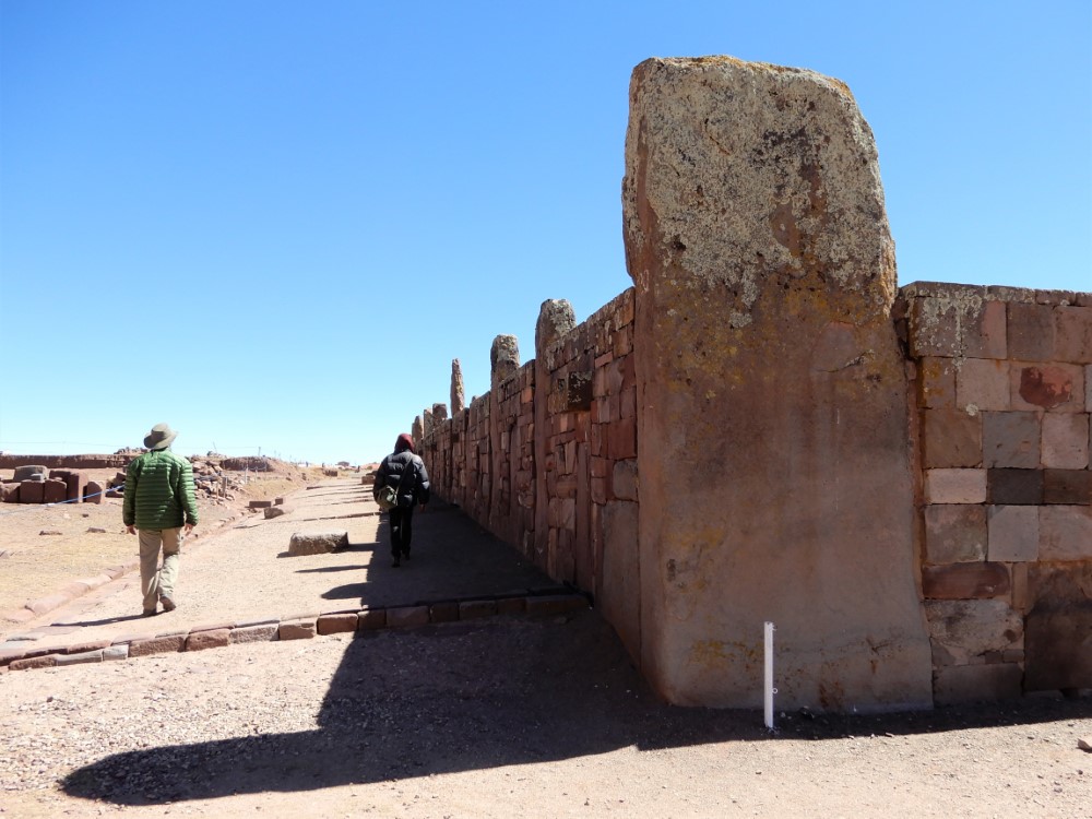
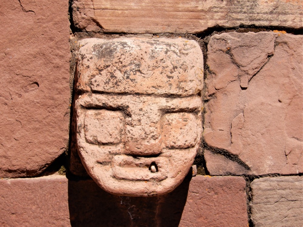
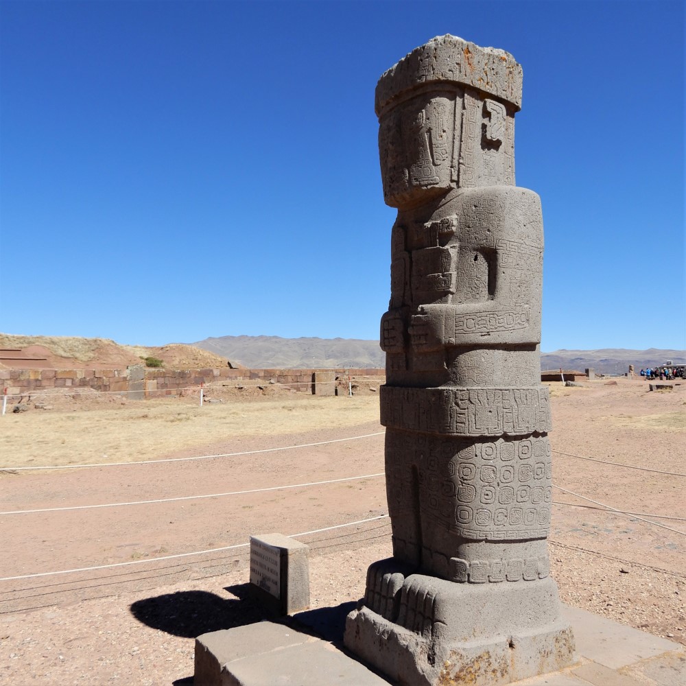
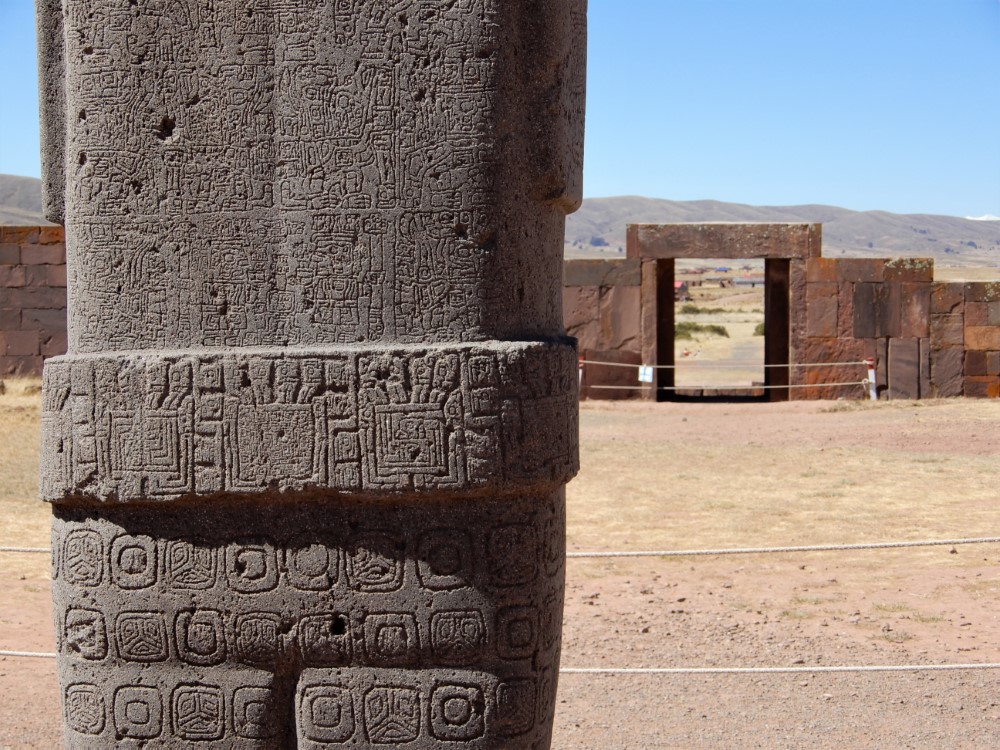
Tiwanaku
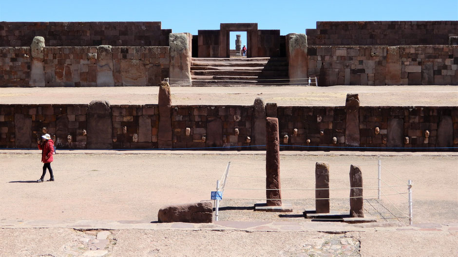
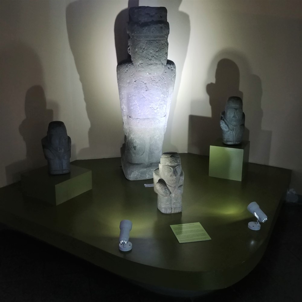
With Leo, an expressive (modern day hippie) guide, we found Tiwanaku to be a bit of a missing link for us and our understanding of the rapid rise of the amazing Inca empire. Founded around 110 A.D., just a few hundred years after Chavin de Huantar, which we visited in Peru, we could start to see the evolution of finer stone work and precision astronomical layout. There were still many unexplained mysteries laid out in front of us, especially because Bolivia’s archaeological sites are so poorly maintained that in cases like Tiwanaku they remain largely buried to protect the site’s artifacts.


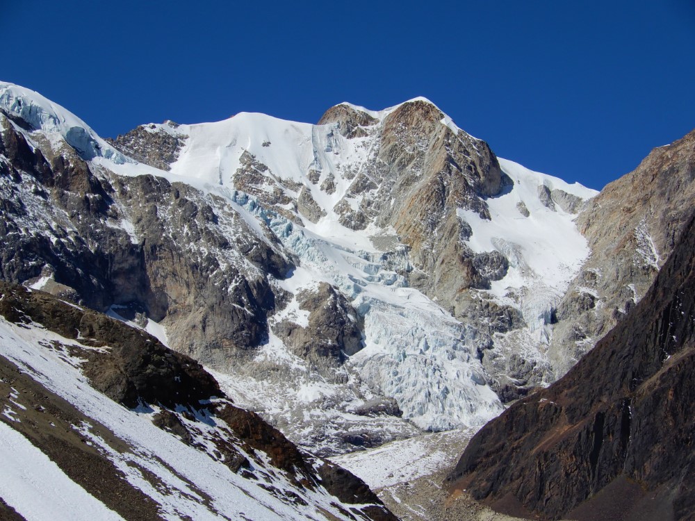
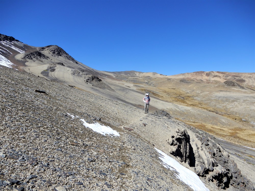
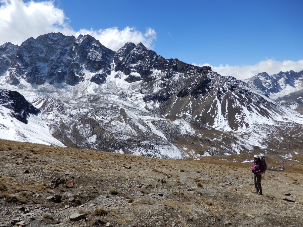
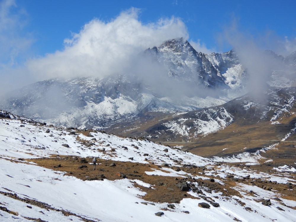
Trekking in the Cordillera Real
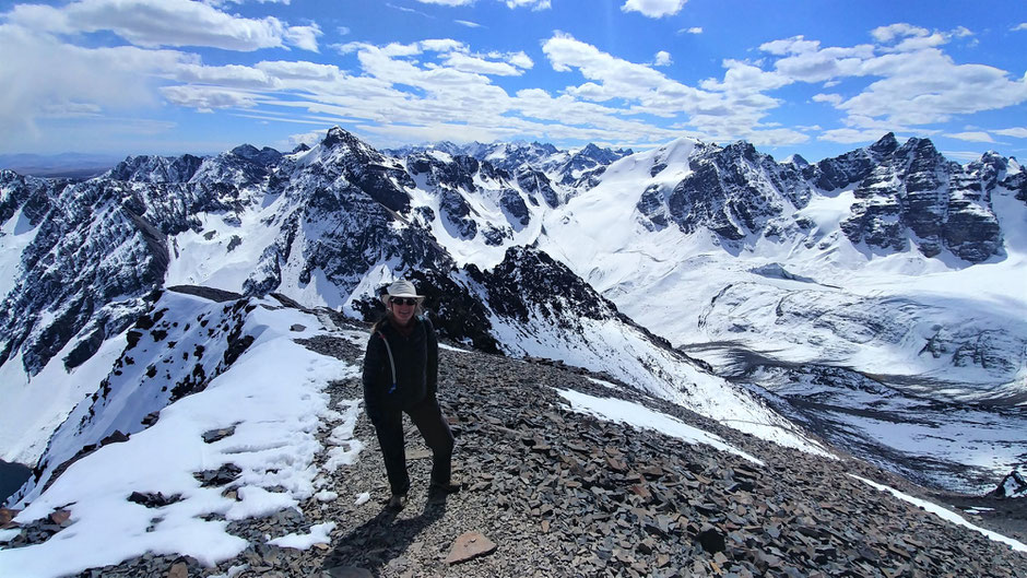
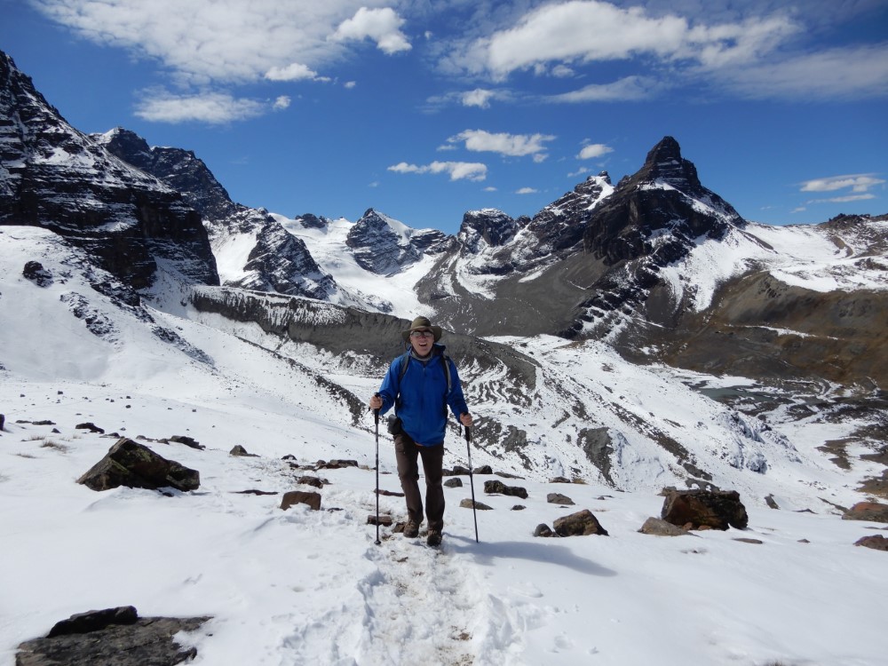
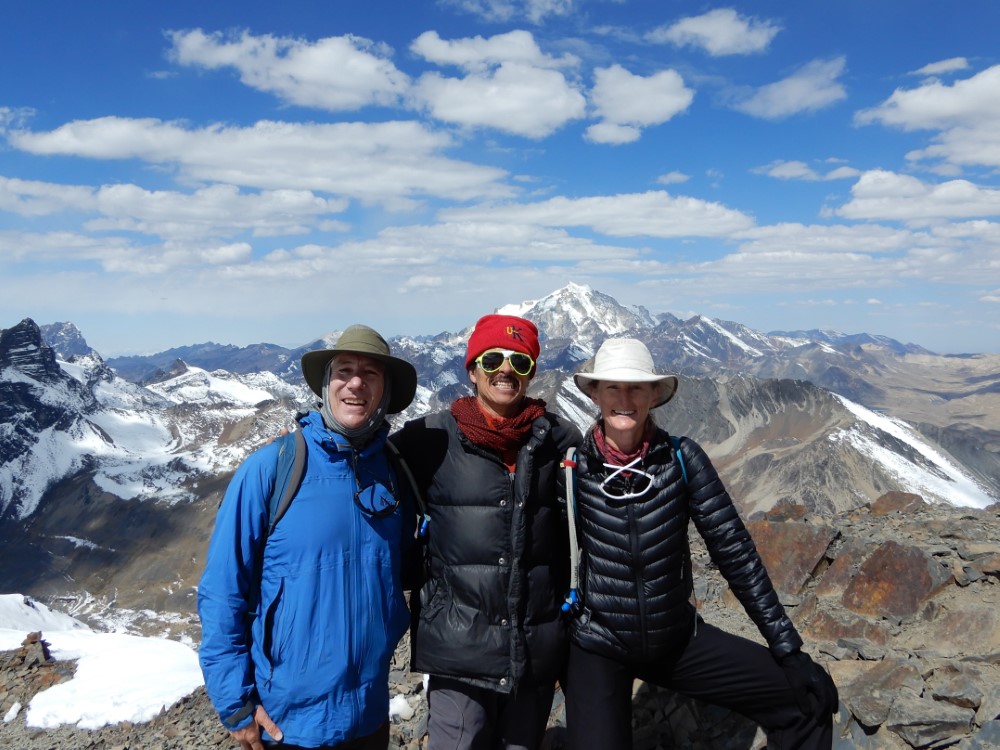
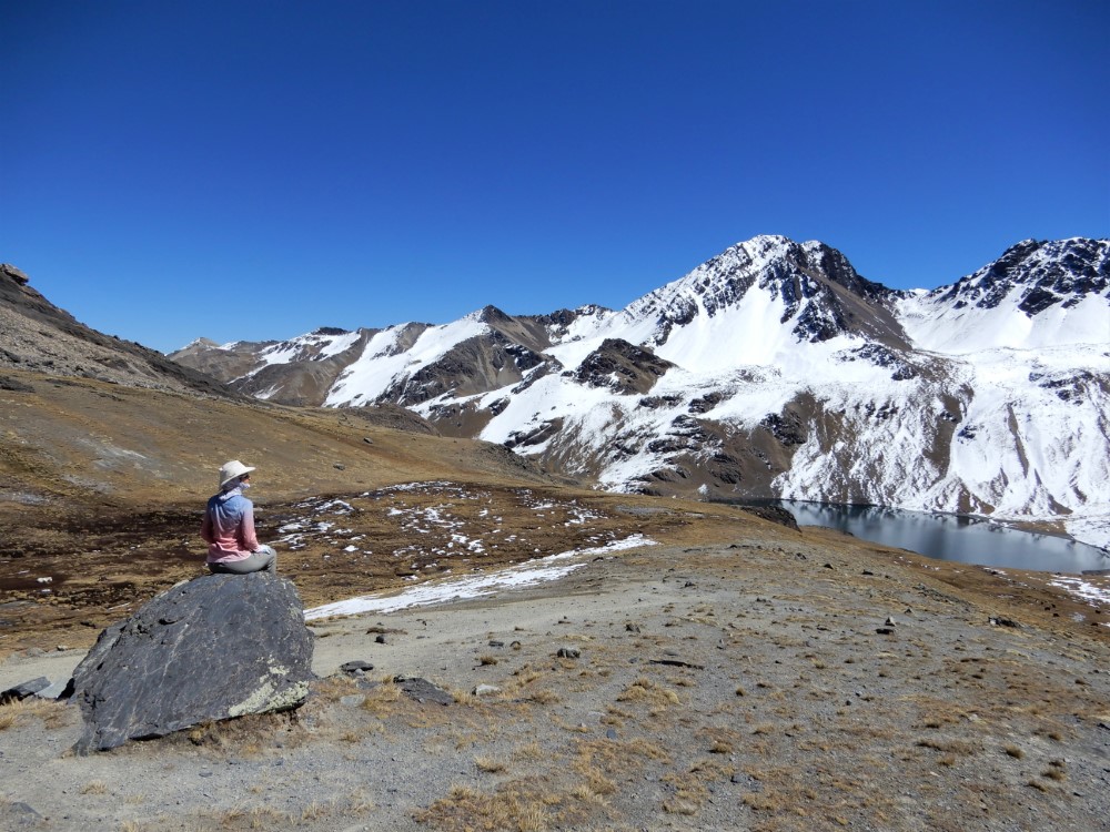
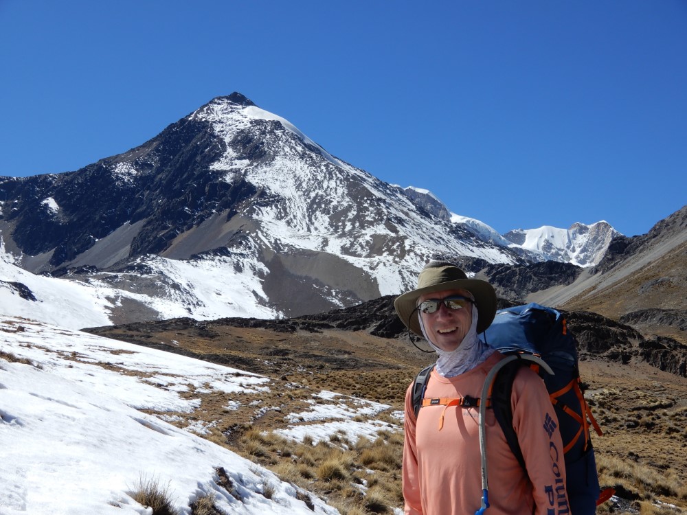
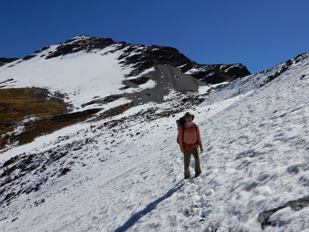
We reunited with crazy Leo for a day hike up “Pico Austria”, near the impressive peak of “El Condoriri” (named for its resemblance to a condor stretching its wings). The view from Pico Austria’s 5,320 m/17,454 ft summit was spectacular, and was such an up-close-and-personal experience with the Cordillera that we decided we had to come back to the area on our own, for an unguided, 3-day, 30 km trek around Huayna Potosi (the 6,088 m [~20,000 ft] peak directly behind us in the photo with Leo).
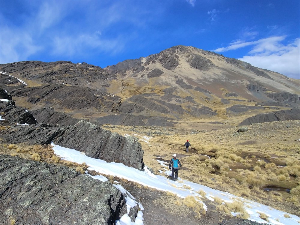
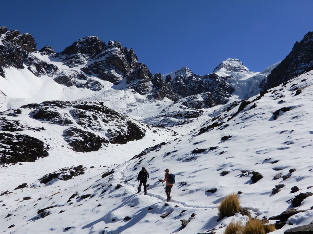


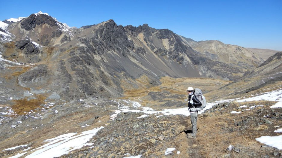
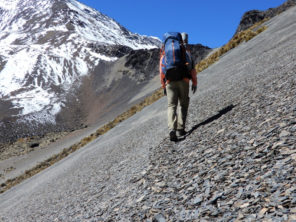
Finding ourselves again on the edge of some of the world’s highest mountains, we were eager to set out on the trek. Dropped off at the same point as our Condoriri hike, we set off to the south this time on a trail that we ended up having completely to ourselves for the next three days. It was magical for us seemingly to be the only two people walking in the mountain range!
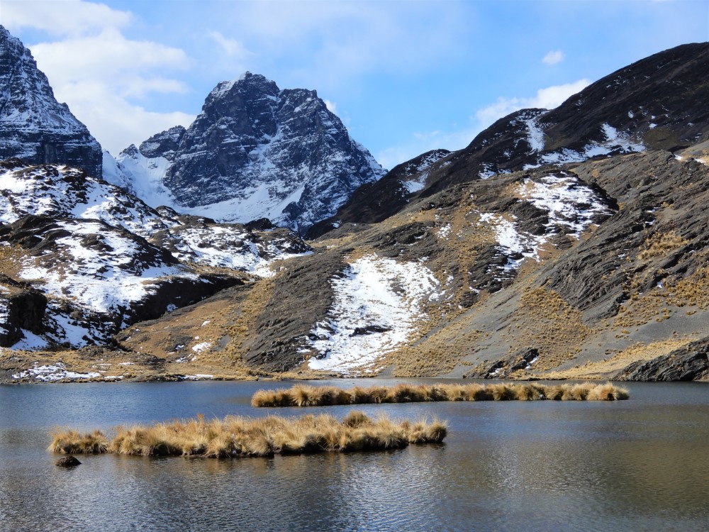
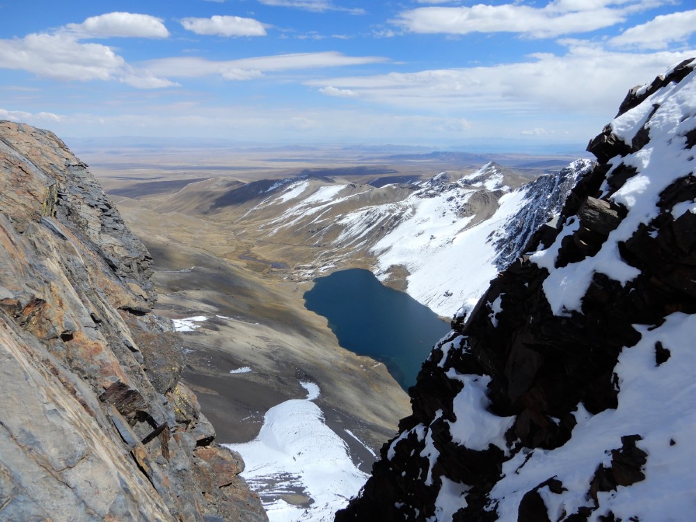
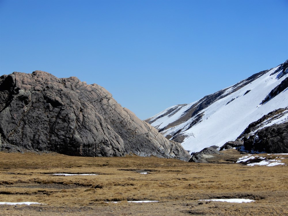
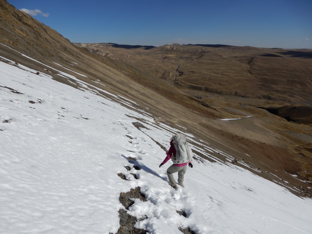
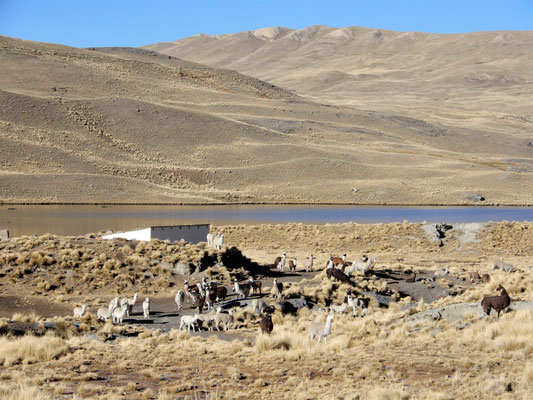
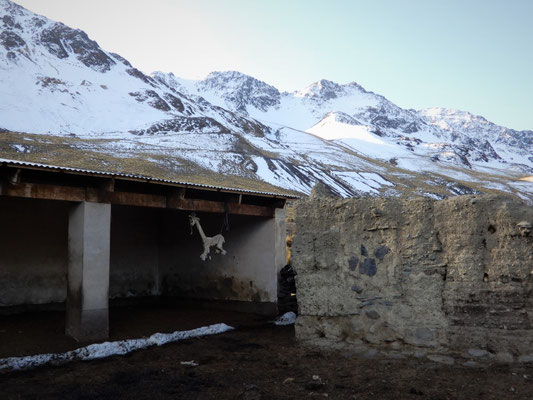
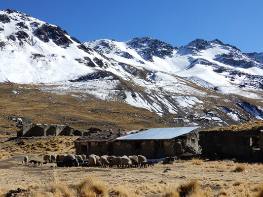
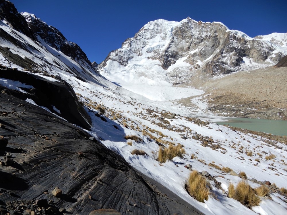
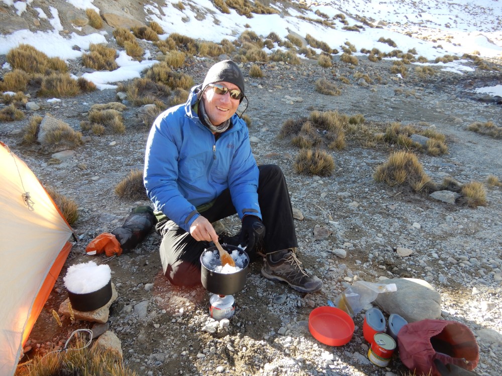
It was late spring, so there were still large snow pads on many of the south-facing slopes (remember, we’re in the southern hemisphere!), which made for some exciting and wet going from time to time. The hike elevation averaged over 4,500m (15,000 ft), with the passes nearing 5,200m (17,000 ft), and on the first day we crossed two passes. We finished in a valley on the shores of a high lake, camping in the lee of an unoccupied hut in a micro “village” of just 3 - 4 houses, asking permission of the only shepherd family who was there at the time.


As we were eating dinner at sunset, the family’s herds of sheep, alpaca and llamas returned along the opposite side of the lake to their corrals, which were protected by a dessicated llama fetus, a typical good luck talisman for the region. The next morning as we ate our breakfast, the herds passed right through our little campsite on their way back to their high pasture land.
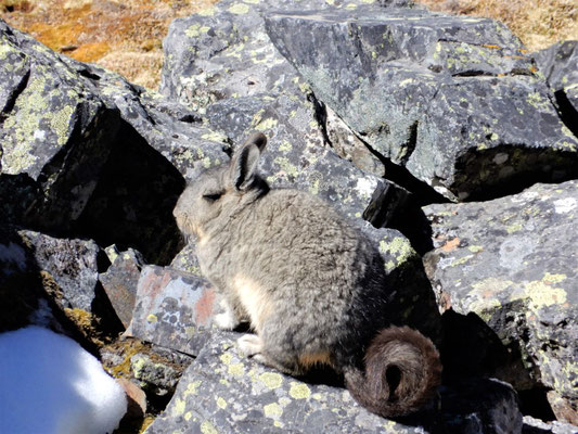
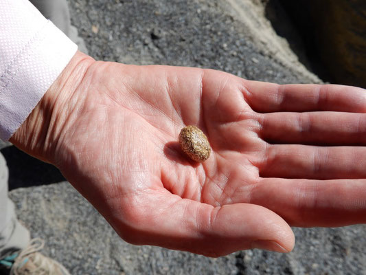
We saw very little wildlife, but were entertained by a pack of rabbit-like viscacha and surprised by some rufous-bellied seedsnipes that were hiding in plain site (many thanks to Richard Loyn in Australia for correctly identifying birds we thought were ptarmigans). We also saw lots of signs of the llamas that roam all over these high mountains, and were amused to find out that high-altitude sun-soaked llama poop turns a beautiful shade of gold!

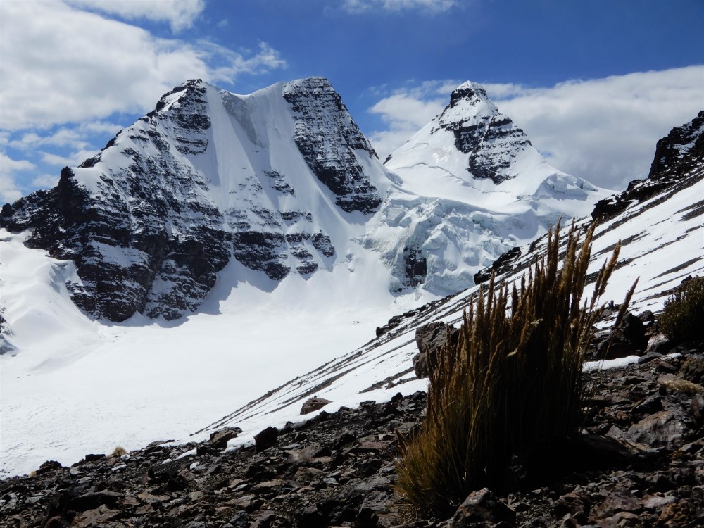
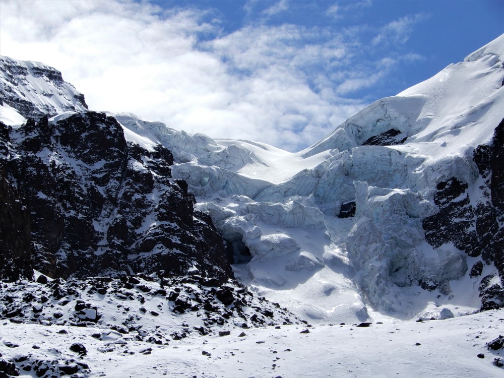
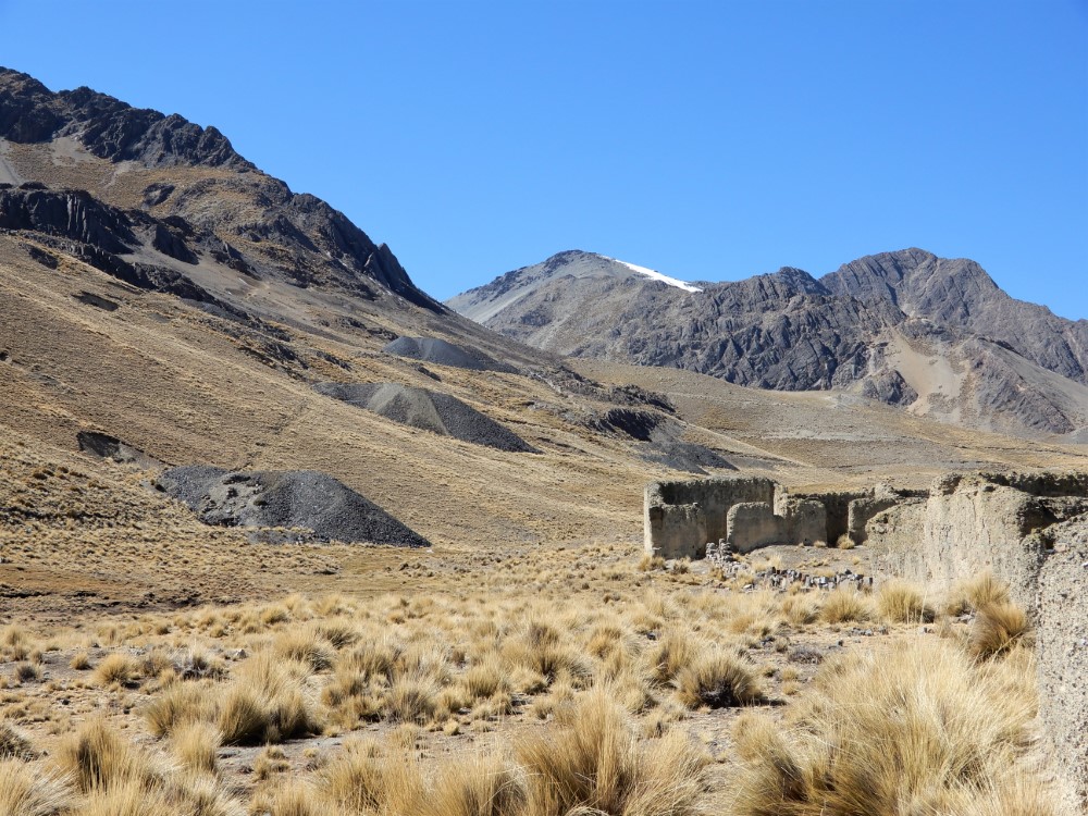
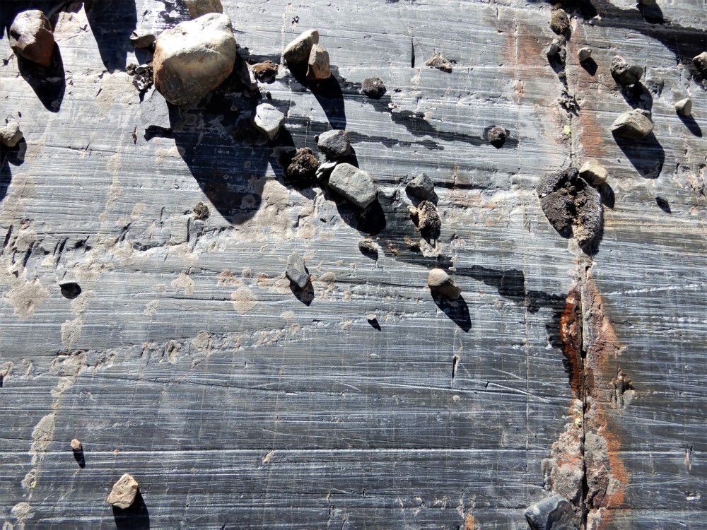
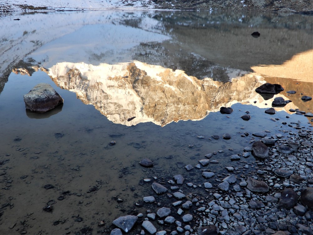
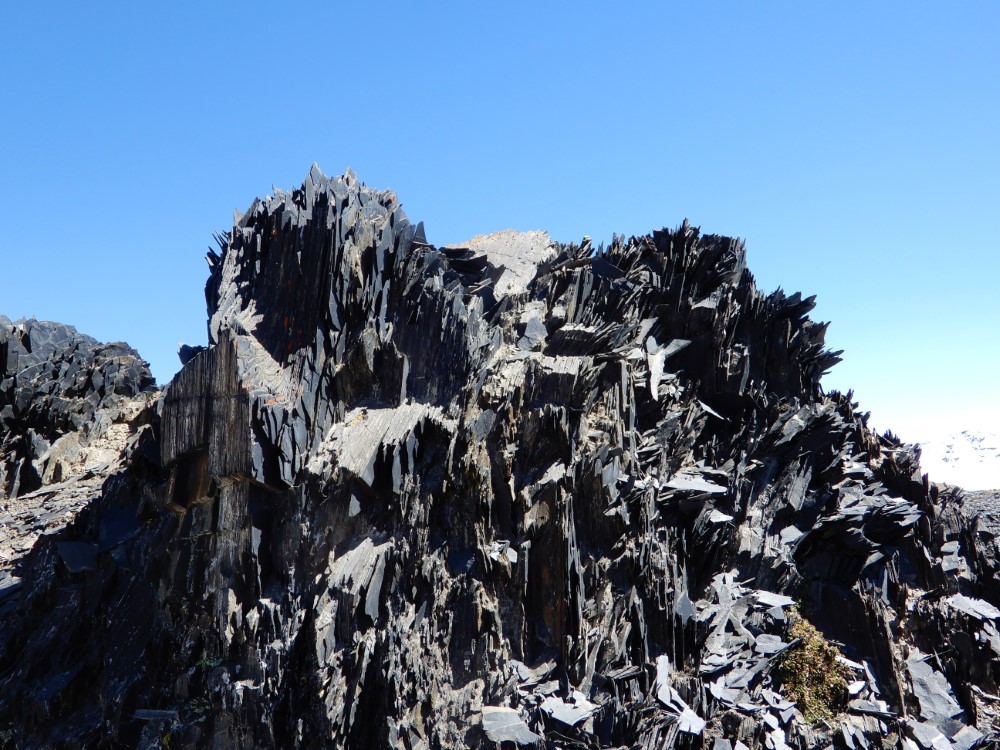
The second day, we climbed passed an abandoned mining complex, then crossed some very steep talus slopes on our way over a pass to our highest campsite of the entire trip, on the shore of a small cirque lake at over 4,900 m (16,000 ft). We were surrounded by glaciation, including huge moraines and deeply scarred rocks - it was magnificent!


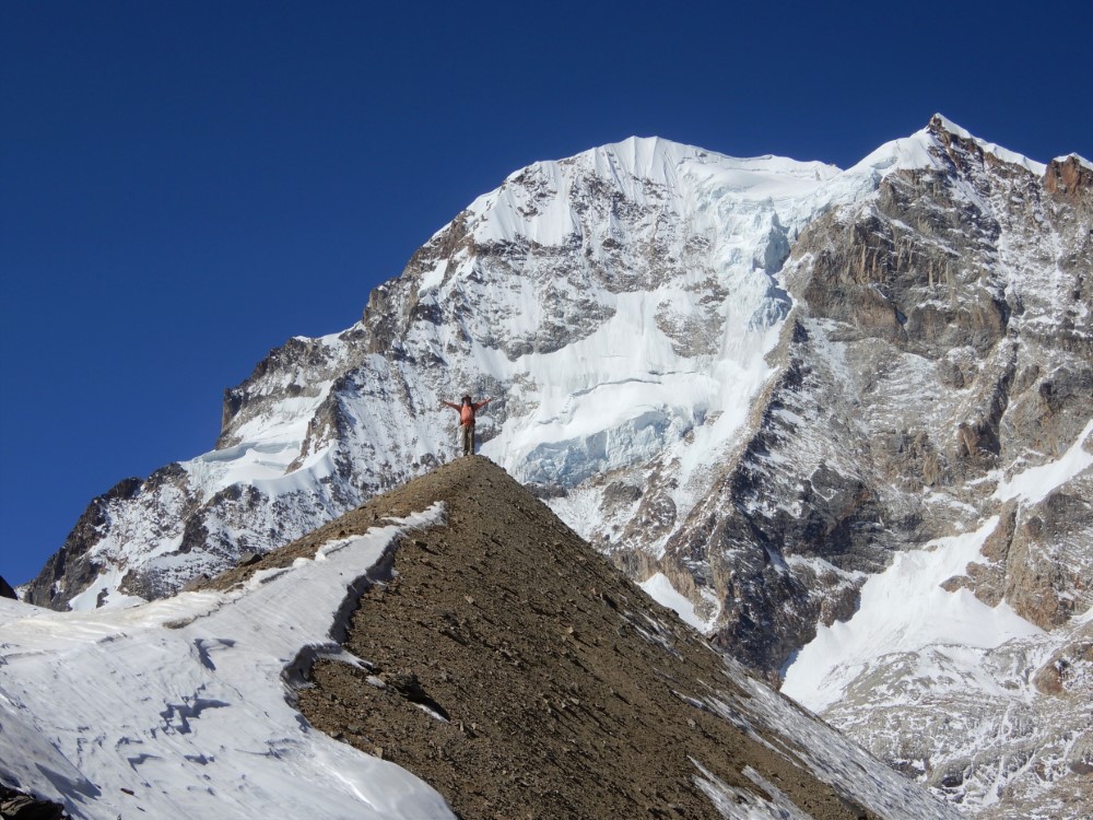


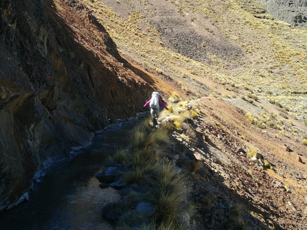
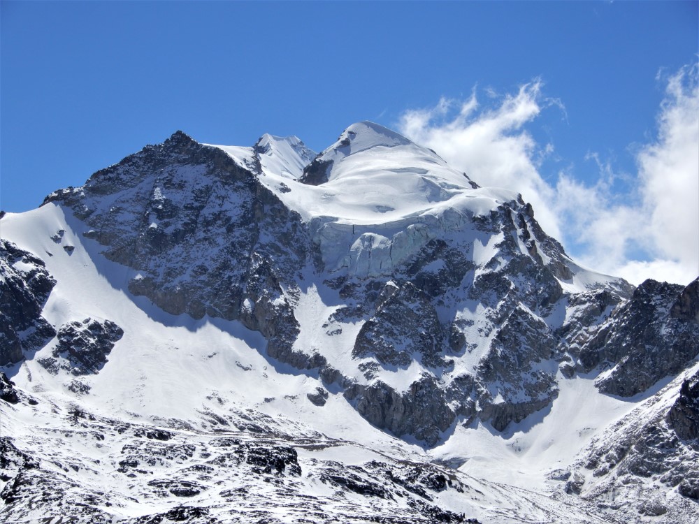


We began the final day walking several kilometers along an ambitious canal carved into the mountainside to deliver water to villages beyond our view. We then headed over yet another pass, and got a front row view of Huayna Potosi. We continued around its base to a pre-arranged pick up location, just as some stormy weather arrived. We were full to the brim with love and respect for these mountains!
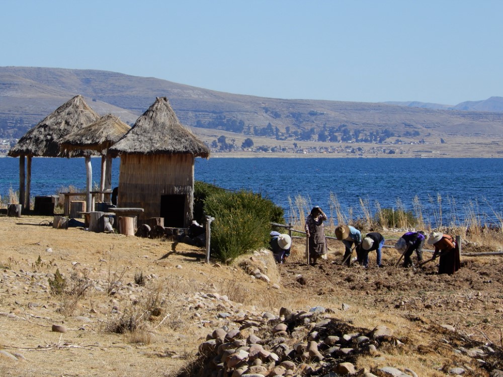
Copacabana
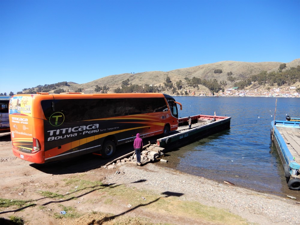
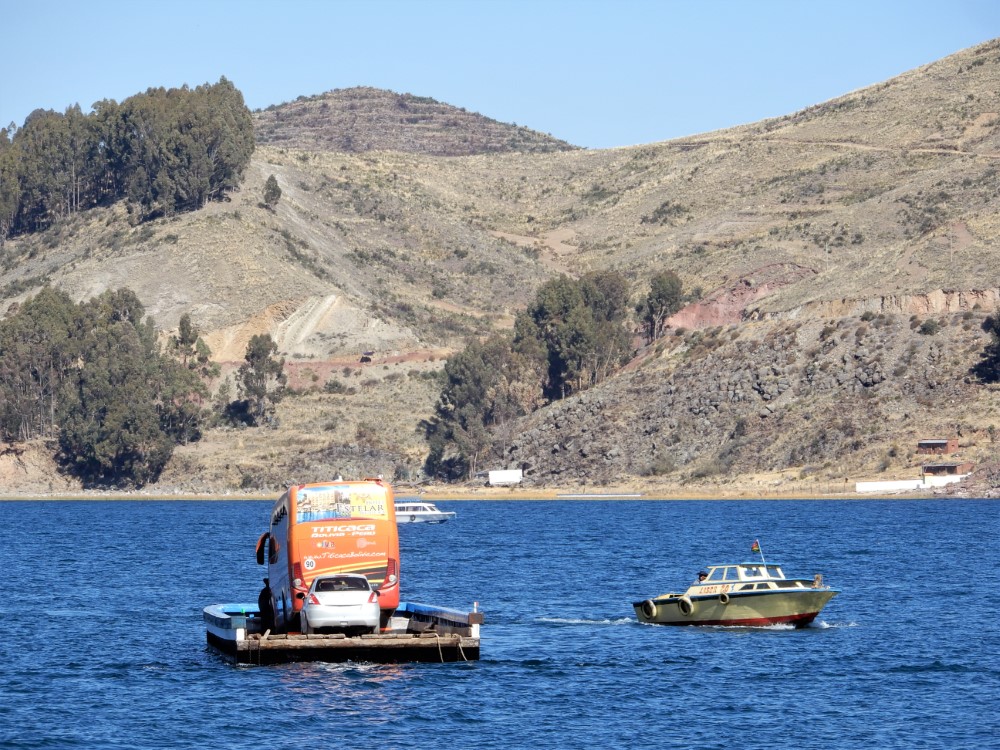
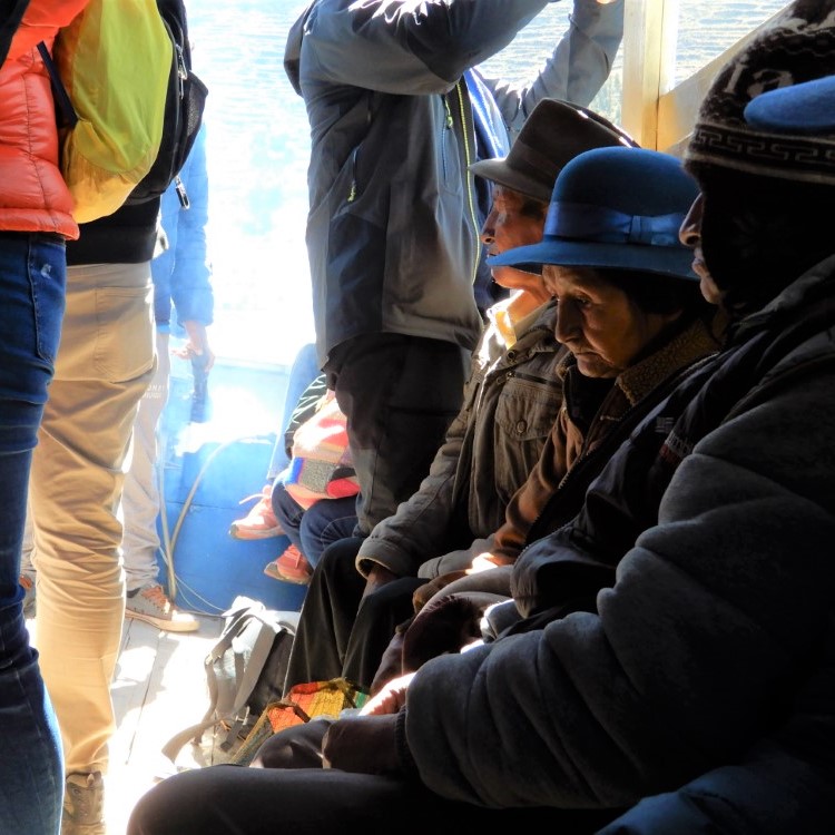
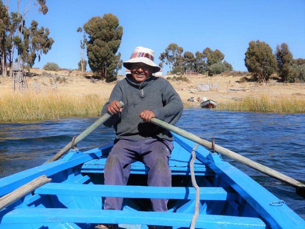
We took a bus from La Paz to Copacabana on the shore of Lake Titicaca. This included a short “ferry” in which the bus passengers were shuttled in a couple of wooden boats and the bus on a wooden barge propelled by a small outboard motor.
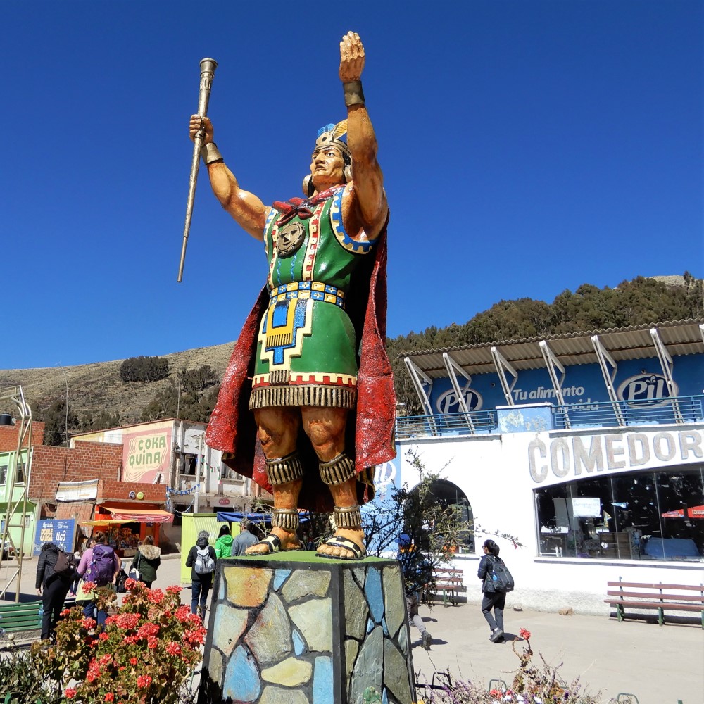

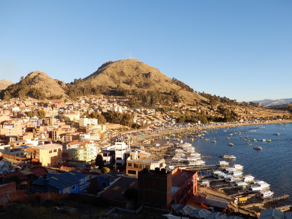


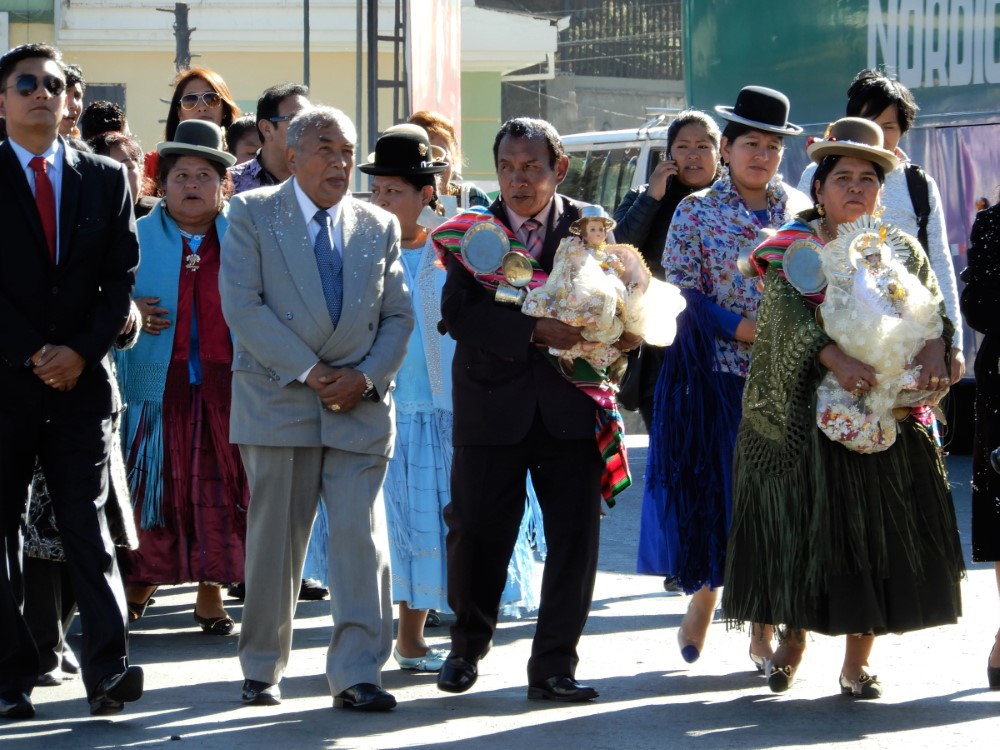
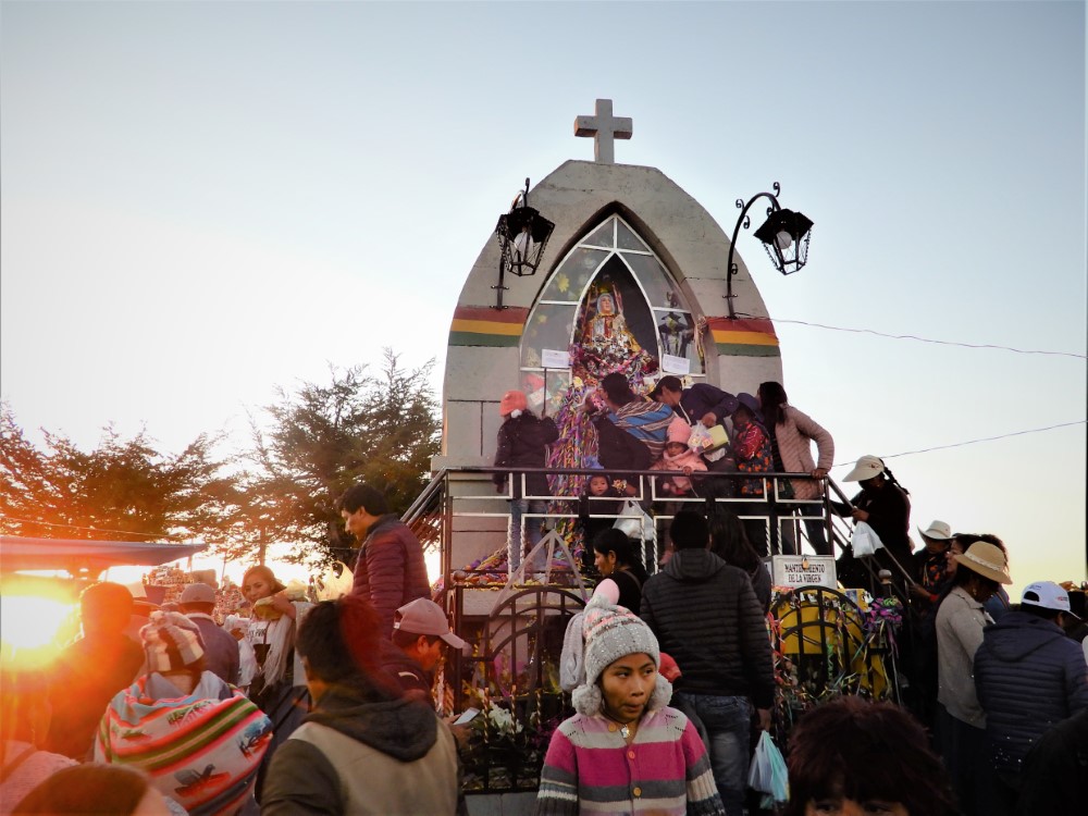
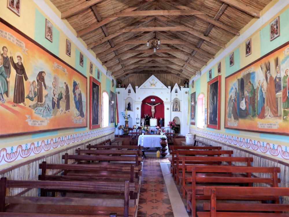
This is the original Copacabana, whose patron saint, the Virgen de Copacabana, became the patron saint for all of Bolivia at the country’s independence. The famous beach in Rio de Janeiro, Brazil, is actually named after it. We were able to visit the town during its festival of the virgin, a huge regional event, drawing people from hundreds of kilometers away, from both Bolivia and Perú.
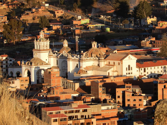

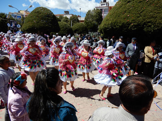
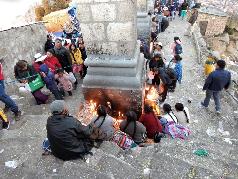
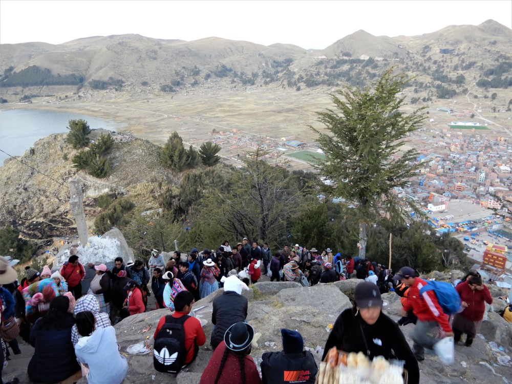
People come to visit the virgin inside the famous Basilica of Our Lady of Copacabana (which dates from 1679), and to make the pilgrimage up the town’s mountain to the virgin’s shrine on top. Even at sunset, the line stretched halfway down the mountain, with vendors selling candles and virgin memorabilia all the way up and down the trail. The downtown was crammed full of stalls selling all forms of food, crafts, and plastic scale models of things people can ask the virgin’s help in getting, including cholets, cars, animals, and stacks of money.


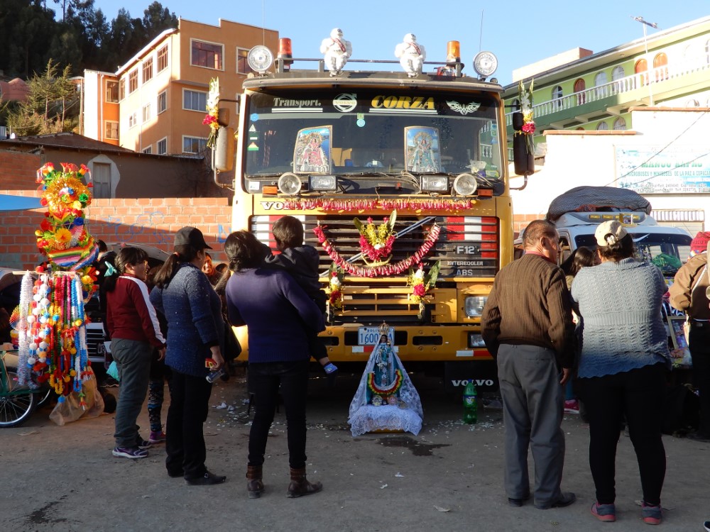
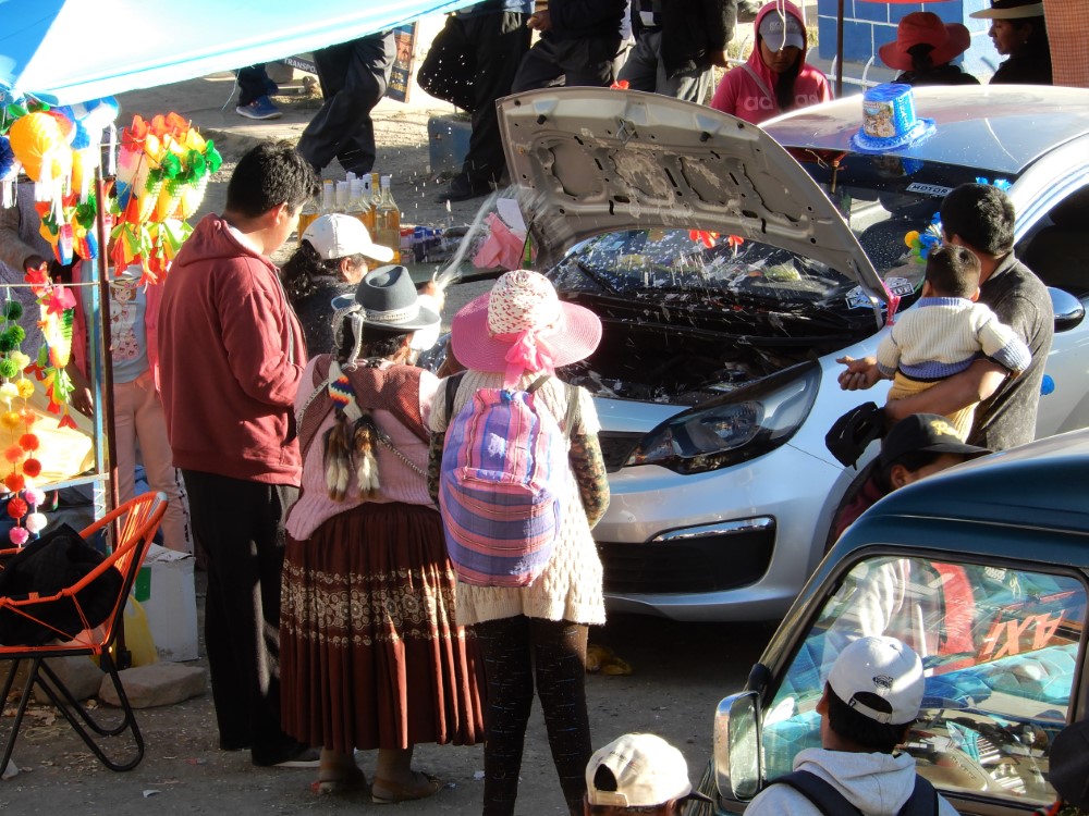
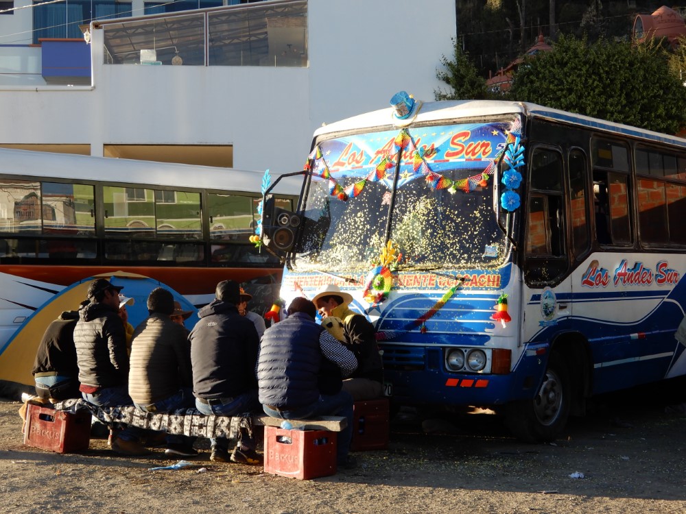
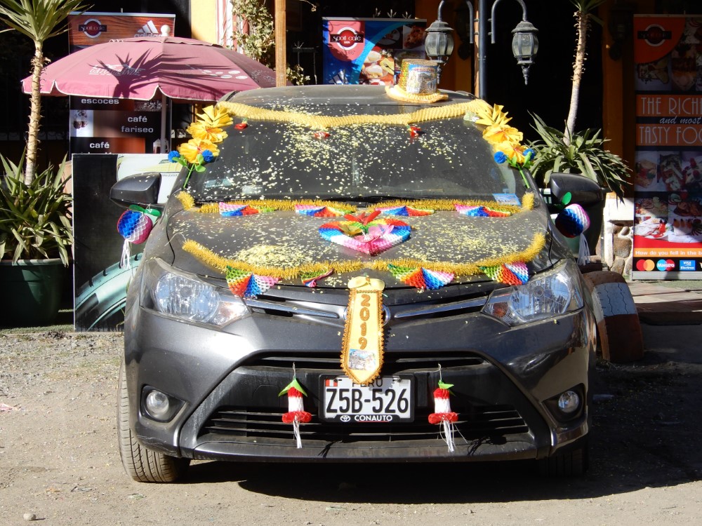
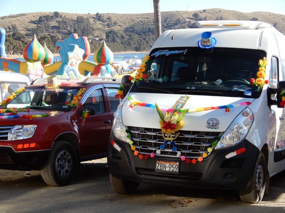
During the days of the celebration, there’s also a huge beach party, made much more festive by all of the car blessings taking place. People come from far and wide to get their cars blessed for safety by one of numerous self-proclaimed “shamen” offering their services.


The elaborate car-blessing ceremony involved incense, chanting, praying, and spraying beer generously inside/outside the car and all over the engine. Car decorations almost always included a colorful party hat, which was left on for weeks after the event (as we know because we saw them weeks later during our ride to Cusco).


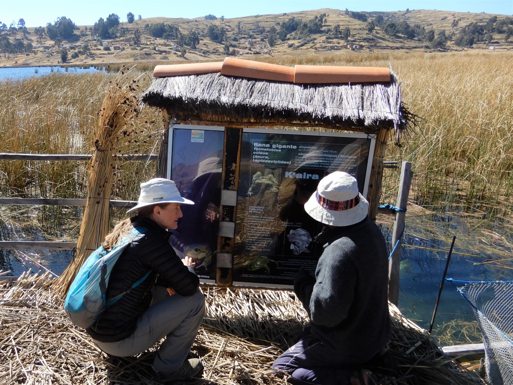
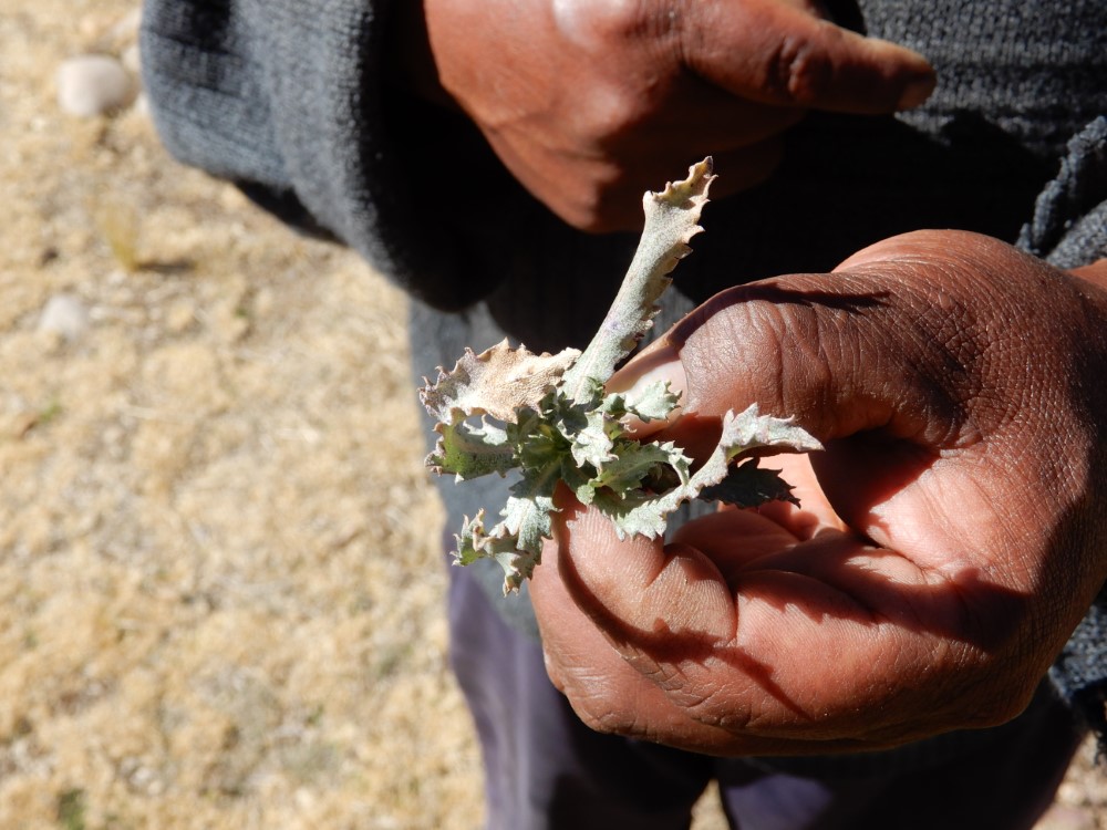


In between festivities, we ventured to Sahuiña, a nearby village where they are actively working to conserve the endangered endemic Titicaca Water Frog -- one of the world’s largest fresh water frogs (in the 1970s Jacques Cousteau found 50 cm [20 inch] specimens that weighed over 1 kg [2.2 lbs]!) Our local guide was eager and charming as he showed us the frog hatchery and multiple examples of local medicinal plants.
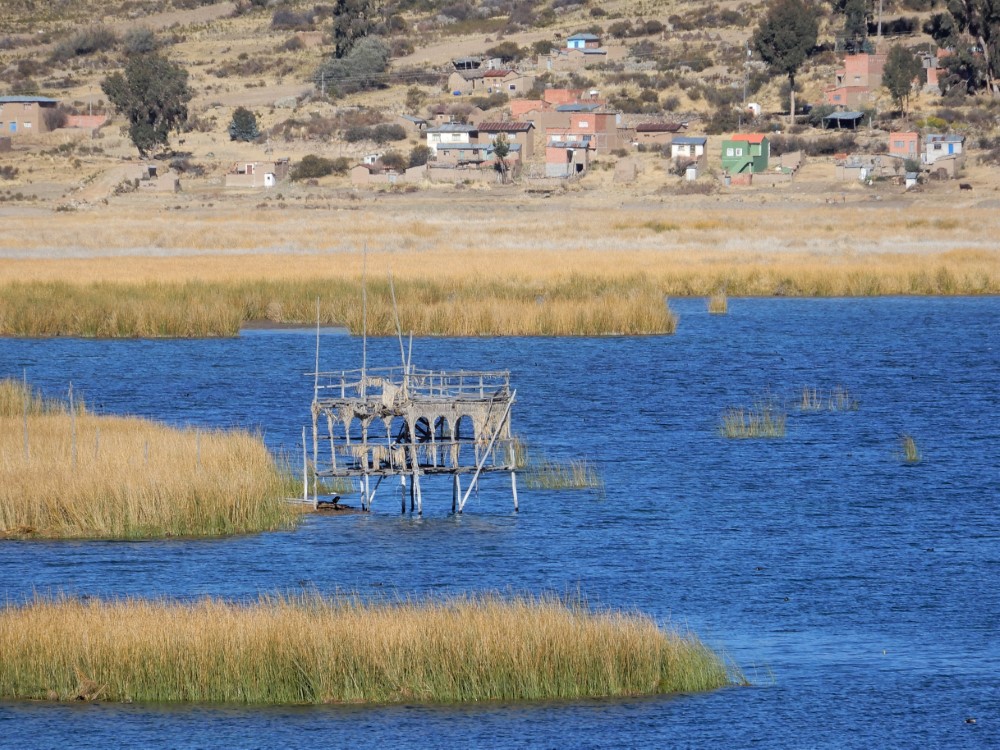
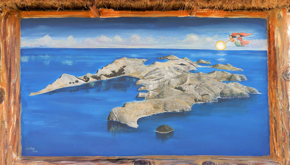
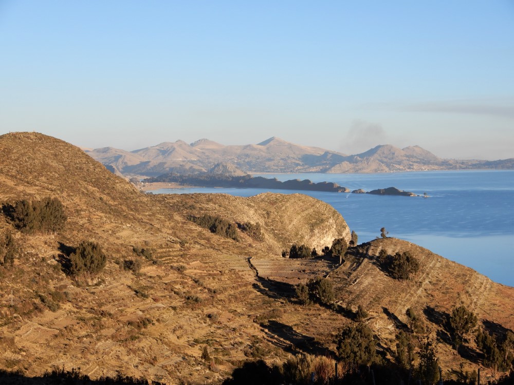
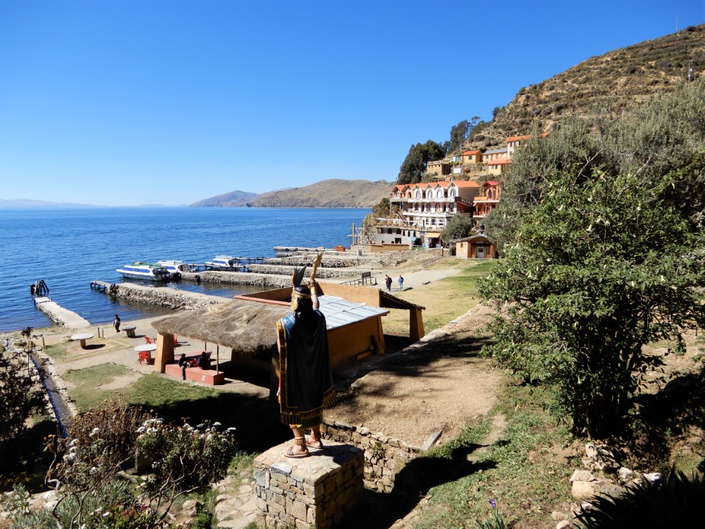
Isla del Sol
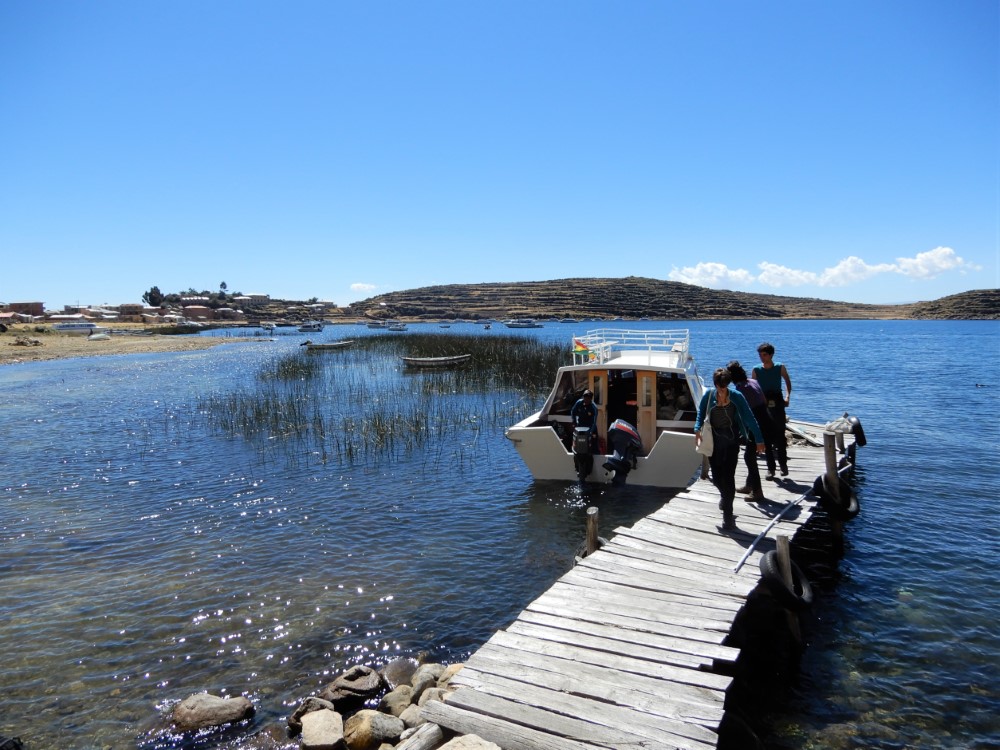
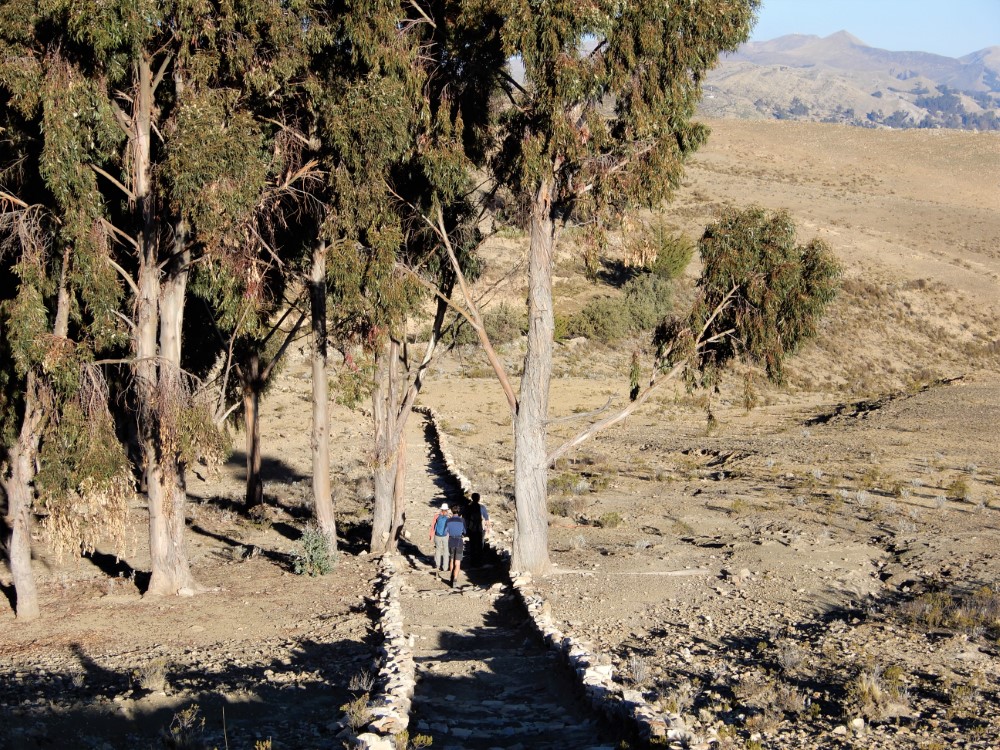
From Copacabana we also took a ferry to Isla del Sol (Island of the Sun) in Lake Titicaca, in order to visit an archaeological site on the north end and then walk 10 km across the island to the south end. The north end of the island had recently been closed to tourists, but we had read that it was now open again. Once on the ferry, we learned that the north-side ferry stop was actually still closed, but we could hire a private boat and guide at the south end to take us north.
So we joined a Dutch family and an Israeli couple and hired a boatman. Along the way, after probing questions in Spanish from Kacia, the boatman explained that a long-standing dispute between the island’s three villages still raged on… over territorial rights, and equitable distribution of the tourist dollars flowing in. He advised us to just keep walking and play dumb if we were stopped by any villagers along the way.


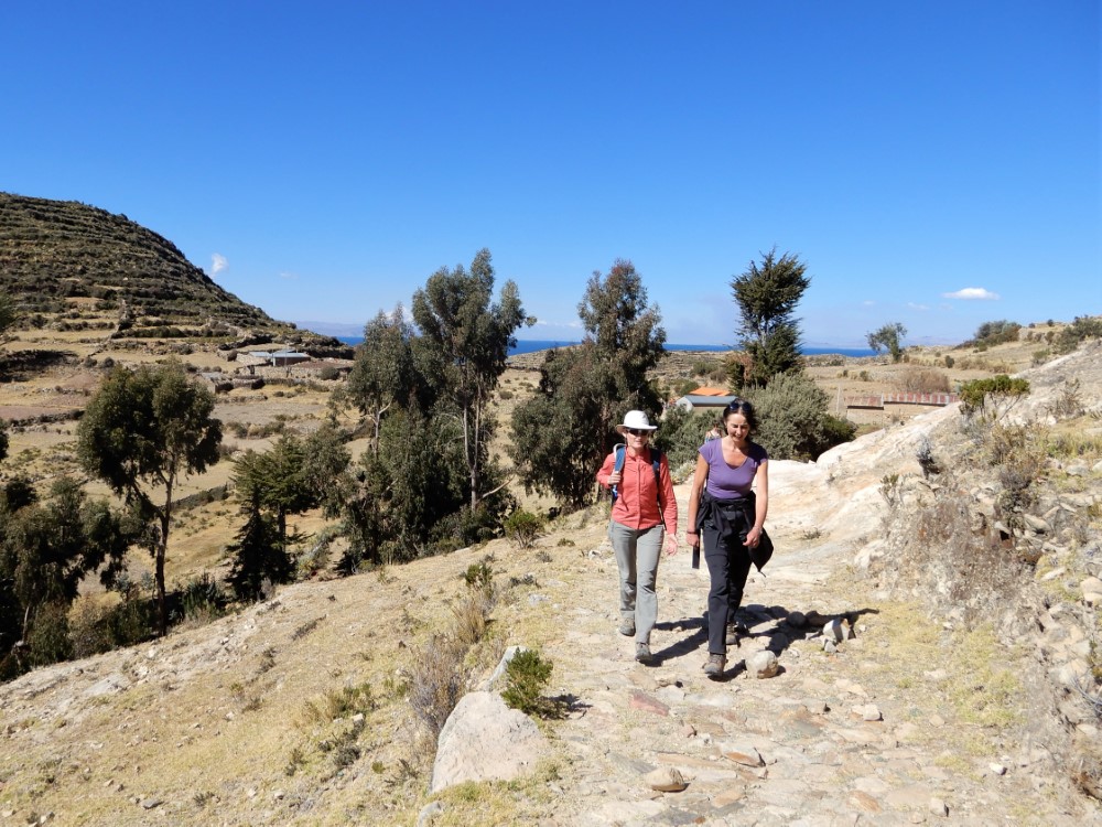


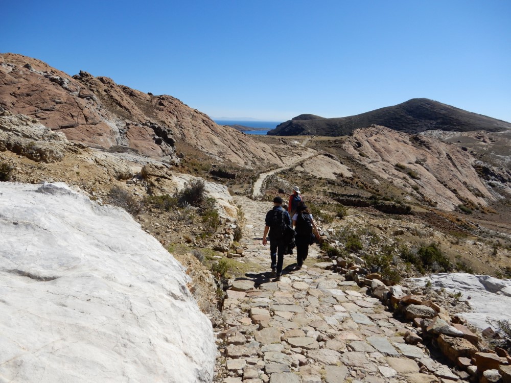
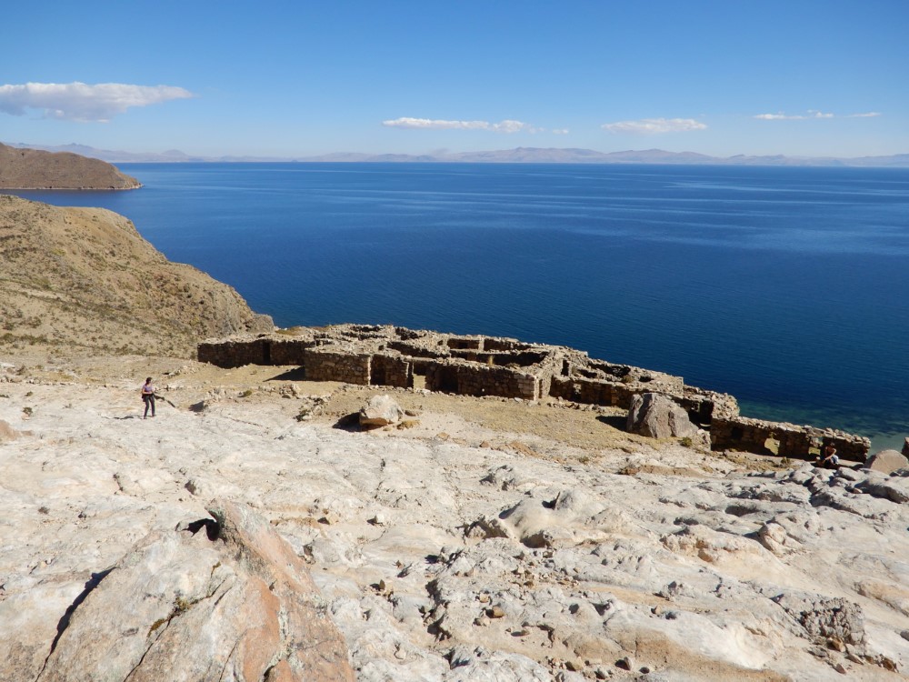
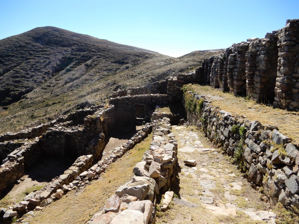
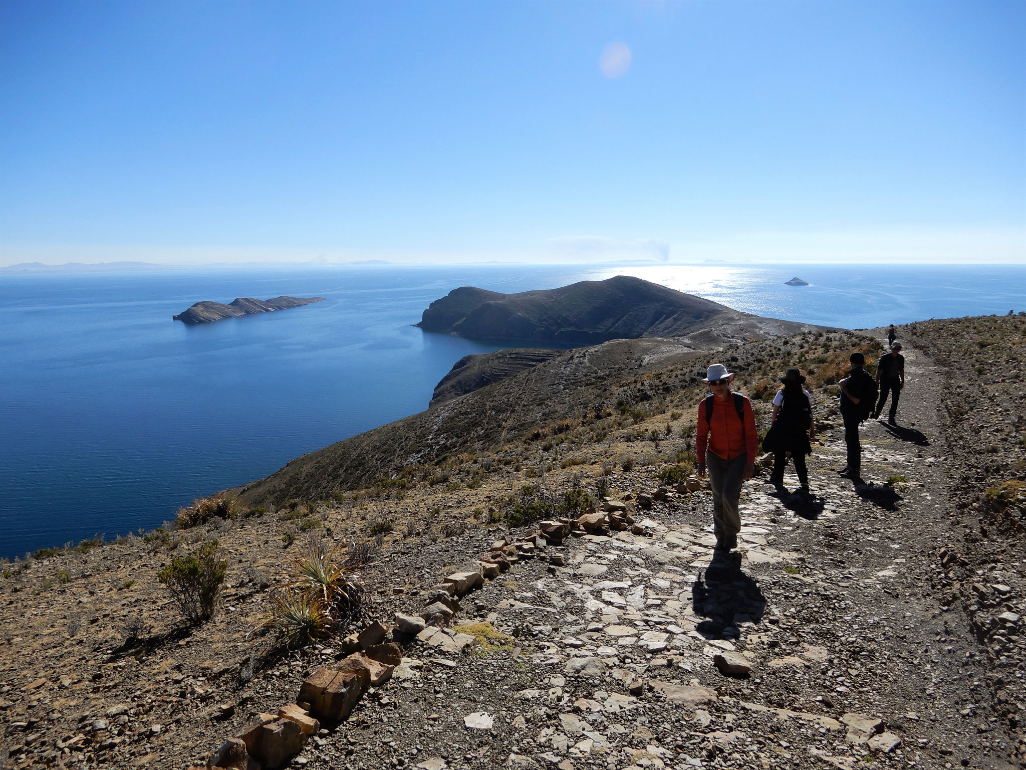
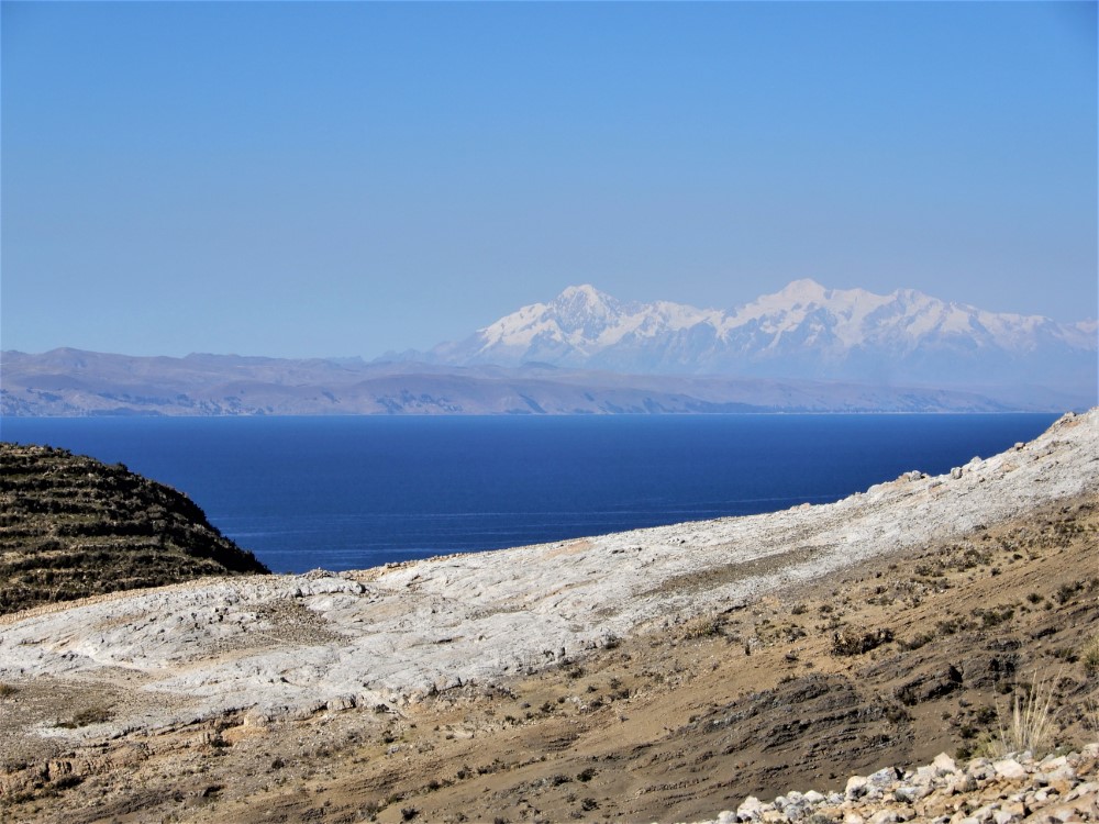
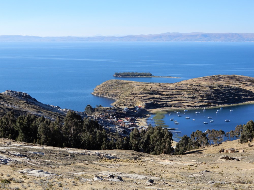


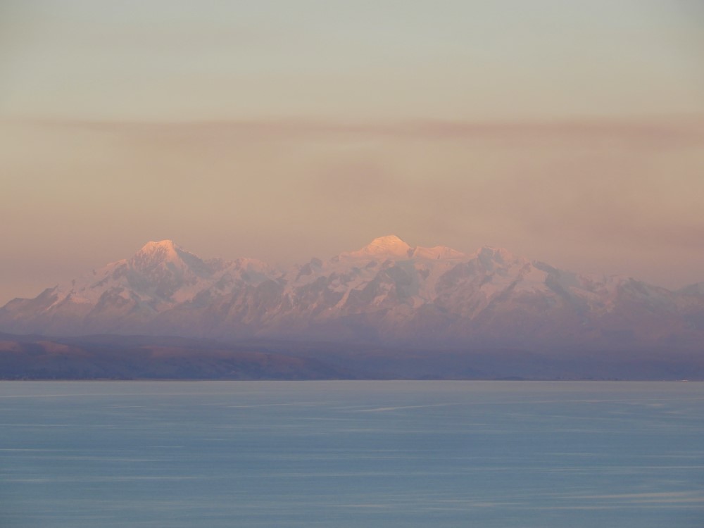
We visited the Pillkukayna ruins without incident, but as we headed south, we were met by three men who politely requested that we pay a “toll”. We handed over about $5 worth of Bolivianos and continued, enjoying the striking views of the Cordillera Real in the distance. After passing the second village, we came upon a clearly demarcated border on the trail, attended by a group of men who insisted on another $5-equivalent toll and asked us to tell other tourists that the trail is closed and they are not welcome. Had we understood this in advance, we would not have done the hike.
As the sun was setting, we finally arrived at the island’s south end, where we stayed in a lovely guesthouse and enjoyed a delicious candlelight dinner. Clearly, the southern village has the most to offer, and is getting the most from the visiting tourists, but they need to sort things out with their fellow islanders to give those tourists access to the entire island, or tourists may decide the trip over isn’t worthwhile.


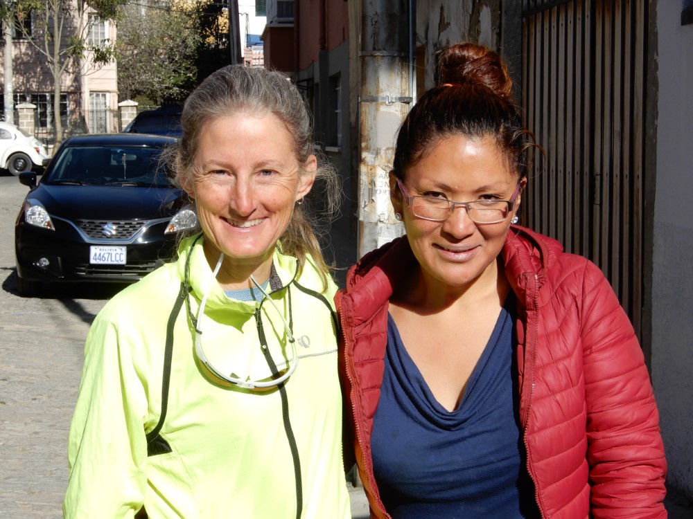
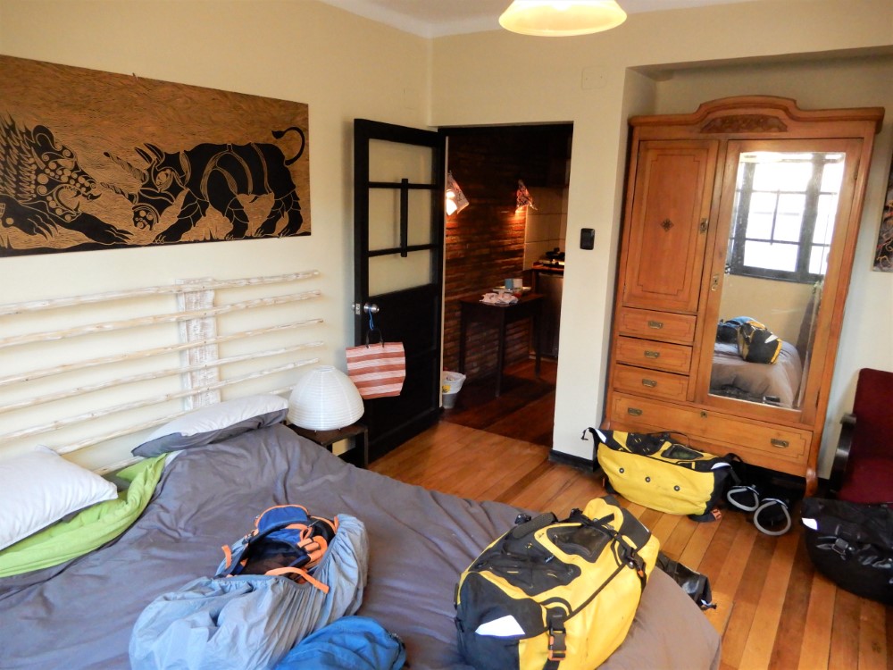


We returned to Guisela’s guesthouse in La Paz for one more day of sightseeing and packing up for our bike ride to Cusco, Peru, the subject of our next blog.
We’re now enjoying being back in the States, and have spent the holidays with family and friends. To see a map of our whole journey, check our Track My Tour page. You can also review past social media posts on Clark's Facebook and Instagram accounts.
We wish everyone a happy new year and wonderful travels!