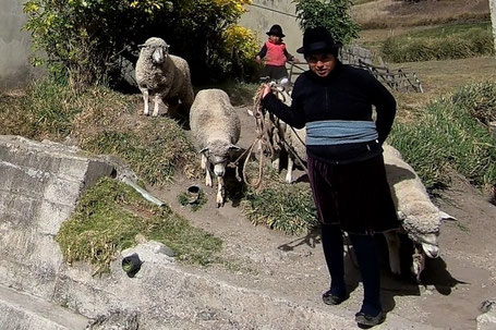
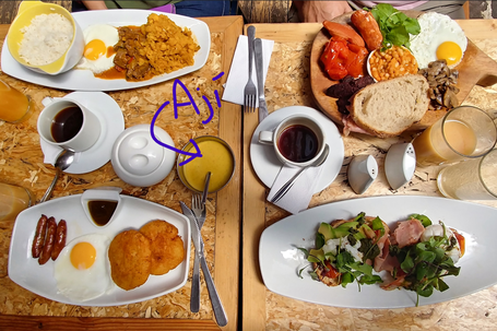
Ah, Ecuador! The land of spectacular volcanoes, tasty ají (homemade chili and tree tomato salsa that varies by family recipe) served with every meal, and rural areas inhabited by indigenous people living traditionally on steep, high-altitude patchwork quilts of farm and pasture land.
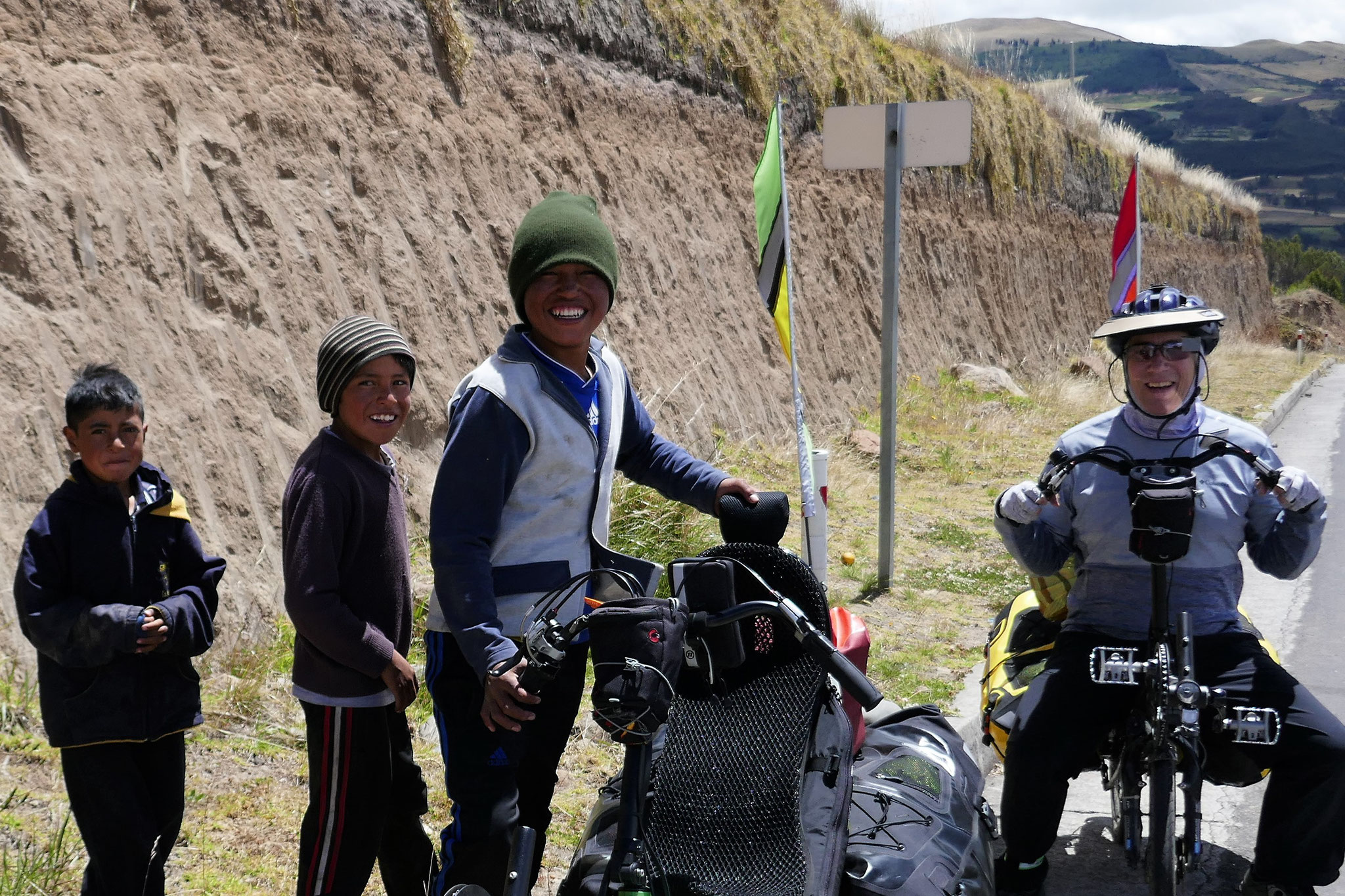
Drivers are still respectful of our place on the road, but are somewhat more indifferent to us than the Colombians were. We’ve seen a lot more roadkill here, especially dogs – casualties of that indifference. So we avoid the Panamerican highway when a scenic alternate route presents itself. These backroads have offered high challenge and high reward.
Crossing the Colombia-Ecuador border
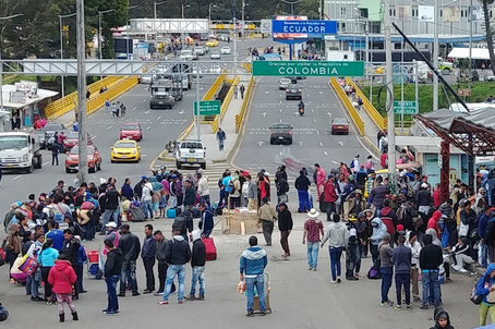
In Colombia we observed numerous groups of people with backpacks or duffel bags walking south along the Panamerican highway. At the border we confirmed that they were Venezuelans leaving their homes and families behind to look for opportunities to start anew in Ecuador or Peru. We waited in line with them at immigration for a couple of hours, with the constant sound of screaming children who were receiving yellow fever vaccines being offered for free at the border.
Ecuador’s currency is the U.S. dollar,
so while we still pay ATM fees, there is a no exchange rate. Remember the Sacagawea gold-colored dollar coins? Apparently, they all ended up in Ecuador. Unlike in the U.S., prices in Ecuador are
nearly always rounded to the nearest $0.05 to avoid using pennies. But pennies are still currency here, and one vendor in Ecuador´s border town of Tulcán was happy when we unloaded our pennies on
her because she uses them for her daily $0.12 bus fare.
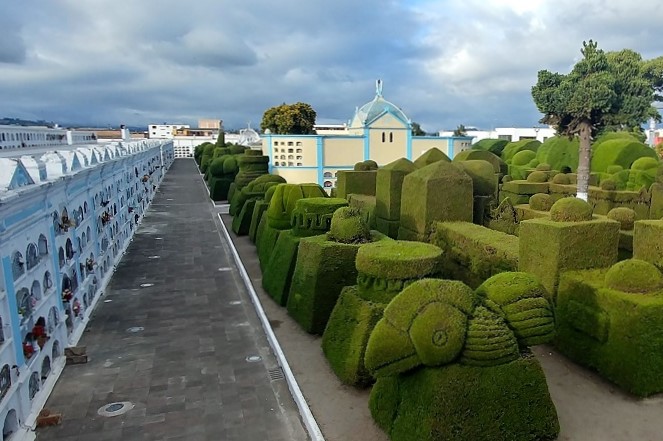
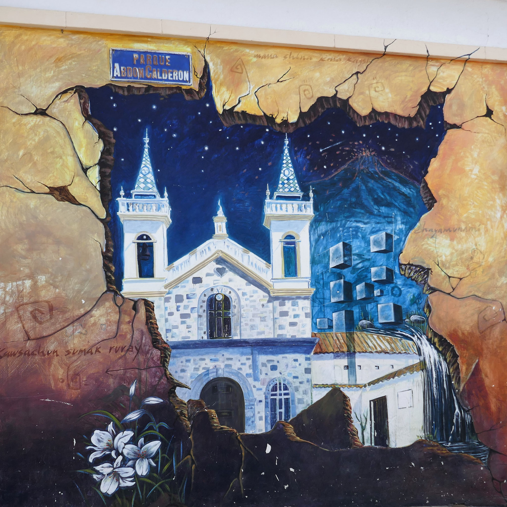
Tulcán’s town treasure is its enormous public cemetery full of giant, artistic topiary. Many other towns in Ecuador have adopted the idea of topiary in their parks and cemeteries, but none
compares to Tulcán.


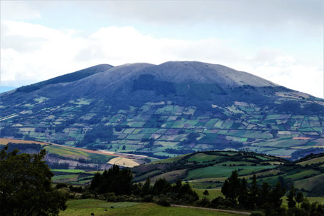
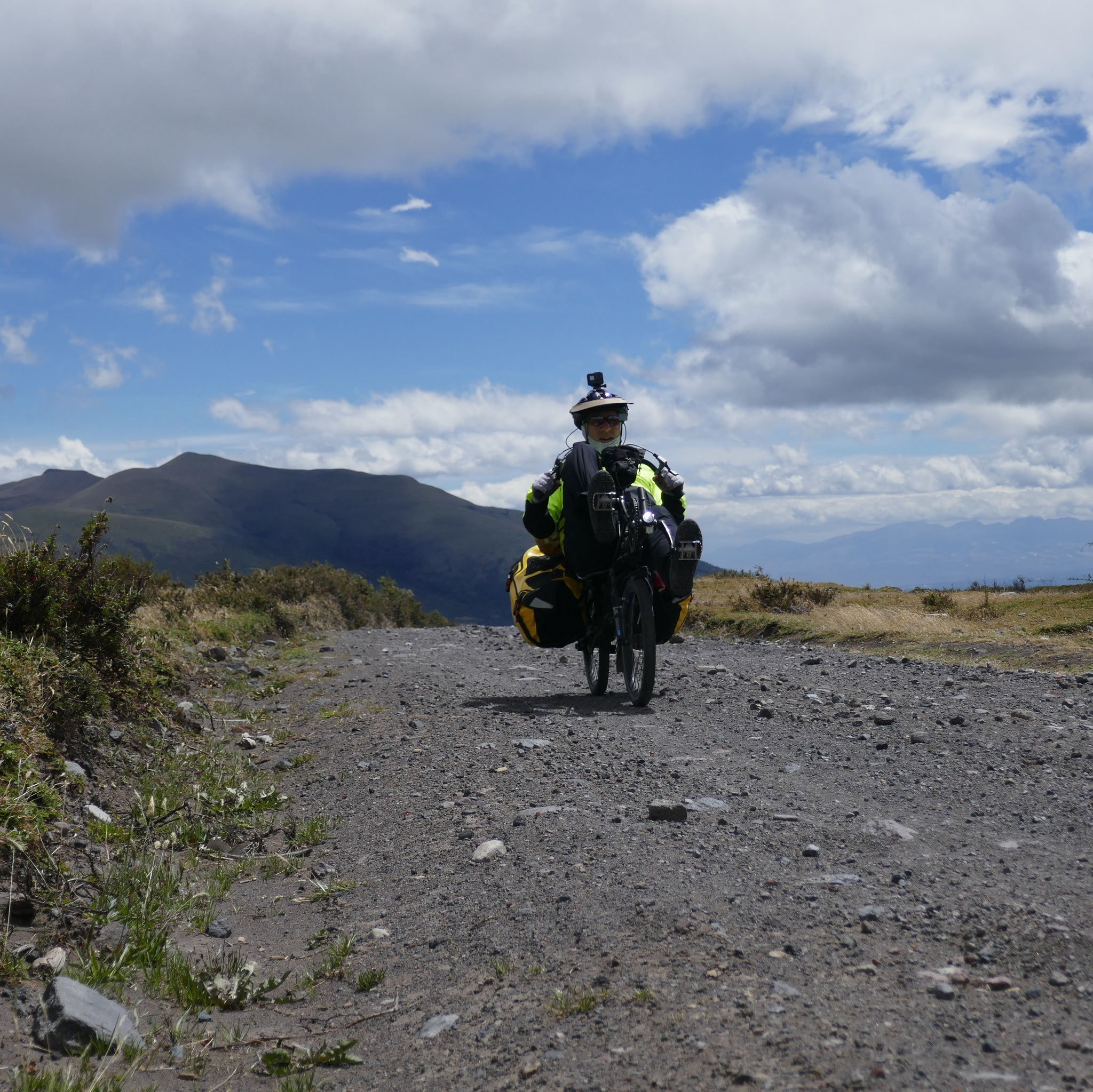
Ecuador's vast páramo reserve
From Tulcán we began our first backroad adventure through the vast páramo of El Ángel Ecological Reserve. We climbed the rugged, rocky dirt road all day without seeing another soul, occasionally pushing our bikes around the giant puddles that became more frequent as we ascended into the clouds. The protection of this páramo from cattle grazing is the best we’ve seen. It was just frailejones, our new favorite plant (see our second Colombia blog), as far as the eye could see. Descending from the páramo on the river-rock cobblestone road to the quiet town of El Ángel would have been bone-jarring if not for the front and rear shocks on our recumbent bikes.


Ibarra
From El Ángel we had a huge, paved descent through several small towns, each with its own giant sculpture of bulls and farmers. After a pleasant five-minute conversation with a group of construction workers, we turned onto the Panamerican highway and rode its wide shoulder up, up, up to the town of Ibarra, where we enjoyed a fine Italian meal with tiramisu to celebrate Clark´s 56th birthday. Ibarra was the first town we’d seen in South America with wide sidewalks, maintained cobblestones and curb cuts at street corners that might allow someone in a wheelchair to effectively get around the town center.


Riding toward Quito


Our next destination was Ecuador’s capital, Quito, which is surrounded by volcanoes (link to Facebook page with 360 deg photo of Quito). If you've been following our progress on our Track My Tour page, you know that we've been winding our way through some of Ecuador's many volcanoes . The backroad from Ibarra toward Quito took us between the volcanoes of Imbabura and glacier-covered Cayambe, both of which were shrouded in clouds. But this road, like many backroads in Ecuador, is not yet in Google Maps. We use an excellent route planning app, Topo Profiler, that shows us the elevation profile, and the specific slopes of roads, which is key to estimating our potential daily progress in this mountainous terrain. However, this app uses Google Maps, and since our road wasn’t in Google Maps, we didn’t know what to expect on this day. The road turned out to be surprisingly steep in places, and required some pushing, but our spirits were bolstered by some enthusiastic local mountain bikers. We also crossed the equator that day without realizing it. (Note: Maps.me is a better map for navigating South America, but doesn’t provide a good elevation profile.)
Quito, the capital city
Quito’s old town is, in our opinion, Ecuador´s Vienna – dense with ornate buildings, churches and plazas – all recently cleaned, well-lit at night, and with a strong police and tourist information presence. In Quito, we watched a fútbol game in the 1951 Olympic stadium with a small, but passionate, crowd of supporters, cycled in the Sunday ciclopaseo (in which the city closes a long, central road to automobile traffic and the bikes take over), visited multiple museums, saw a movie (in English), drank craft beer in a pub run by an Oregonian and a New Mexican, paid $0.25 to ride the highly-used Bus Rapid Transit system (which has dedicated lanes throughout the city), and watched an artistic light show projected on the façade of the San Francisco Church in old town. We stayed with our first Warmshowers hosts, Pablo and Paty, who are passionate advocates for bicycling and public health, and their rambunctious cat. Every morning we had a clear view from their hillside apartment of the surrounding volcanoes, before the clouds predictably rolled in. Pablo and Paty are kindred spirits - they took us to their favorite neighborhood, introduced us to a good bike mechanic to ensure Clark’s brake was fixed, shared locavore meals with us, and provided us with invaluable information and help.


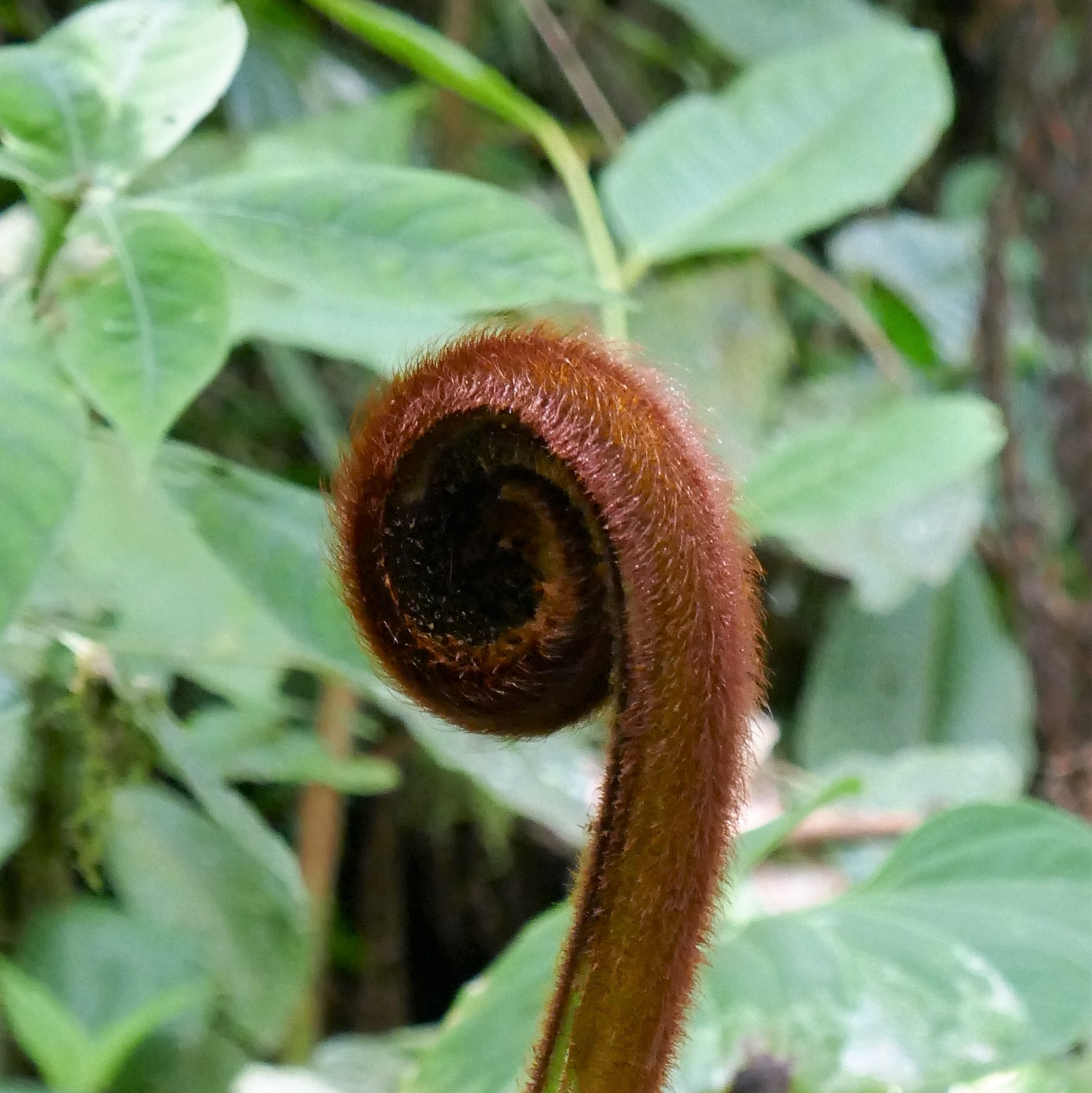
The cloud forest
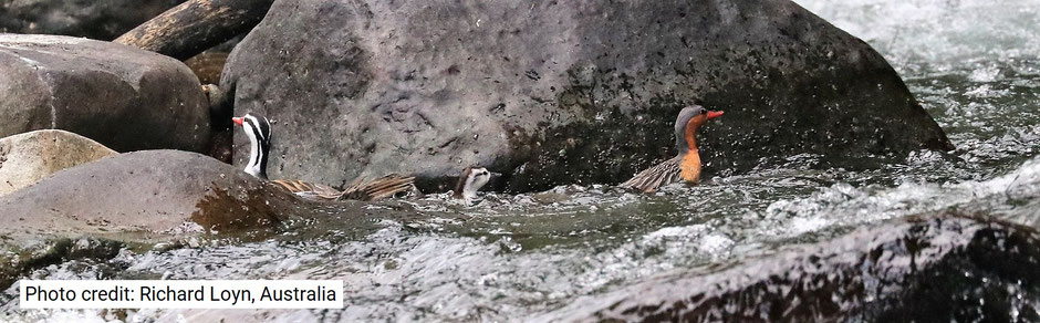


Paty and Pablo stored our bikes for us while we took a four-day trip to the cloud forest near Mindo. We stayed at the beautiful and well-run Maquipucuna Reserve – one of the pioneers of land conservation in Ecuador. Over the past 30 years they have purchased over 14,000 acres of former farmland, in cooperation with the local communities, and let it convert naturally to rainforest, providing much-needed habitat and food source for the endangered Andean Spectacled Bear. The bears had just arrived to eat the native tiny wild avocado fruit that is thriving in the forest, and although we didn’t see any bears, some of the other guests did (credit for the bear and torrent ducks photos goes to the other guest shown in the images, Richard Loyn of Australia). The only downside was the multitude of chigger bites that appeared a few days later, and continue to irritate Clark weeks after the fact.
Cotopaxi
Heading south from Quito we continued to deviate from the Panamerican highway for the best volcano views. First, we rode east of the Panamerican through Cotopaxi National Park. We loved this ride, but the altitude and the steep, rough, cobblestone road into the park exhausted us and we eagerly hired a passing pickup truck to carry us the last 8 km. Jose, the driver, stopped en route to pluck some branches from the roadside bushes for us to sample the wild mortiño berries (similar to huckleberries) that were in season. We stayed that night at the beautiful Chilcabamba lodge, where an extended power outage went largely unnoticed, thanks to a creative staff, candles, solar hot water, propane cooking, wood-fired heat, and a generator for wi-fi and essential lighting.


Quilotoa crater loop


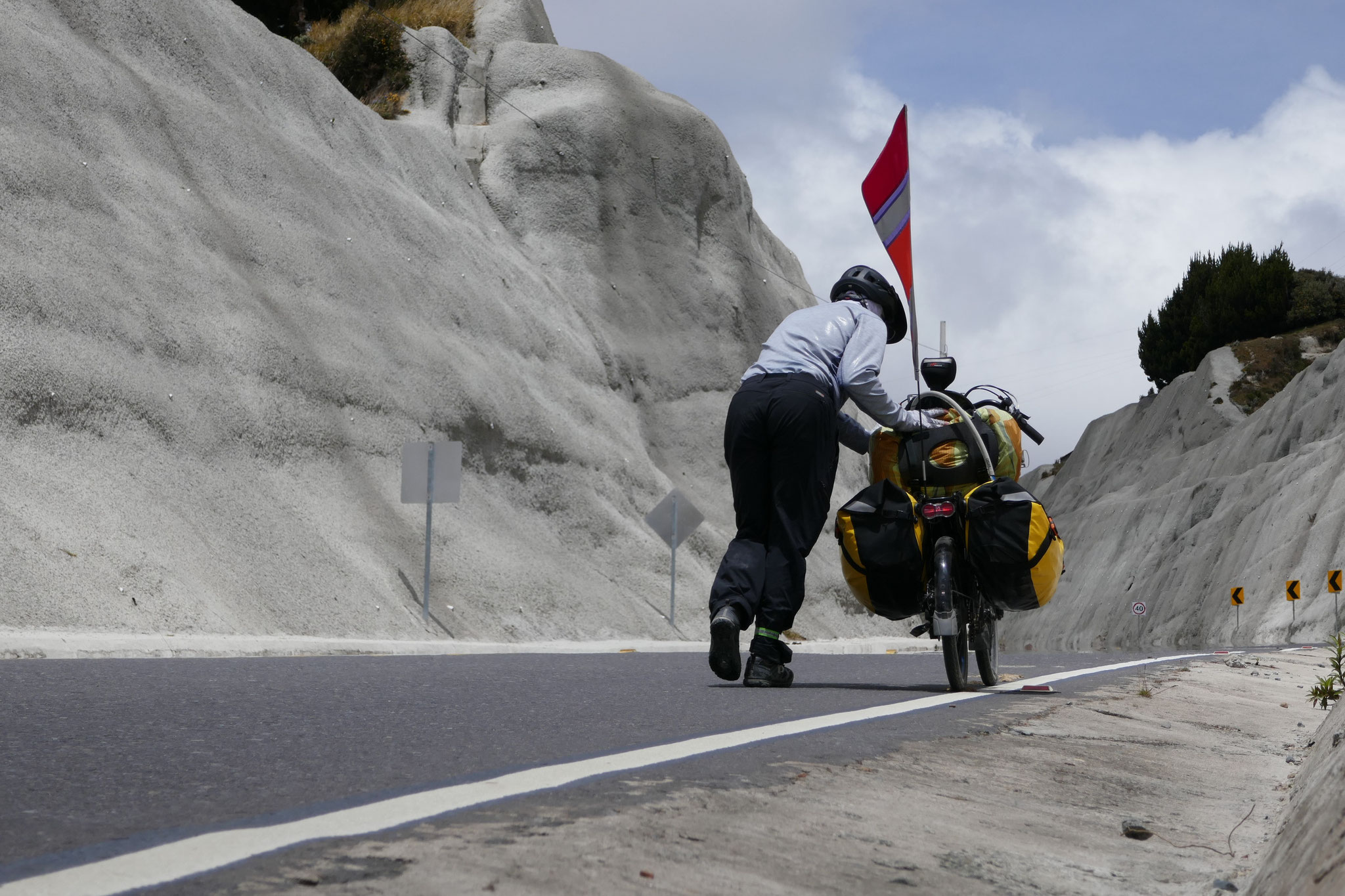


We then crossed to the west side of the Panamerican for our next scenic backroad to the Quilotoa volcanic crater. Much of this route was newly paved in an ambitious road widening and leveling (except for a 2 km stretch of more than 15% grade, up which we had to push the bikes) project to help promote tourism. The massive unreinforced road cuts have resulted in the inevitable ongoing clearing of small landslides from the road. The deep volcanic ash that surrounds the crater has been carved by rivers into dramatic gorges, and the ash plateaus and steep slopes are used by the local indigenous people for grazing sheep, cows and llamas, and for growing potatoes, maize, and lupine (the lupine seeds are tasty legumes called chocho).
The Quilotoa crater is filled with a green lake whose surface changes dynamically with wind and cloud shadows. The 10-km hike around the precipice rim of the crater was breathtaking. We returned to a water outage in the guesthouse that did not go unnoticed – we carried water in our foldable bucket from the outdoor concrete laundry sink to flush the toilet. To complete the loop back down to the Panamerican highway, we crossed three passes, adding warm layers of clothing before each descent, and removing them again before the next ascent.


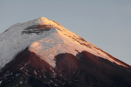
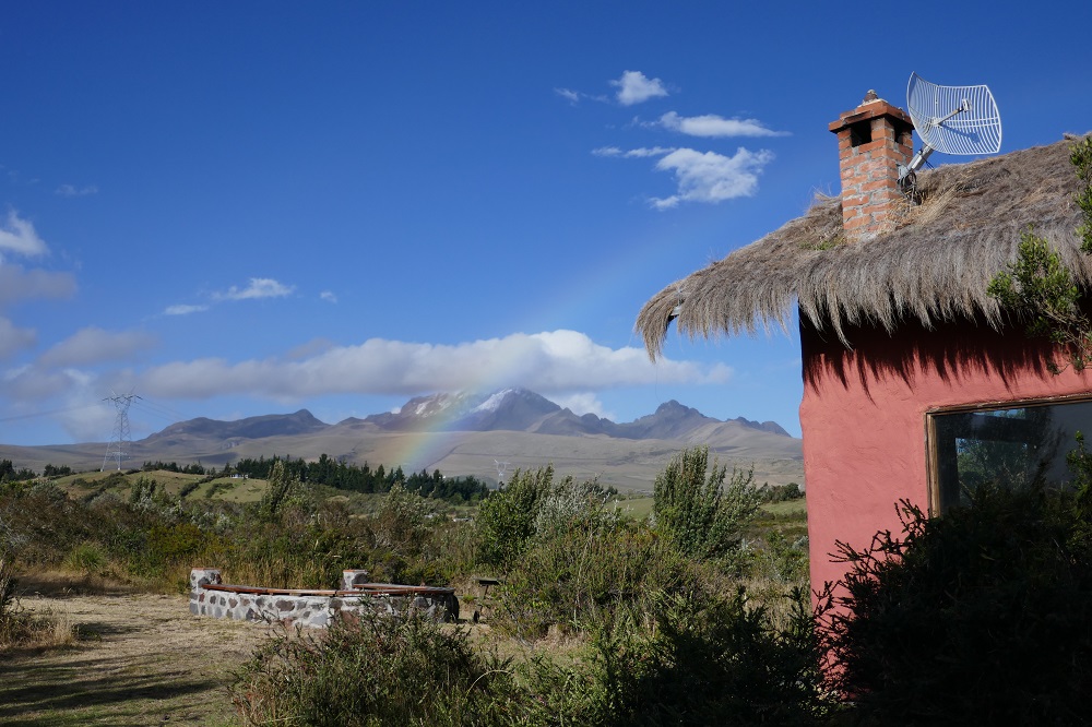
Chimborazo - Ecuador's giant


Our third detour from the Panamerican highway was to visit Ecuador’s highest volcano, Chimborazo (6310 m, 20,700 ft). Thanks to the Earth’s equatorial bulge, the top of Chimborazo is the closest point of our planet to the sun. Following a recommendation from Javier, our second Warmshowers host, we rode west from the Panamerican along the Ambato River. The gently climbing, low-traffic, paved road made possible this day of 65 km of continuous climbing. As we ascended through the green river canyon to the golden grasses of the high páramo, Chimborazo came into clear view and beckoned us to continue across the windy plains to its base. We saw groups of vicuñas, in their element, backlit by the setting sun. Chimborazo was majestic, perched high above a sea of clouds. We arrived at the entrance to the Chimborazo Wildlife Reserve at elevation 4,400 m (14,436’) and pitched our tent in the shelter of the visitor center, allowing us a warm and restful sleep in an otherwise treacherous environment. The visitor center’s water pipe froze overnight, so we scrambled our eggs for breakfast, and then coasted downhill for an hour, wearing every stitch of clothing we have, to find a hot cup of coffee and to refill our water bottles.
Now we are in Cuenca, southern Ecuador’s gem of a city, and will soon head south toward Peru. This area is less populated and (relatively) lower in elevation, but the scenery remains spectacular!