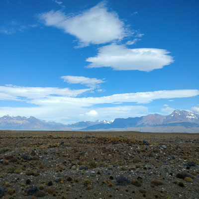
Southern Patagonia was characterized by the razor edge transition from the glacier-covered mountains to the west, to the flat, golden steppe to the east. Here the road traveled through the arid steppe, but kept returning to the mountains for quintessential Patagonian craggy mountain views.

Riding El Chaltén to El Calafate
We left El Chaltén, Argentina, on February 5. During the following 6 weeks, we had expected about 18 days of riding and one multi-day trek. We ended up not trekking, and riding only 6 days. Nevertheless, thanks to our flexible schedule, we squeezed out an incredible array of experiences as we traveled south through Southern Patagonia (down to the Strait of Magellan), Tierra del Fuego (the archipelago south of the Strait), and Antarctica (the topic of our next blog).
We cruised out of El Chaltén, celebrating the smooth pavement and stopping frequently for the spectacular clear view over our shoulders of the grey spires of Mt. Fitzroy and others. The wind was strongly in our favor all day, so much so that we found one bike tourer heading the opposite direction, pushing his bike along the flat pavement. We were immediately in the dry grasslands, looking across the milky Lake Viedma to the tongue of the vast Viedma Glacier that we had overlooked from Paso del Viento during our Huemul trek.


In these riding conditions, our average speed nearly doubled from less than 10 km/hr on the ripio of Central Patagonia to over 18 km/hr, making the 214 km ride to El Calafate possible in two days. There were no towns at all on the route, only a handful of estancias (ranches) that have fenced all of their lands. Over the next few days we saw a dozen guanaco carcasses hanging from the fences, having died after failed attempts to jump over them.

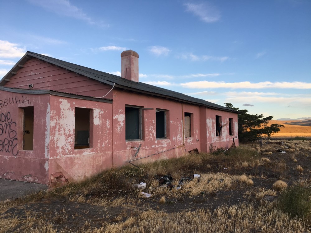


Thankfully, a cluster of abandoned buildings, including the so-called “pink house”, served us well as overnight shelter from the wind and the adjacent Leona River offered a needed source of freshwater (and a bath). The pink house has been frequented by bike tourers for years, leaving the buildings’ walls completely covered with “I was here” graffiti. When we arrived, we were pleased to find Matt, our new Aussie friend whom we’d met a few weeks earlier at the Puerto Yungay ferry stop up north in Chile. We were joined later that evening by Kirsty and James, newlyweds from the UK on an 18-month pedaling honeymoon.
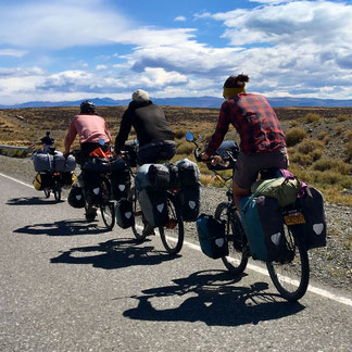
The next day, when the road turned west, directly into a strong headwind, we discovered that our low-profile recumbent bikes have an advantage in the wind, so we formed a bike train with our three cycling companions, with the recumbents taking turns at the nose, and we drafted off of each other for the 30 km to El Calafate.
Perito Moreno glacier

El Calafate, a tourist town named for Patagonia’s Calafate berry (the native evergreen barberry plant with tasty fruit), is a gateway to numerous glaciers flowing eastward from the Southern Patagonian Ice Field. The easiest to access is the Perito Moreno glacier, and it may also be the most impressive to the viewer for two reasons. First, it is one of Patagonia’s very few glaciers still advancing, so it is constantly calving at its tongue. Second, the glacier terminates at a landmass that splits the glacial valley into a fork. There are a variety of viewpoints along a network of walkways on the landmass, allowing us to look directly at the 75 m-high vertical face of the calving glacier. It was a truly memorable experience. We packed a lunch, took the bus to the National Park, and spent hours exploring different vantage points and listening to the thunderous, cracking and splashing of the ice as pieces fell from the wall into the water, or broke off underwater and erupted up through the water’s surface.


From Argentina back to Chile
After waiting out high winds for a couple days, we continued our ride, returning east to the windswept grassland of the steppe, then south to Patagonia’s most famous National Park, Torres del Paine.
The first three days of this four-day segment were very remote, with the only source of water and shelter from the wind being Argentina state highway maintenance facilities. As such, it is common for bike tourers to rely on the kindness of the hosts at these government facilities for a place to camp and refill water. The first night we and our three friends were five of 12 bike tourers camping there that night. The resident staff person was none-too-thrilled to play host, but was accommodating nonetheless. The second night’s host was entrepreneurial. He charged a small fee for camping, and offered toilets and hot showers, and even dorm beds in a converted construction office trailer. We enjoyed seeing herds of guanacos and rheas along the way.


The third day we struggled mightily against a strong and gusty crosswind, before crossing from Argentina back to Chile. Once again, the two countries’ immigration offices were separated by 8 km of no man’s land, and once again, the dirt road from Argentina changed to pavement as we crossed the border into Chile. It seems that Argentina has no interest in improving the access for travelers leaving Argentina to go to Chile.

On the Chilean side of the border was the small town of Cerro Castillo, a former cattle enterprise with a cowboy history, where we could reprovision. The lodging options were few and fully booked, so we slept at the bus station -- informally designated as the town’s camping area. Ultimately 8 cyclists and 7 backpack travelers camped there, with new arrivals creating ongoing disruptions as they set up their tents well after dark.


Torres del Paine
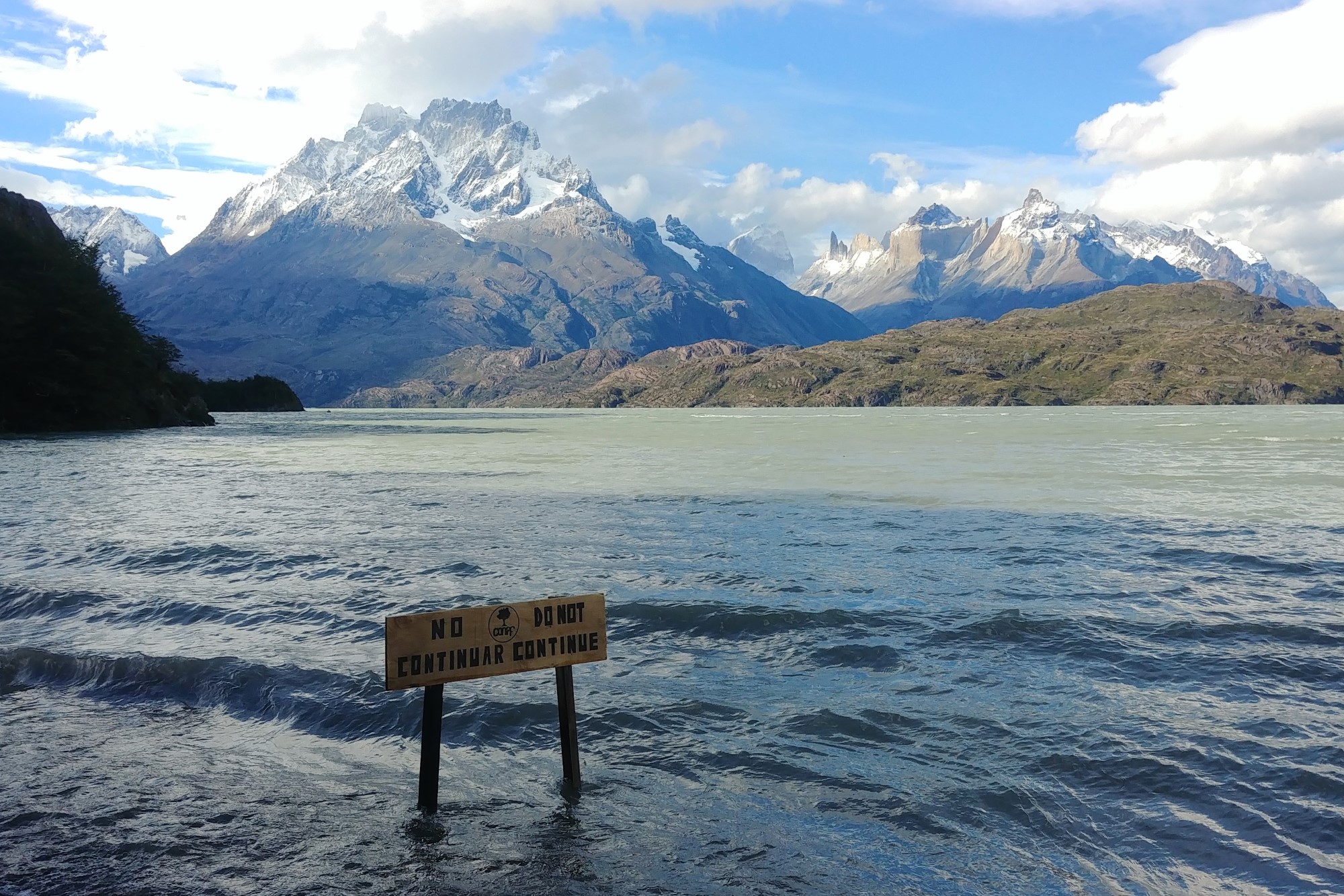
The next day was glorious. Loaded up with five days of food, we rode to the north entrance of Torres del Paine National Park. As we approached, we enjoyed ever-changing views of the famous rocky peaks, a herd of guanacos, and two alkaline lakes: Lago Sarmiento with calcium carbonate structures similar to those in Mono Lake in California, and Laguna Amarga with pink flamingos feeding on brine shrimp.


The peaks were tall spires of bright, quartz-rich, gray granite, capped with a dark layer of metamorphic rock — apparently a mudstone that had been cooked by the molten rock that pushed up under it over millennia to form a big granite dome. Erosion has broken away the granite, leaving towering vertical faces with the dramatic purplish-black cap. From the park entrance we crossed a river, climbed a steep dirt road while being pelted with wind-blown dust, then had a lovely ride to the park’s campground. Though we didn’t know it at the time, this turned out to be our last day of riding during this southernmost part of our trip.


Torres del Paine is famous for its multi-day treks, but we didn’t have the reservations needed, so we did one day hike and planned to cycle slowly through the park, camping three nights, then ride south a couple more days to Puerto Natales.


A bus ride to Puerto Natales

The weather forecast for the day we planned to ride through the park predicted ferocious winds, so we opted to skip the ride and catch the two-hour bus to Puerto Natales instead. Our three friends opted to cycle. It was dead calm when we loaded our bikes on the bus making us doubt our decision, but our friends later assured us that we had made the right call. The wind became too strong for them to ride, and with every gust they would drop to the ground using their bikes as shelter from airborne sand and pebbles (click the photo, or this link, for an exfoliation video from Matt, the “Stylish Pedlar”). Over the next two days, they suffered hard rain and muddy roads, in addition to the wind. Meanwhile, back in Puerto Natales, the exterior wall of our guesthouse bounced wildly against the cold, wind-driven rain (remember, this is summer in Patagonia), and we were amazed that the large plate glass window didn’t shatter.
The luxury of a car
The weather cleared up on the fourth day, so we rented a car and drove back into the park to see what we had missed. Our biking friends, who had just arrived in town, declined to join us, as they needed to recover from their harrowing ride. The precipitation resulted in fresh snow on the mountains and swollen rivers. Flooding rivers, in fact. The hundreds of people who were still in the park campground in which we had stayed were now stranded, as the road to the bridge across the river was now deep underwater.


Kayaking high waters


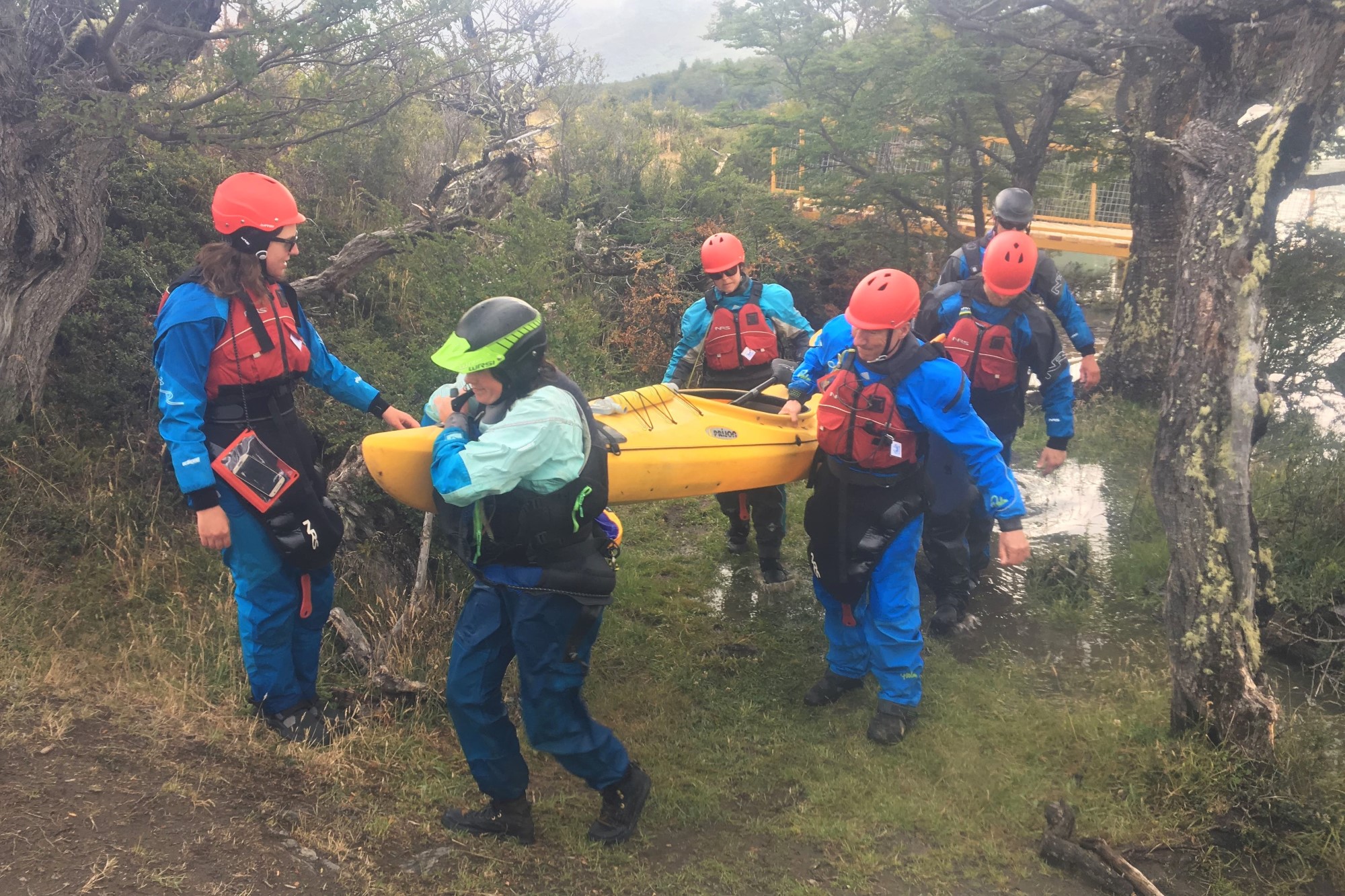


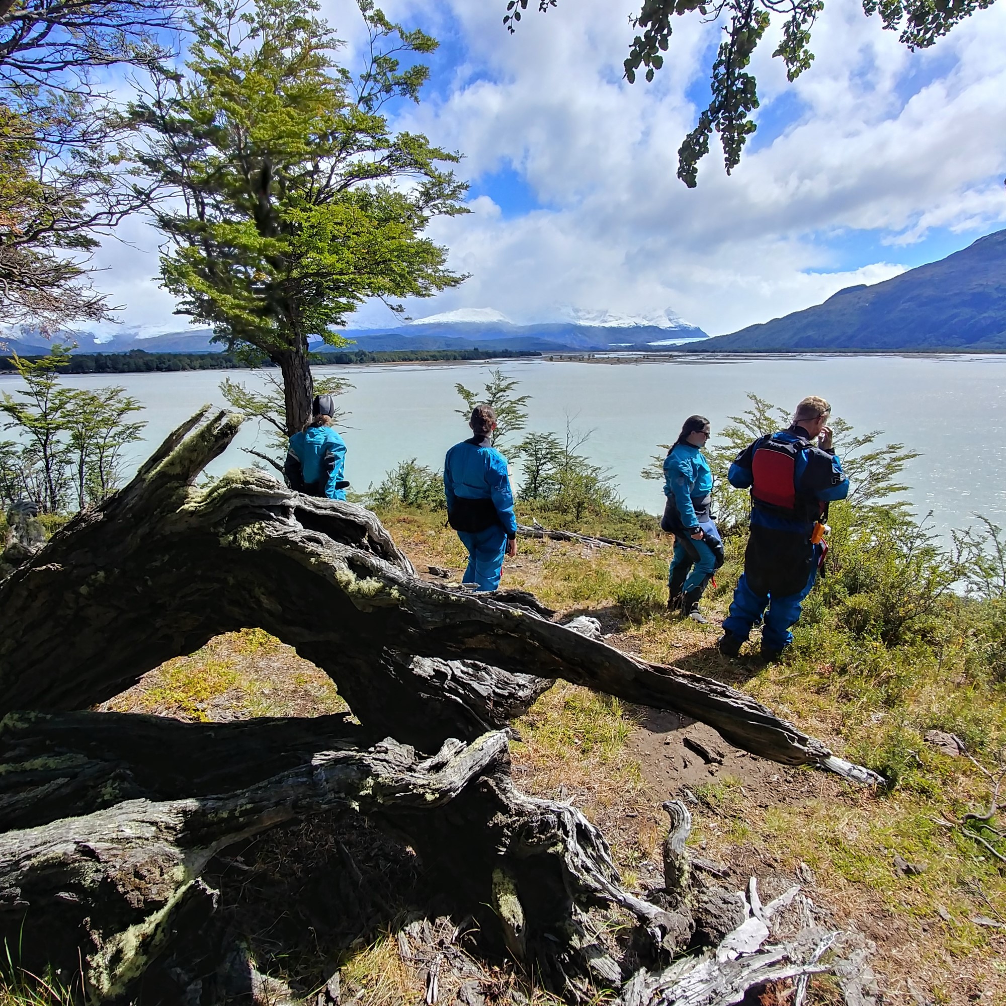


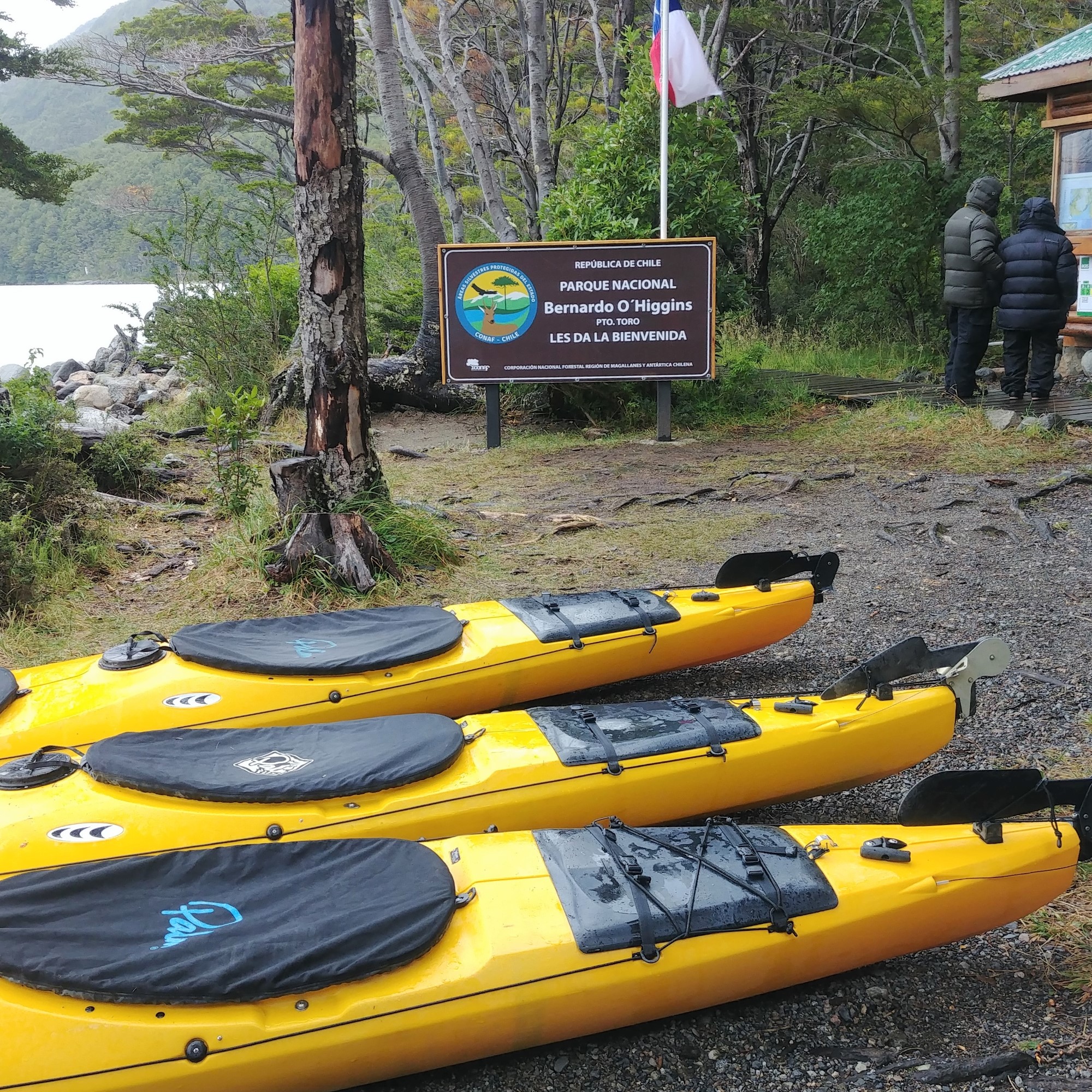


We drove to the glacial headwaters of the Grey River and freaked out when we saw the fast rapids at the first bend in the river. We had already booked a guided three-day sea kayak excursion that was to start by paddling down the Grey River, and we were sure that we did not have the kayak skills to negotiate that high water. Due to the flooding, the first day of the kayak trip was (thankfully) cancelled, but we still (thankfully) got to paddle the second two days! The first day we took advantage of the river’s current to paddle 46 km (28 miles) down the otherwise calm Rio Serrano, using the high water to shortcut bends in the river and float over the normal obstacles of rocks and fallen trees. Upon arriving at the river’s mouth at the Sound of Last Hope, we camped in the forest. The next morning we paddled with icebergs in a small lake under a glacier before taking a catamaran back to Puerto Natales. The trip, run by Kayak en Patagonia, was great — well organized, top-notch gear, knowledgeable guides, and only six guests allowed on each trip.
Puerto Natales
Back in Puerto Natales, Clark patched his tire, whose sidewall was damaged by running too long at low pressure on ripio, and we enjoyed a great flight of craft beer and a free walking tour. The town was founded in 1911 as a port for exporting wool and meat from the booming Patagonia sheep industry. Its lamb meat packing and cold storage plants used to provide jobs that attracted immigrants from across Europe. The port is on the Seno de la Última Esperanza (Sound of Last Hope), so named by explorers in 1557 who had long been searching for (but ultimately failed to find) the Strait of Magellan — the shortcut from the Pacific to the Atlantic.


A bus ride to Punta Arenas
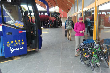
From Puerto Natales, we again opted to take a bus to the next town of Punta Arenas to avoid three days of known bleak riding against hard winds. As the biggest city in southern Chile, Punta Arenas was our place to cure our electronic woes and plan the rest of our tour south. We first replaced our computer cable, memory card, and camera. Then we succeeded in last-minute booking of two berths on a 10-day Antarctica marine mammals cruise! The cruise left from Ushuaia in just three days, forcing us to once again take a bus (we would have needed 6 days to ride to Ushuaia). It was a bit sad for us not to pedal those final kilometers to the southern tip of South America, but the opportunity to see Antarctica made it a no-brainer.
In our last two days in Punta Arenas, we visited an outdoor ship museum where we climbed into full-scale replicas of four ships: the Nao Victoria that was Magellan’s ship and the first to circumnavigate the globe in 1522, the HMS Beagle that brought Charles Darwin to South America in the 1830s, the Chilean schooner Ancud which brought settlers to claim sovereignty over the Strait of Magellan in 1843, and Shackleton’s lifeboat in which he sailed across the frigid Southern Ocean in 1916 to obtain rescue for his stranded crew.


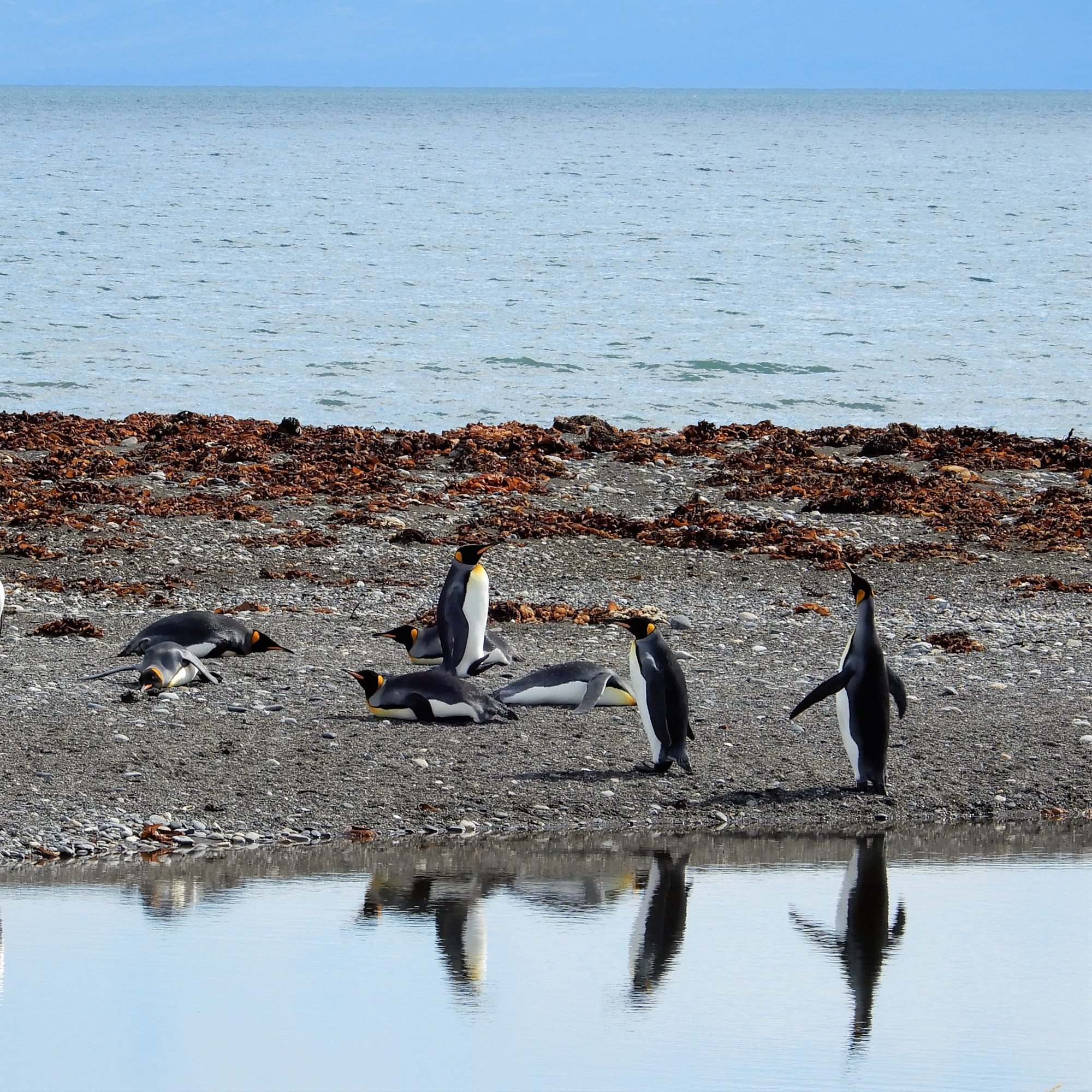


We also took a day-trip to visit a colony of King Penguins — beautiful, slightly smaller versions of Emperor Penguins, with striking orange coloring on their heads and beaks. There were a few fluffy brown juveniles and a couple of eggs on the ground that hadn’t hatched. They were a delight to watch as they strutted purposefully with wings back, and periodically trumpeted with heads back and beaks straight up. We learned, as we had many times throughout Patagonia, about how the systematic genocide of the indigenous people who inhabited these lands before the Europeans arrived. And we visited the ghost estancia of the largest European settlement in this area.
A bus ride to Ushuaia
The eight-hour bus from Punta Arenas to Ushuaia took a ferry across the Strait of Magellan to the island of Tierra del Fuego, crossed the border from Chile to Argentina, got a flat tire (which had to be fixed at a roadside tire repair shop in the middle of nowhere), traversed the island over dry, flat grassland to the Atlantic Ocean, then returned to the mountains and forest as it turned south into Ushuaia. As dusk set in, we checked into a guesthouse that had agreed to store our bikes and bags for 10 days during the cruise. The next day we threw every stitch of clothing we have with us into a backpack and boarded the Russian ship, Akademik Sergey Vavilov, bound for Antarctica. Read about our Antarctica experience in our next blog.


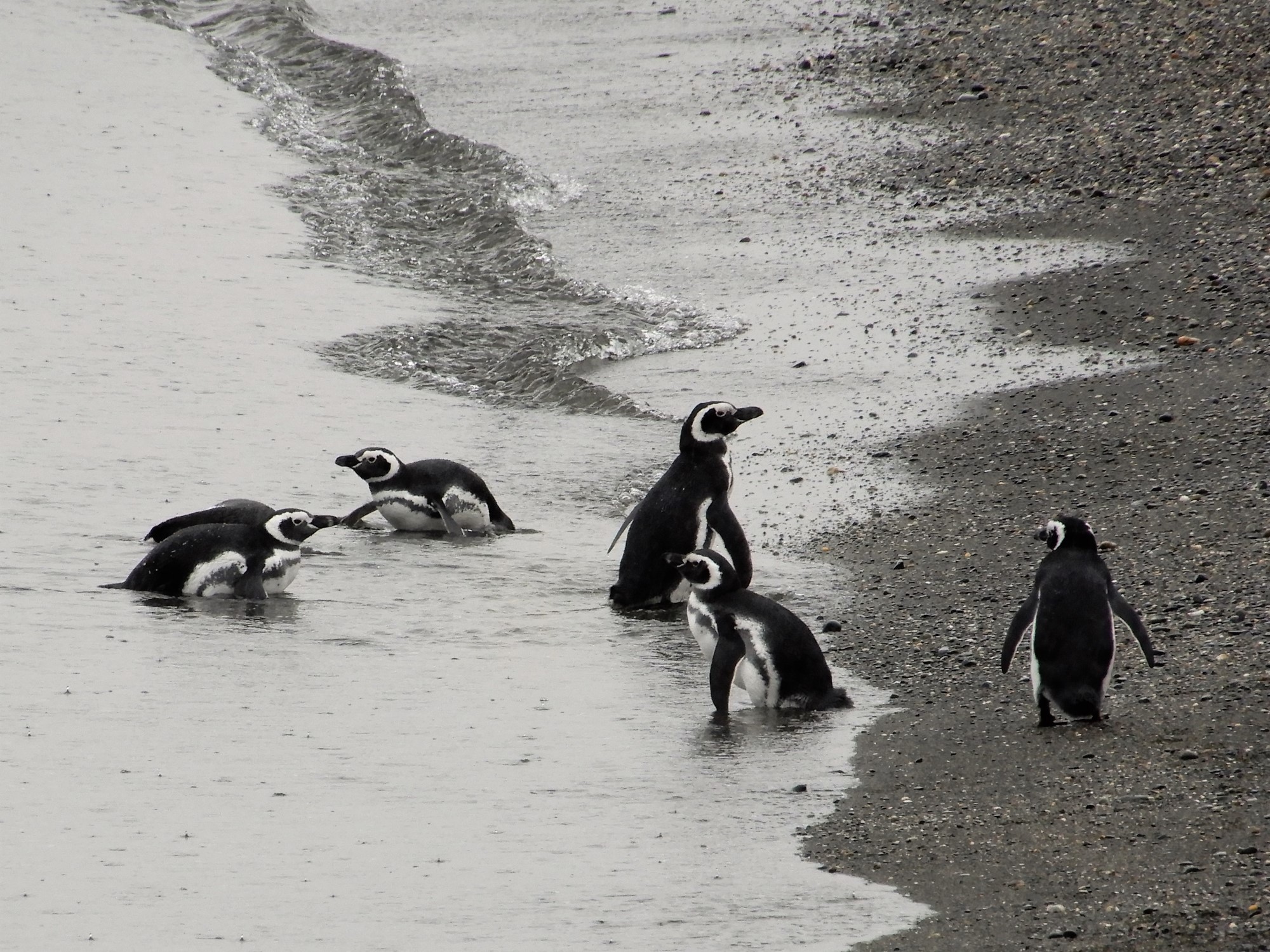
Ushuaia is Argentina’s southernmost city (a.k.a. the “Fin del Mundo”), and a port busy with local petroleum exports and Antarctica cruises. Local tourism takes advantage of the marine wildlife in the Beagle Channel (another waterway between the Atlantic and Pacific Oceans), ski resorts, and Tierra del Fuego National Park. It rained a lot in Ushuaia after our Antarctica trip, so we didn’t do any multi-day trekking as we had hoped. Instead we took a boat ride through the Beagle Channel to see fur seals and Magellanic penguins, and tour a historic sheep ranch with a large collection of marine mammal skeletons.


On one clear day we cycled 25 km to the national park, where we hiked to a high viewpoint overlooking Ushuaia to the east, the Beagle Channel to the south, and glacier-covered mountains of Chile to the west. We continued riding to the southernmost end of the road before turning back. We couldn’t help but notice that the forest was quiet. The previously ever-present calls of our buddy bird, the Fío-fío, were now absent, as it had already begun its winter migration north to Brazil. The Lenga trees’ leaves were changing color. Fall had begun, and it was time for us, too, to head north.
Jetting to the north
We booked airline tickets from Ushuaia to Salta, in northern Argentina, (we moved north 30 degrees latitude - the equivalent of traveling from Ketchikan, Alaska, to La Paz, Mexico). In Salta, we will meet Kacia’s parents to travel together for three weeks in April (see our blog on Northern Argentina/Chile). To prepare our bikes for the flight, we found some plywood-size sheets of cardboard being tossed out at a woodworking store and constructed custom boxes. We are now in Salta, getting Bolivia visas so that we can hop back on our bikes and ride north.


To find out where we are at any given moment, check our Track My Tour page, where we post a photo and blurb every day that we’re on the move. Also, you can get more up-to-the-minute, spontaneous updates if you follow Clark's accounts on Instagram and/or Facebook.